Mountain refuge Weisskugel Hütte (Refuge Pio XI)
We have it listed in the app!
We have it listed in the app!
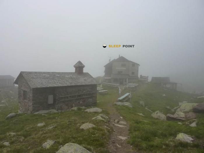

The Weisskugel Hütte (Refuge Pio XI) refuge stands at 2557 meters above sea level, overlooking the surroundings of weißkugelhütte - rifugio pio xi alla palla bianca, richtersteig, graun - curon venosta, vinschgau - val venosta, provincia de bolzano, trentino-alto adigio, 39027, italia. It is a key spot for mountaineers looking to spend the night or take a break. Its coordinates (46.826, 10.705) place it in a strategic position for exploring the peaks and trails of the region.
1.1°C
Feels like: -3°C9.4 km/h
Gusts: 30.2 km/h3010 m
Snow lineUV 0
Clouds: 57% 0.4 mm
 18.1 km/h
 UV máx: 7.15
 05:25
05:25
 21:06
12.75 mm
13.8 km/h
UV máx: 6.5
05:24
21:06
0.9 mm
10.9 km/h
UV máx: 6.8
05:24
21:07
0.9 mm
16.2 km/h
UV máx: 7.15
05:23
21:08
4.2 mm
14.1 km/h
UV máx: 7.85
05:23
21:09
5.1 mm
14.8 km/h
UV máx: 5.4
05:23
21:09
0 mm
11.1 km/h
UV máx: 7.25
05:22
21:10
21:06
12.75 mm
13.8 km/h
UV máx: 6.5
05:24
21:06
0.9 mm
10.9 km/h
UV máx: 6.8
05:24
21:07
0.9 mm
16.2 km/h
UV máx: 7.15
05:23
21:08
4.2 mm
14.1 km/h
UV máx: 7.85
05:23
21:09
5.1 mm
14.8 km/h
UV máx: 5.4
05:23
21:09
0 mm
11.1 km/h
UV máx: 7.25
05:22
21:10
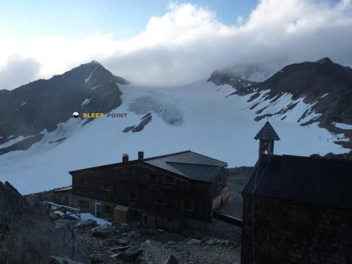
On the alpine side that links the environment of Graun - Curon Venosta with the cords of the Tyrolean border, Weisskugel Hütte (Refuge Pio XI) It occupies a clearly mountainous position at 2557 meters. The altitude and frame of peaks, glaciers and summits above 3300 and 3700 meters place this shelter on a high mountain terrain where the relief commands: long slopes, hills exposed to the change of time and a more typical atmosphere of alpine crossing than of valley walk.
Their practical interest is very linked to the passage of long-distance itineraries. In this area, references such as the Zentralalpenweg 02 , stages of Ötztal Trek and Langtaufer Höhenweg , so it can function as a support in days of link between valleys or as an intermediate point within a wider journey. It also makes sense for mountaineers who move to nearby peaks like the Weißkugel - Palla Bianca or Weißseesitze - Cima del Lago Bianco , always in a demanding alpine context.
The access and use of this shelter should be read in road continuity and not only as an isolated destination. The presence of signposted trails does not eliminate the hardness of the terrain or the need for mountain experience. At this point, meteorology can change quickly. The orientation, the state of the itinerary and the residual snow depending on the season can make the day very difficult.
In planning, autonomy also weighs. The registered sources are far from the shelter, more than 9 kilometres away, so it is not appropriate to take the water for granted in the vicinity and it is prudent to leave with sufficient margin or confirm this aspect before the route. The same is true for any journey this part of Trentino- High Adigy where apparent distances tend to deceive more than at low levels.


📏 6 Km
⛰️ 3277 m

📏 8.1 Km
⛰️ 2845 m
📏 12.8 Km
⛰️ 3019 m

📏 14.1 Km
⛰️ 2844 m

📏 14.1 Km
⛰️ 2501 m

📏 22.9 Km
⛰️ 2258 m

📏 28.9 Km
⛰️ 1714 m

📏 29 Km
⛰️ 2500 m
Download the app and start looking for the shelter of your next adventure


Find a place to sleep before night falls.


