Mountain refuge Similaun Hütte
We have it listed in the app!
We have it listed in the app!
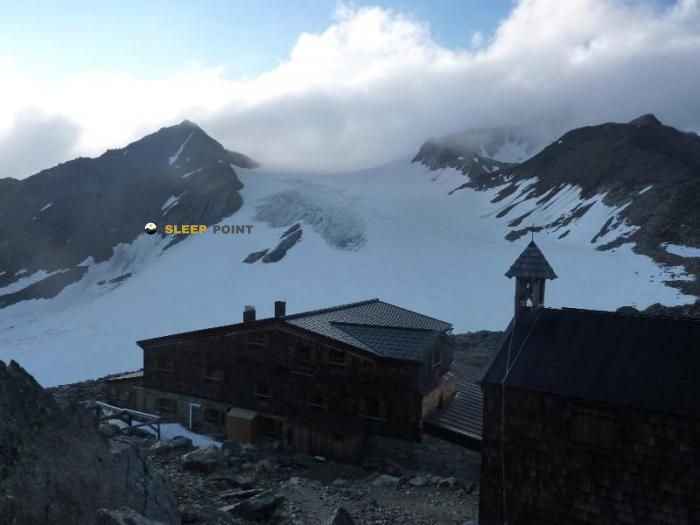

The Similaun Hütte refuge acts as a base camp for the summits and routes of similaunhütte - rifugio similaun, 63, unser frau - madonna, schnals - senales, vinschgau - val venosta, provincia de bolzano, trentino-alto adigio, 39020, italia. At 3019 meters of elevation, its coordinates (46.772, 10.855) represent safety after a long day of effort.
-1.2°C
Feels like: -5.4°C9.8 km/h
Gusts: 28.4 km/h2970 m
Snow lineUV 0.85
Clouds: 51% 10.1 mm
 24.5 km/h
 UV máx: 7.5
 05:25
05:25
 21:04
2.9 mm
25.9 km/h
UV máx: 7.5
05:24
21:05
22.7 mm
18.1 km/h
UV máx: 6.15
05:24
21:06
4.2 mm
13.7 km/h
UV máx: 6.7
05:23
21:06
0 mm
15.9 km/h
UV máx: 6.6
05:23
21:07
6.3 mm
9.2 km/h
UV máx: 7.7
05:23
21:08
6 mm
11.3 km/h
UV máx: 2.8
05:22
21:08
21:04
2.9 mm
25.9 km/h
UV máx: 7.5
05:24
21:05
22.7 mm
18.1 km/h
UV máx: 6.15
05:24
21:06
4.2 mm
13.7 km/h
UV máx: 6.7
05:23
21:06
0 mm
15.9 km/h
UV máx: 6.6
05:23
21:07
6.3 mm
9.2 km/h
UV máx: 7.7
05:23
21:08
6 mm
11.3 km/h
UV máx: 2.8
05:22
21:08
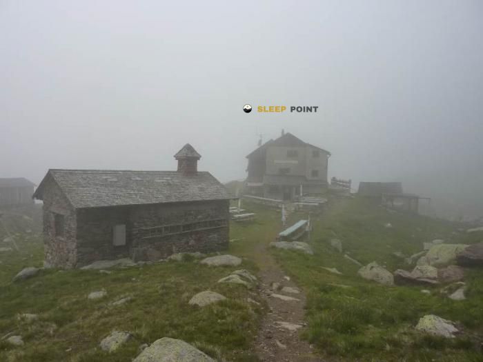
It is necessary to plan here with margin and autonomy. The invented sources are far from the building, more than 4 km away, so the water should not be considered safe in the day if it has not been confirmed before. In this sector of Schnals - Senals within the Upper Adigio, the shelter appears more as a piece of passage and reorganisation of route than as support with immediate logistics around.
Similoun Hütte is located at 3019 meters, in a very exposed section of the Similoun and the division of the Alps of Ötztal. This position is related to a glacier terrain, hills and side changes where the orientation conditions the progression. It is not just a high point: it is a place that helps to read the map between basins and decide whether to continue, cross to another slope or withdraw before time complicates the route.
Its usefulness is well understood in the journey. In the area they pass long routes such as Zentralalpenweg 02 , and also senderist connections of the Senales environment, so that it works as a link between longer days and local tours. In this context, the shelter serves to fail stages, adjust schedules and keep a reasonable exit open when the weather or the state of the ground force to change the plan.
The Alpine character of the place is reinforced by nearby summits such as Finailspitze - Punta di Finale , less than 2 km, and by the proximity of Similoun itself. In addition, the area is linked to the surroundings of Hauslabjoch, known for the finding of Ötzi, a data that helps to place the shelter in a border and highly recognizable strip of the massif, between Italy and Austria.
With this combination of altitude, mountain transit and practical isolation, the day here requires to anticipate rapid changes in conditions, to carry reliable guidance and not to rely on unverified resources on the ground.


📏 4 Km
⛰️ 2501 m

📏 4.9 Km
⛰️ 2845 m

📏 9.9 Km
⛰️ 3277 m

📏 10.8 Km
⛰️ 2844 m
📏 12.8 Km
⛰️ 2557 m

📏 31.5 Km
⛰️ 2242 m

📏 32.2 Km
⛰️ 2258 m

📏 35.2 Km
⛰️ 2191 m
Download the app and start looking for the shelter of your next adventure


Find a place to sleep before night falls.


