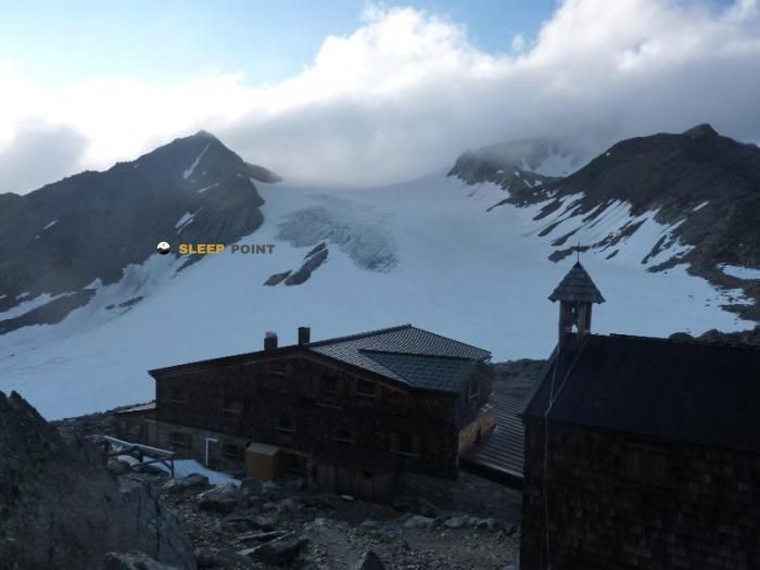
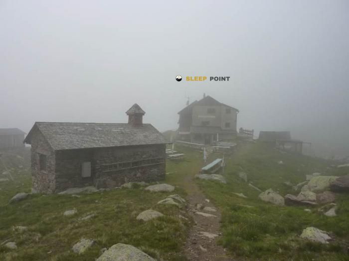
Mountain refuge Martin Busch Hütte (Samoar Hütte)
We have it listed in the app!
We have it listed in the app!


Discover the Martin Busch Hütte (Samoar Hütte) refuge, an alpine shelter located at 2501 meters in the area of martin-busch-hütte, 403, hütten vent, sölden, bezirk imst, tirol, 6458, austria. Whether you are on a multi-day trek or a day hike, this point (46.801, 10.887) will provide the peace and shelter you seek in the mountains.
6.3°C
Feels like: 1.8°C13.6 km/h
Gusts: 21.6 km/h3860 m
Snow lineUV 5.2
Clouds: 64% 3.8 mm
 16.7 km/h
 UV máx: 7.6
 05:24
05:24
 21:05
23.8 mm
12.4 km/h
UV máx: 7.75
05:23
21:06
2.2 mm
12 km/h
UV máx: 7.3
05:23
21:06
0.2 mm
10.5 km/h
UV máx: 6.35
05:23
21:07
1.5 mm
7.9 km/h
UV máx: 7.35
05:22
21:08
12.9 mm
10.5 km/h
UV máx: 4.1
05:22
21:08
3.3 mm
10.1 km/h
UV máx: 3.7
05:22
21:09
21:05
23.8 mm
12.4 km/h
UV máx: 7.75
05:23
21:06
2.2 mm
12 km/h
UV máx: 7.3
05:23
21:06
0.2 mm
10.5 km/h
UV máx: 6.35
05:23
21:07
1.5 mm
7.9 km/h
UV máx: 7.35
05:22
21:08
12.9 mm
10.5 km/h
UV máx: 4.1
05:22
21:08
3.3 mm
10.1 km/h
UV máx: 3.7
05:22
21:09
The most useful thing to plan here is its role within a network of crossing routes. In the surroundings of Vent, within the Tyrol, this refuge is linked to routes such as the Zentralalpenweg 02 , Venter Höhenweg and the passage of Piccard-Übergang , so it works mainly as a point of passage or reorganisation of the day on alpine land, rather than as a simple isolated destination.
At 2501 meters, Martin Busch Hütte (Samoar Hütte) It already enters a strip where weather conditions the march. In this type of location, an output that seems short on the map can change character with fog, wind, residual snow or sudden temperature drop. It is therefore appropriate to read the planned itinerary well and to assess whether it compensates to deviate from the main route or to maintain a more direct progression according to the state of the day and the group.
Its mountain interest is to link routes of the Ötztal sector and to provide continuity to the routes that can approach the Alpine border between Austria and Italy. It also appears in the geographical context of the Similoun and the area where the finding of Ötzi is located, which helps to locate the shelter in an area of high hills and mountain steps with strong exposure to the changing time.
In practical terms, access and effort management matter as much as distance. There is no data here to set specific times or levels, so it is reasonable to prepare the day with margin and without depending on adjusted calculations. The registered sources are a few kilometres away, so it is not appropriate to have near water without having been checked before.
If used as cross support, the key is autonomy: to review foresight, to carry equipment suitable for high mountain and to propose alternatives in case time forces to shorten, wait or change through. In a mountain shelter of this kind, prudent planning weighs more than speed on the itinerary.


📏 4 Km
⛰️ 3019 m

📏 7.5 Km
⛰️ 2845 m

📏 7.5 Km
⛰️ 2844 m

📏 9.6 Km
⛰️ 3277 m
📏 14.1 Km
⛰️ 2557 m

📏 31.2 Km
⛰️ 2191 m

📏 33 Km
⛰️ 2278 m

📏 35.2 Km
⛰️ 2258 m
Download the app and start looking for the shelter of your next adventure


Find a place to sleep before night falls.


