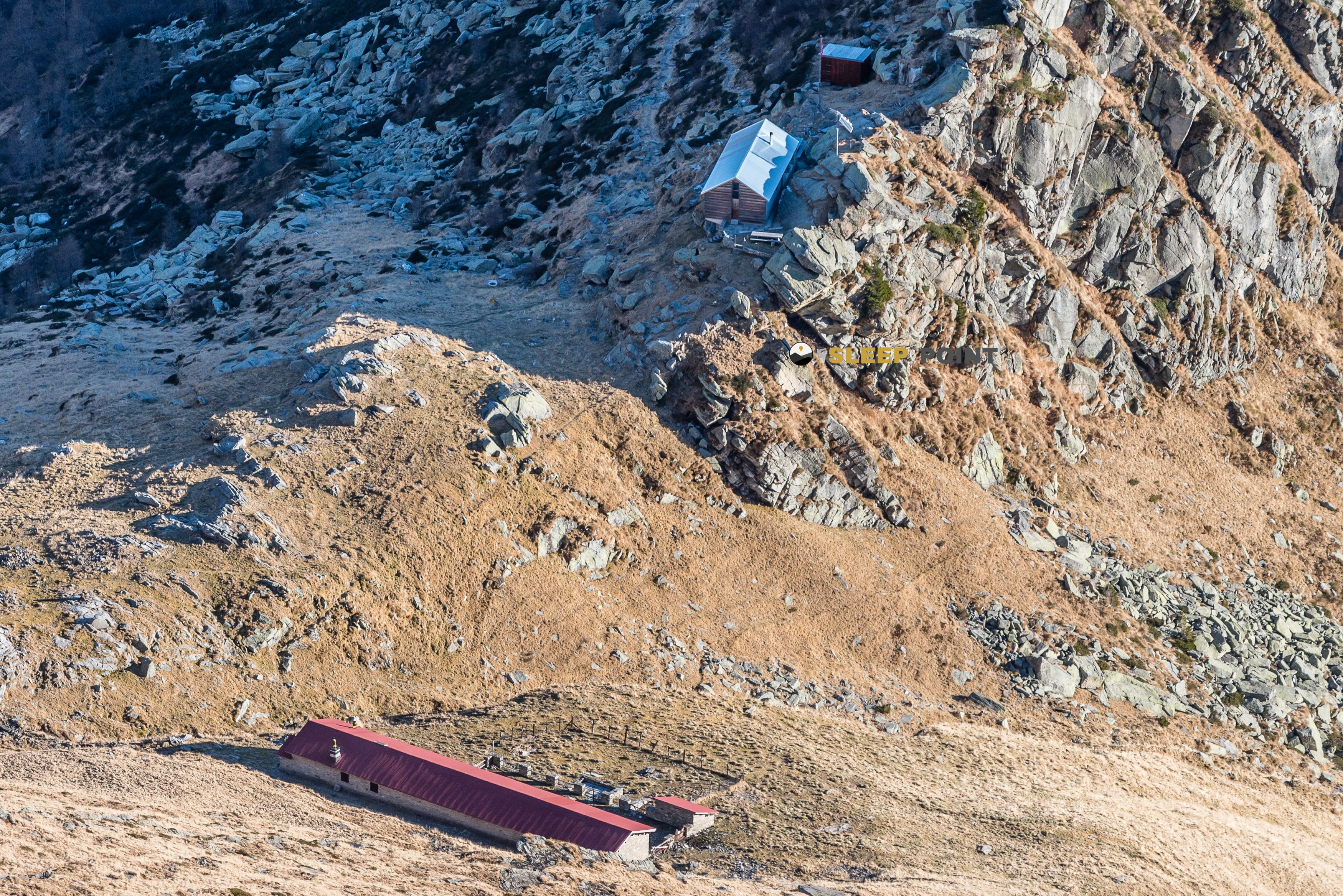
Mountain refuge Rifugio Alpe d'Aspra
We have it listed in the app!
We have it listed in the app!
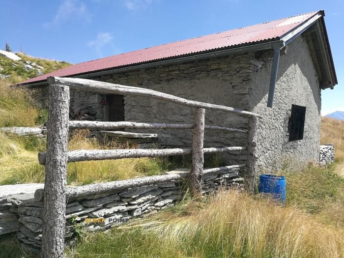

Strategically located in alpe arami-gaggio, bellinzona, circolo di bellinzona, distretto di bellinzona, tesino, 6523, suiza, the Rifugio Alpe d'Aspra refuge makes exploring the area easier. At 1773 meters above sea level, this point of interest (46.245, 8.98) is a vital resource when planning your route.
7.8°C
Feels like: 5°C7.6 km/h
Gusts: 29.2 km/h3830 m
Snow lineUV 0.1
Clouds: 96% 32.5 mm
 16.3 km/h
 UV máx: 6.2
 05:34
05:34
 21:10
13.5 mm
24.9 km/h
UV máx: 7.45
05:34
21:11
17.95 mm
7.1 km/h
UV máx: 6.75
05:33
21:12
0 mm
8.6 km/h
UV máx: 6.15
05:33
21:12
2.4 mm
11.3 km/h
UV máx: 7.45
05:32
21:13
23.55 mm
12.6 km/h
UV máx: 5.75
05:32
21:14
0 mm
12.9 km/h
UV máx: 2.55
05:32
21:14
21:10
13.5 mm
24.9 km/h
UV máx: 7.45
05:34
21:11
17.95 mm
7.1 km/h
UV máx: 6.75
05:33
21:12
0 mm
8.6 km/h
UV máx: 6.15
05:33
21:12
2.4 mm
11.3 km/h
UV máx: 7.45
05:32
21:13
23.55 mm
12.6 km/h
UV máx: 5.75
05:32
21:14
0 mm
12.9 km/h
UV máx: 2.55
05:32
21:14
Rifugio Alpe d'Aspra is located in the canton of Tesino, within the surroundings of Bellinzona and in the mountain strip that links alpe arami-gaggio with the elevations that close this sector. At 1773 meters, its position places it on a clearly montane terrain, above the valley bottom and already close to the tops as Gaggio , Cima d'Erbea Occidentale or Cima dell'Uomo . This context helps to understand its function: not so much as an isolated destination for a walk, but as a support for a day with a higher level, a hillside orientation and a more exposed environment than that of low levels of the Bellinzona valley.
To plan the exit well, it is necessary to have autonomy. There are no data here on equipment or services, and the nearest registered sources are more than 2.5 km away, so the water should not be taken for granted on arrival. Nor are there any specific associated routes, so it is wise to use it as a geographical reference within a larger mountain area, not as an automatic point of passage on a defined journey. It may be useful for mountaineers looking for a sober base to move along these slopes of the Tesino or to approach nearby summits, always with mapping, weather forecast and sufficient margin. In a sector where the relief gains height quickly, the key is less in the linear distance and more in the continuity of the terrain, the exposure to the change of time and the ability to manage a day without safe road support.


Download the app and start looking for the shelter of your next adventure


Find a place to sleep before night falls.