Mountain refuge Refuge d'Eychouzé (Naguilhes)

We have it listed in the app!


            Mountain refuge Refuge d'Eychouzé (Naguilhes) in coume de menier, orlu, foix, ariège, occitania, francia metropolitana, 09110, francia
Five orange stars in a horizontal row representing a five-star rating.

Refuge d'Eychouzé (Naguilhes)

Lat: 42.642xxx – Lon: 1.92xxx
📍 coume de menier, orlu, foix, ariège, occitania, francia metropolitana, 09110, francia
Refuge d'Eychouzé (Naguilhes)

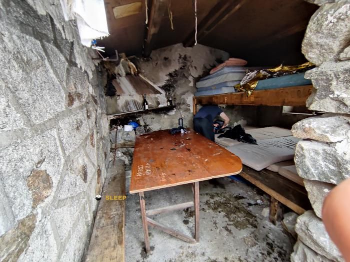
If you are looking for total disconnection, venture into coume de menier, orlu, foix, ariège, occitania, francia metropolitana, 09110, francia until you reach the Refuge d'Eychouzé (Naguilhes) refuge, positioned at 2080 meters. Use your device to navigate to the exact point (42.642, 1.92) to find this alpine shelter.

See more
See more
Usuario

Lucas Martinez

Premium user

Live weather: Refuge d'Eychouzé (Naguilhes)

Live weather report for Refuge d'Eychouzé (Naguilhes): current 5°C at 2080 meters (feels like 2.3°C). Wind at 3.4 km/h with gusts that may reach 16.9 km/h. The freezing level is at 4340 m and the maximum temperature will be 11.9°C.
Temperature

5°C

Feels like: 2.3°C
Wind

3.4 km/h

Gusts: 16.9 km/h
Freezing level 0°

4340 m

Snow line
Sky & UV

UV 0

Clouds: 100%

Next 48 hours evolution

7-day forecast

04/06
11.9° 3.9°
21.6 mm 16.9 km/h UV máx: 5.1
06:15 21:25
05/06
7.9° 0.3°
2.8 mm 15.7 km/h UV máx: 8
06:15 21:26
06/06
14.3° 3.4°
0.4 mm 7.4 km/h UV máx: 6.8
06:15 21:26
07/06
17.8° 6.7°
0 mm 10.3 km/h UV máx: 6.9
06:14 21:27
08/06
20° 9.1°
4.5 mm 8.6 km/h UV máx: 7.75
06:14 21:28
09/06
14.4° 4.9°
3.6 mm 7.6 km/h UV máx: 7.65
06:14 21:28
10/06
17.5° 4.3°
1.2 mm 7.7 km/h UV máx: 7.9
06:14 21:29

The high slopes linking the Orlu with the eastern divisive of the Ariège form a cross-road, with open atmosphere and clear mountain sensation above the forest. In this context they pass long-distance itineraries such as the GR 7 and HRP two references that explain the role of this coat well: not so much as an isolated destination, but as support on a long day or as a resource to start a stage when time changes, time is extended or tiredness advises not to move forward.

The area moves in high and exposed heights, and the Refuge d'Eychouzé (Naguilhes), at 2080 meters, fits that pirenian mountain logic where planning matters more than speed. Its environment is related to variants of GR 7 and the passage of the HRP, so it can be useful for those who travel this sector between hills and lacustrous cubes, or for those who are heading towards the itinerary of l'Étang d'En Beys. Rather than concentrating valley services, it works as an intermediate point in an area where it is appropriate to reach with margin.

It also helps to read the ground the nearby presence of tops like the Pic d'Étang Faury or Pic Lanoux which reinforce the Alpine character of the sector without necessarily turning the shelter into a basis of ascension. On stable days it can be used to link high-rise tours; with fog, wind or storm, its interest changes and becomes above all logistical, as I guard within a longer journey.

The day should be organized with autonomy. The registered sources do not appear next to the shelter, but several kilometres away, so it is not wise to have immediate water in the vicinity. In a passing area like this, between the Orlu environment and the itineraries that approach the Andorran border, the best reading of the place is that of a mountain support to adjust stages, not that of a point with hand-guaranteed resources.

Hiking routes from the refuge

GR 7

Des Vosges aux Pyrénées 13, vers le Col de Tougnets

↔ Variable distance
GR 7

Des Vosges aux Pyrénées 14, Porte de Barboilliere - Portella Blanca d'Andorra

↔ Variable distance
7B

Des Vosges aux Pyrénées, variante

↔ Variable distance
HRP

HRP Étape 33

↔ Variable distance
AX37

L'Étang d'En Beys

↔ 8 km
HRP Var.

HRP Variante 33.1

↔ Variable distance
HRP Var.

HRP Variante 33.2

↔ Variable distance
GR 10

La traversée des Pyrénées - sec.2

↔ Variable distance

Nearby peaks

Pic de Mortiers

2605 m
Lat: 42.6374 Lon: 1.9856

Puig de Terrers

2532 m
Lat: 42.6465 Lon: 1.9922

Pic Lanoux

2660 m
Lat: 42.6155 Lon: 1.8993

Pic de L'Homme

Altitude not available
Lat: 42.6417 Lon: 1.8903

Pic d'Étang Faury

2702 m
Lat: 42.6218 Lon: 1.912

Cap de Carbone

1857 m
Lat: 42.6676 Lon: 1.8595

Pic Grat Casal

2498 m
Lat: 42.6253 Lon: 1.8584

Pic de l'Estagnas

2615 m
Lat: 42.6205 Lon: 1.8662

Nearby water fountains

Fuente

4.8 Km
Lat: 42.6205 Lon: 1.8662

Fuente

5.94 Km
Lat: 42.6205 Lon: 1.8662

Fuente

6.49 Km
Lat: 42.6205 Lon: 1.8662

Fuente

6.98 Km
Lat: 42.6205 Lon: 1.8662

Fuente

6.98 Km
Lat: 42.6205 Lon: 1.8662

Fuente

7.08 Km
Lat: 42.6205 Lon: 1.8662

Fuente

7.09 Km
Lat: 42.6205 Lon: 1.8662

Fuente

7.09 Km
Lat: 42.6205 Lon: 1.8662
FAQ

Frequently asked questions

Pregunta frecuente
Are there other mountain refuges near Refuge d'Eychouzé (Naguilhes)?
Yes, nearby you can find other options to spend the night or take shelter. El refugio más próximo es el Cabane Eychouzé, que se encuentra a aproximadamente 0 km de distancia.
Pregunta frecuente
At what exact altitude is the Refuge d'Eychouzé (Naguilhes) refuge located?
The Refuge d'Eychouzé (Naguilhes) refuge is located at an altitude of 2080 meters above sea level, in the natural surroundings of coume de menier, orlu, foix, ariège, occitania, francia metropolitana, 09110, francia.
Pregunta frecuente
What are the GPS coordinates of the Refuge d'Eychouzé (Naguilhes) refuge?
To locate the Refuge d'Eychouzé (Naguilhes) refuge on your GPS or map, use the following coordinates: Latitude 42.642 and Longitude 1.92.
More areas

Other areas

Collaborative

Together we improve

image

Send your photos

You can upload photos of shelters and update their status so other users know if they can go there.

Get started
Get started
image

Rate the shelter

Leave your comments to rate the shelter’s condition. In the mountains, we look after each other.

Get started
Get started
image

Add new ones

Did we miss any? Publish the shelters you know so everyone can use them.

Get started
Get started
Download for free from the Apple App Store and Play Store.

Download the app and start looking for the shelter of your next adventure

Aplicación móvil para encontrar refugios de montaña donde dormir
Aplicación móvil para encontrar refugios de montaña donde dormir.
Mapa interactivo de refugios de montaña en los Pirineos dentro de la app
Mapa de refugios de montaña para senderismo y trekking en la app.
Pantalla con información de refugio de montaña con altitud capacidad y servicios
Pantalla con información de refugio de montaña con altitud capacidad y servicios.
Detalles de refugio de montaña con servicios y meteorología en aplicación móvil
Detalles de refugio de montaña con servicios y meteorología en aplicación móvil.
Aplicación para explorar refugios de montaña mediante mapa interactivo
Aplicación para explorar refugios de montaña mediante mapa interactivo.
Ficha completa de refugio de montaña con opiniones y servicios
Ficha completa de refugio de montaña con opiniones y servicios.
Información detallada de refugio en app para montañeros
Información detallada de refugio en app para montañeros.
Listado de refugios de montaña para senderismo y trekking
Listado de refugios de montaña para senderismo y trekking.
Explorar refugios de montaña desde una aplicación móvil
Explorar refugios de montaña desde una aplicación móvil.