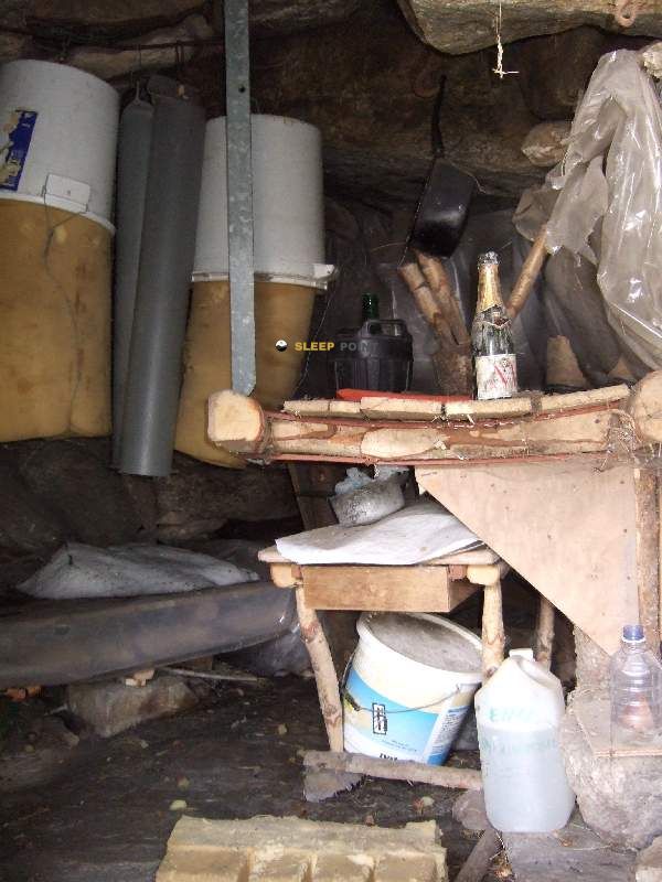
Mountain refuge Cabane Rieufort de Gascous
We have it listed in the app!
We have it listed in the app!


Located at 1750 m above sea level, the Cabane Rieufort de Gascous refuge is a true haven of peace in cabane rieutort de gascous, d 520a, aston, foix, ariège, occitania, francia metropolitana, 09310, francia. Connect with nature and use its coordinates (42.685, 1.636) to guide your steps to its door.
6.2°C
Feels like: 4.7°C3.2 km/h
Gusts: 3.2 km/h4480 m
Snow lineUV 0
Clouds: 100% 19.9 mm
 16.9 km/h
 UV máx: 5.65
 06:16
06:16
 21:26
0.4 mm
9.6 km/h
UV máx: 7.95
06:16
21:27
0.7 mm
10.9 km/h
UV máx: 6.25
06:16
21:28
3.4 mm
14.6 km/h
UV máx: 7.5
06:15
21:28
3.6 mm
12.7 km/h
UV máx: 8.05
06:15
21:29
1.8 mm
9.4 km/h
UV máx: 2.5
06:15
21:30
1.8 mm
8.7 km/h
UV máx: 7.8
06:15
21:30
21:26
0.4 mm
9.6 km/h
UV máx: 7.95
06:16
21:27
0.7 mm
10.9 km/h
UV máx: 6.25
06:16
21:28
3.4 mm
14.6 km/h
UV máx: 7.5
06:15
21:28
3.6 mm
12.7 km/h
UV máx: 8.05
06:15
21:29
1.8 mm
9.4 km/h
UV máx: 2.5
06:15
21:30
1.8 mm
8.7 km/h
UV máx: 7.8
06:15
21:30
In the environment of HRP and near the GR 10 , Cabane Rieufort de Gascous it is mainly a use of passage or support for mountaineers who travel long days along the side of Aston in Ariège. It can also be useful for those who link itineraries to the sector of Beille or seek to divide tours of medium and high mountain without going down to the valley. Its position places it in a strip where hiking stops being a valley walk and enters more open terrain, with a logic of journey and autonomy.
At 1,750 metres, the shelter moves in a clear mountain environment, with sufficient relief to serve as the basis for exits towards nearby summits such as the Pic du Pas de Bouc , Pic de l'Estagnol or Pic de Thoumasset . It is not necessary to raise it only as a shelter for ascension: its interest is also in ordering stages for a border and liaison sector, where long-distance routes and altitude routes are combined. For senderists with basic experience in orientation and effort management, it can be a useful reference within a wider day.
The information available points to a shelter that should be understood from the mountain logistics. The registered sources are several kilometres away, with the nearest one more than 5 km away, so it is not wise to have immediate water in the vicinity. In this type of land, and even more so if it is linked with HRP or GR 10, it is important to go out with sufficient autonomy and to anticipate changes in time, fog or wind, common in medium-high levels of the Pyrenees.
By location and context, the Cabane Rieufort de Gascous It makes more sense for those who already move through continuity routes than for an improvised exit. In the area there are variants of the HRP and high routes such as the return to Andorra, which reinforces its role as a support point within the trekking of this sector of Occitania.


📏 1.3 Km
⛰️ 1510 m

📏 1.7 Km
⛰️ 1611 m

📏 1.7 Km
⛰️ 1610 m
📏 1.8 Km
⛰️ 1650 m

📏 2 Km
⛰️ 1630 m

📏 2.1 Km
⛰️ 1600 m

📏 2.3 Km
⛰️ 1650 m

📏 2.5 Km
⛰️ 2203 m
Download the app and start looking for the shelter of your next adventure


Find a place to sleep before night falls.


