Mountain refuge Refuge de Quioules
We have it listed in the app!
We have it listed in the app!


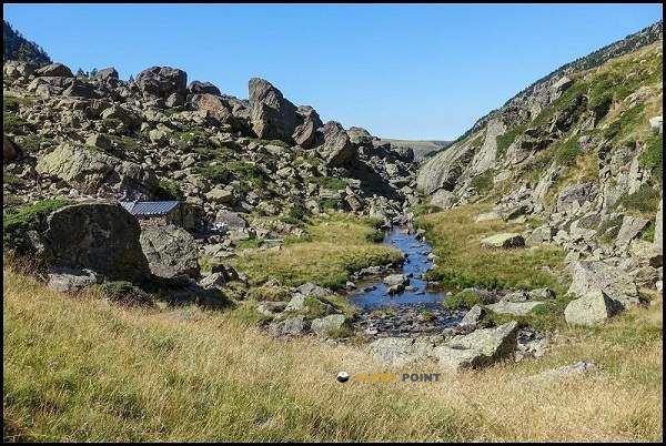
Conquering the trails of cabane de quioulès, d 520a, aston, foix, ariège, occitania, francia metropolitana, 09310, francia is easier with the Refuge de Quioules refuge. Located at 1611 m (coordinates 42.67, 1.637), it is the ideal shelter against harsh mountain weather.
7.8°C
Feels like: 5.9°C4.6 km/h
Gusts: 3.2 km/h4470 m
Snow lineUV 0
Clouds: 100% 19.4 mm
 16.3 km/h
 UV máx: 5.65
 06:16
06:16
 21:26
0.6 mm
9.9 km/h
UV máx: 7.95
06:16
21:27
0.7 mm
10.9 km/h
UV máx: 6.25
06:16
21:28
3.4 mm
14.6 km/h
UV máx: 7.5
06:15
21:28
3.6 mm
12.7 km/h
UV máx: 8.05
06:15
21:29
1.8 mm
9.4 km/h
UV máx: 2.5
06:15
21:30
1.8 mm
8.7 km/h
UV máx: 7.8
06:15
21:30
21:26
0.6 mm
9.9 km/h
UV máx: 7.95
06:16
21:27
0.7 mm
10.9 km/h
UV máx: 6.25
06:16
21:28
3.4 mm
14.6 km/h
UV máx: 7.5
06:15
21:28
3.6 mm
12.7 km/h
UV máx: 8.05
06:15
21:29
1.8 mm
9.4 km/h
UV máx: 2.5
06:15
21:30
1.8 mm
8.7 km/h
UV máx: 7.8
06:15
21:30
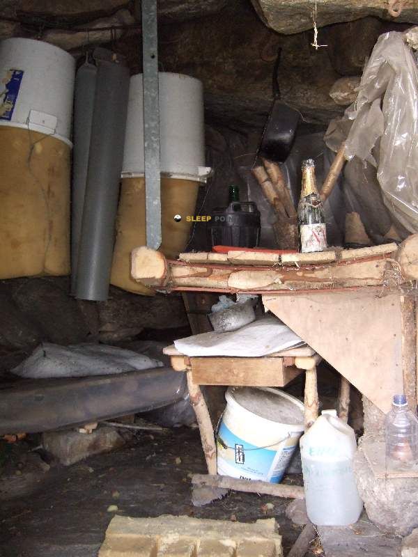
In this part of Ariège, above Aston and in a relief of medium and high mountain very open to meteorology, the Refuge de Quioules It fits better as a walking coat than as an isolated destination. Its height, 1611 m, places it in a strip where the land already forces it to read the valley well and to manage the day with margin, especially if long routes are linked or across slopes close to the Andorran border. The reference of the D 520a helps to place it in the sector, but in practice its interest is more in the continuity of the march than in the road access: it works as support in an area where effort should be shared before or after winning high hills and sections.
This function is well understood by its relationship to the journey routes such as the HRP and GR 10 , two classic axes to cross the Pyrenees and connect basins. From that logic, the shelter can serve to break down stages, adjust a transition between valleys or resolve a long day without falling too much altitude. The environment of Beille which strengthens its role within a wide mountain landscape and background displacements rather than concrete ascension. On the other hand, there is no useful data to raise it as a base for nearby summits. In logistics, the most delicate point is water: the registered sources are several kilometres away, with the nearest one more than 6 km away, so it is not appropriate to have immediate supply next to the shelter and it is prudent to leave with sufficient autonomy and to verify the situation before the journey.


📏 0 Km
⛰️ 1610 m

📏 1.4 Km
⛰️ 2203 m

📏 1.4 Km
⛰️ 1780 m

📏 1.7 Km
⛰️ 1750 m

📏 2 Km
⛰️ 1510 m
📏 2.3 Km
⛰️ 1650 m
📏 2.3 Km
⛰️ 1914 m

📏 2.5 Km
⛰️ 1970 m
Download the app and start looking for the shelter of your next adventure


Find a place to sleep before night falls.


