Mountain refuge Cabane d'Uls

We have it listed in the app!


            Mountain refuge Cabane d'Uls in cabane d'uls, d 44h, labach, melles, saint-gaudens, alto garona, occitania, francia metropolitana, 31440, francia
Five orange stars in a horizontal row representing a five-star rating.

Cabane d'Uls

Lat: 42.854xxx – Lon: 0.839xxx
📍 cabane d'uls, d 44h, labach, melles, saint-gaudens, alto garona, occitania, francia metropolitana, 31440, francia
Cabane d'Uls

If you are planning a route through cabane d'uls, d 44h, labach, melles, saint-gaudens, alto garona, occitania, francia metropolitana, 31440, francia, the Cabane d'Uls refuge is a must-stop. Located at 1870 m above sea level, it offers hikers and climbers a safe place to regain strength. Save its coordinates (42.854, 0.839) in your GPS to stay on course during your journey.

See more
See more
Usuario

Lucas Martinez

Premium user

Live weather: Cabane d'Uls

Alpine weather summary for Cabane d'Uls: temperature at 7.4°C, feels like 5.6°C. Wind at 5.7 km/h with peaks of 7.9 km/h. UV index at 0.95 and freezing altitude at 4330 m. Maximum temperatures of 10.7°C in the coming hours.
Temperature

7.4°C

Feels like: 5.6°C
Wind

5.7 km/h

Gusts: 7.9 km/h
Freezing level 0°

4330 m

Snow line
Sky & UV

UV 0.95

Clouds: 84%

Next 48 hours evolution

7-day forecast

04/06
10.7° 2.7°
20.28 mm 18 km/h UV máx: 4.35
06:19 21:30
05/06
7.9° 0.2°
0.9 mm 12.1 km/h UV máx: 7.05
06:19 21:31
06/06
14.9°
0.1 mm 8.9 km/h UV máx: 7.4
06:18 21:31
07/06
18.9° 7.9°
0 mm 12.8 km/h UV máx: 7.15
06:18 21:32
08/06
21.2°
1.2 mm 10.4 km/h UV máx: 7.85
06:18 21:33
09/06
8.6° 3.9°
3 mm 7.8 km/h UV máx: 4.4
06:17 21:33
10/06
17.2° 3.8°
0 mm 8.6 km/h UV máx: 7.7
06:17 21:34

Between a timely base and a safe passage

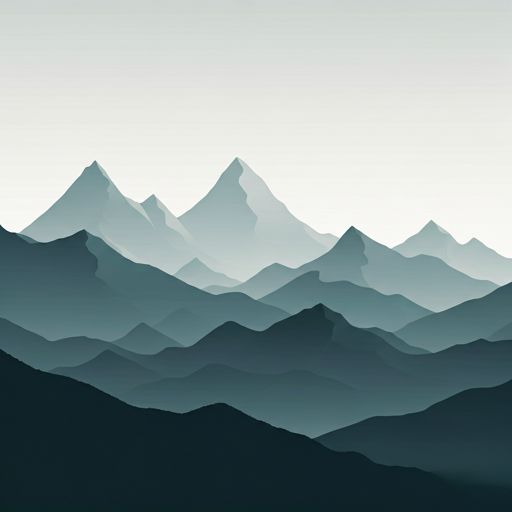
More than a shelter designed only to attack a concrete top, Cabane d'Uls it fits well in support of a crossing through this border sector between the French High Garona and the surroundings of the Val d'Aran. At the end of Melles, at 1,870 meters, it appears in a mountain strip where the cords easily link long-distance routes and steps between sides. That position makes sense within such routes as the GR 10 and, somewhat further south, the great circular of the Val d'Aran by the GR 211 , rather than as a simple isolated destination.

The surrounding land has a clearly mountainous character, with open relief, high slopes and relatively close summits that help to read the area: Cap de Gauch is very close, and the Pic du Crabere strengthens the border and divisive environment. In this context, the shelter can serve to start a day, link valleys or resolve an intermediate stage on a long journey. It is not appropriate, however, to put it with a minimum logistics. The invented sources are not next to the building: the nearest ones are more than 2.5 km away, so the water should be previewed and not taken for granted when arriving.

It is also interesting to take into account the relative isolation of the place. Although the area connects with known routes, it remains a mountain site where weather and orientation can make the day very much conditioned. If used Cabane d'Uls As a step-by-step refuge on a long-distance journey, it is reasonable to arrive with sufficient autonomy and with the well-prepared itinerary, especially if it is intended to link with the orange side or to continue on the cords and hills of the area.

Hiking routes from the refuge

GR 211

Circular Val d'Aran

↔ 153.4 km
GR 10

La traversée des Pyrénées - sec.5

↔ Variable distance
GR 10

La traversée des Pyrénées - sec.4

↔ Variable distance
GR 211.3

Sender circular de la Val d'Aran. Variant Cap de les Comes de Liat - Eth Sarrat de Pièrres

↔ 6.5 km
Local

Boucle de la chapelle de l'isard

↔ Variable distance
Local

Setau Sagèth

↔ 110 km
Local

el Gran Bucle

↔ 140 km
GRT 52

Plans del Pas Estret - Port d'Urets

↔ Variable distance

Nearby peaks

Tuc dera Comassa

2393.4 m
Lat: 42.8286 Lon: 0.8469

Pica de Horadic

2115.5 m
Lat: 42.8387 Lon: 0.8107

Cap de Gauch

2148 m
Lat: 42.8708 Lon: 0.8356

Pic du Crabere

2630 m
Lat: 42.8257 Lon: 0.8582

Cap de la Pique

2034 m
Lat: 42.8406 Lon: 0.8017

Pic de la Calabasse

2210 m
Lat: 42.8696 Lon: 0.8593

Pic de l'Har

2424 m
Lat: 42.8348 Lon: 0.8954

Pic de Paumaudé

2082 m
Lat: 42.868 Lon: 0.8861

Nearby water fountains

Source

2.52 Km
Lat: 42.868 Lon: 0.8861

Fuente

2.57 Km
Lat: 42.868 Lon: 0.8861

Fuente

4.06 Km
Lat: 42.868 Lon: 0.8861

Fuente

4.6 Km
Lat: 42.868 Lon: 0.8861

Fuente

4.61 Km
Lat: 42.868 Lon: 0.8861

Fuente

4.74 Km
Lat: 42.868 Lon: 0.8861

Fuente

6.24 Km
Lat: 42.868 Lon: 0.8861

Fuente

6.48 Km
Lat: 42.868 Lon: 0.8861
FAQ

Frequently asked questions

Pregunta frecuente
What are the GPS coordinates of the Cabane d'Uls refuge?
To locate the Cabane d'Uls refuge on your GPS or map, use the following coordinates: Latitude 42.854 and Longitude 0.839.
Pregunta frecuente
Is it necessary to carry a GPS to reach the Cabane d'Uls refuge?
It is always highly recommended to carry a GPS device, a route track, or a topographic map in the mountains. You can use the coordinates 42.854, 0.839 to locate this refuge precisely.
Pregunta frecuente
In which municipality or region is the Cabane d'Uls refuge located?
This refuge is located within the municipality of Melles, belonging to the community or region of Occitania.
More areas

Other areas

Collaborative

Together we improve

image

Send your photos

You can upload photos of shelters and update their status so other users know if they can go there.

Get started
Get started
image

Rate the shelter

Leave your comments to rate the shelter’s condition. In the mountains, we look after each other.

Get started
Get started
image

Add new ones

Did we miss any? Publish the shelters you know so everyone can use them.

Get started
Get started
Download for free from the Apple App Store and Play Store.

Download the app and start looking for the shelter of your next adventure

Aplicación móvil para encontrar refugios de montaña donde dormir
Aplicación móvil para encontrar refugios de montaña donde dormir.
Mapa interactivo de refugios de montaña en los Pirineos dentro de la app
Mapa de refugios de montaña para senderismo y trekking en la app.
Pantalla con información de refugio de montaña con altitud capacidad y servicios
Pantalla con información de refugio de montaña con altitud capacidad y servicios.
Detalles de refugio de montaña con servicios y meteorología en aplicación móvil
Detalles de refugio de montaña con servicios y meteorología en aplicación móvil.
Aplicación para explorar refugios de montaña mediante mapa interactivo
Aplicación para explorar refugios de montaña mediante mapa interactivo.
Ficha completa de refugio de montaña con opiniones y servicios
Ficha completa de refugio de montaña con opiniones y servicios.
Información detallada de refugio en app para montañeros
Información detallada de refugio en app para montañeros.
Listado de refugios de montaña para senderismo y trekking
Listado de refugios de montaña para senderismo y trekking.
Explorar refugios de montaña desde una aplicación móvil
Explorar refugios de montaña desde una aplicación móvil.