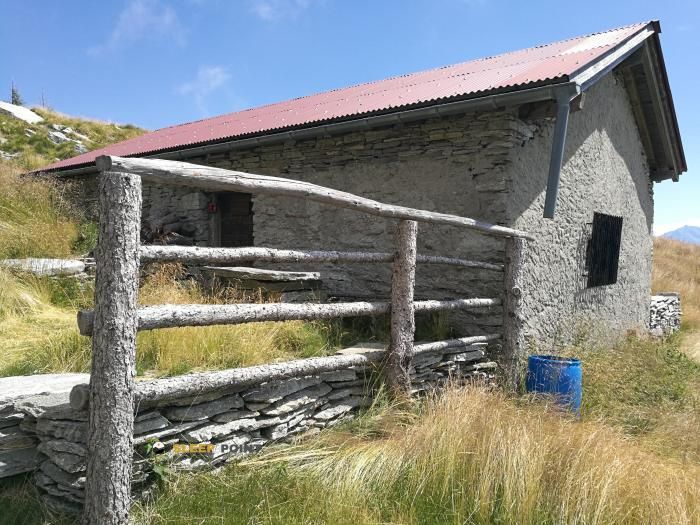
Mountain refuge Albagno
We have it listed in the app!
We have it listed in the app!

The Albagno refuge stands at 1870 meters above sea level, overlooking the surroundings of capanna albagno, ferrata dei tre signori (difficile), bellinzona, circolo di bellinzona, distretto di bellinzona, tesino, 6514, suiza. It is a key spot for mountaineers looking to spend the night or take a break. Its coordinates (46.223, 8.956) place it in a strategic position for exploring the peaks and trails of the region.
8.5°C
Feels like: 6.4°C7.4 km/h
Gusts: 32.4 km/h3820 m
Snow lineUV 2.25
Clouds: 100% 34.7 mm
 15.5 km/h
 UV máx: 5.85
 05:34
05:34
 21:10
32.7 mm
23.9 km/h
UV máx: 7.15
05:34
21:11
21.24 mm
5.6 km/h
UV máx: 5.95
05:33
21:12
0 mm
6.6 km/h
UV máx: 6.05
05:33
21:12
1.2 mm
9 km/h
UV máx: 7.3
05:32
21:13
11.25 mm
10.1 km/h
UV máx: 5.8
05:32
21:14
0 mm
11.4 km/h
UV máx: 5.1
05:32
21:14
21:10
32.7 mm
23.9 km/h
UV máx: 7.15
05:34
21:11
21.24 mm
5.6 km/h
UV máx: 5.95
05:33
21:12
0 mm
6.6 km/h
UV máx: 6.05
05:33
21:12
1.2 mm
9 km/h
UV máx: 7.3
05:32
21:13
11.25 mm
10.1 km/h
UV máx: 5.8
05:32
21:14
0 mm
11.4 km/h
UV máx: 5.1
05:32
21:14
The network of trails that crosses the Tesino in this sector a fundamental point of articulation, especially for those who travel the Via Gottardo or the Swiss route of the E1 . These routes allow to link the aspects of the Bellinzona district facilitating the transit between basins through itineraries that require precise planning of the running times.
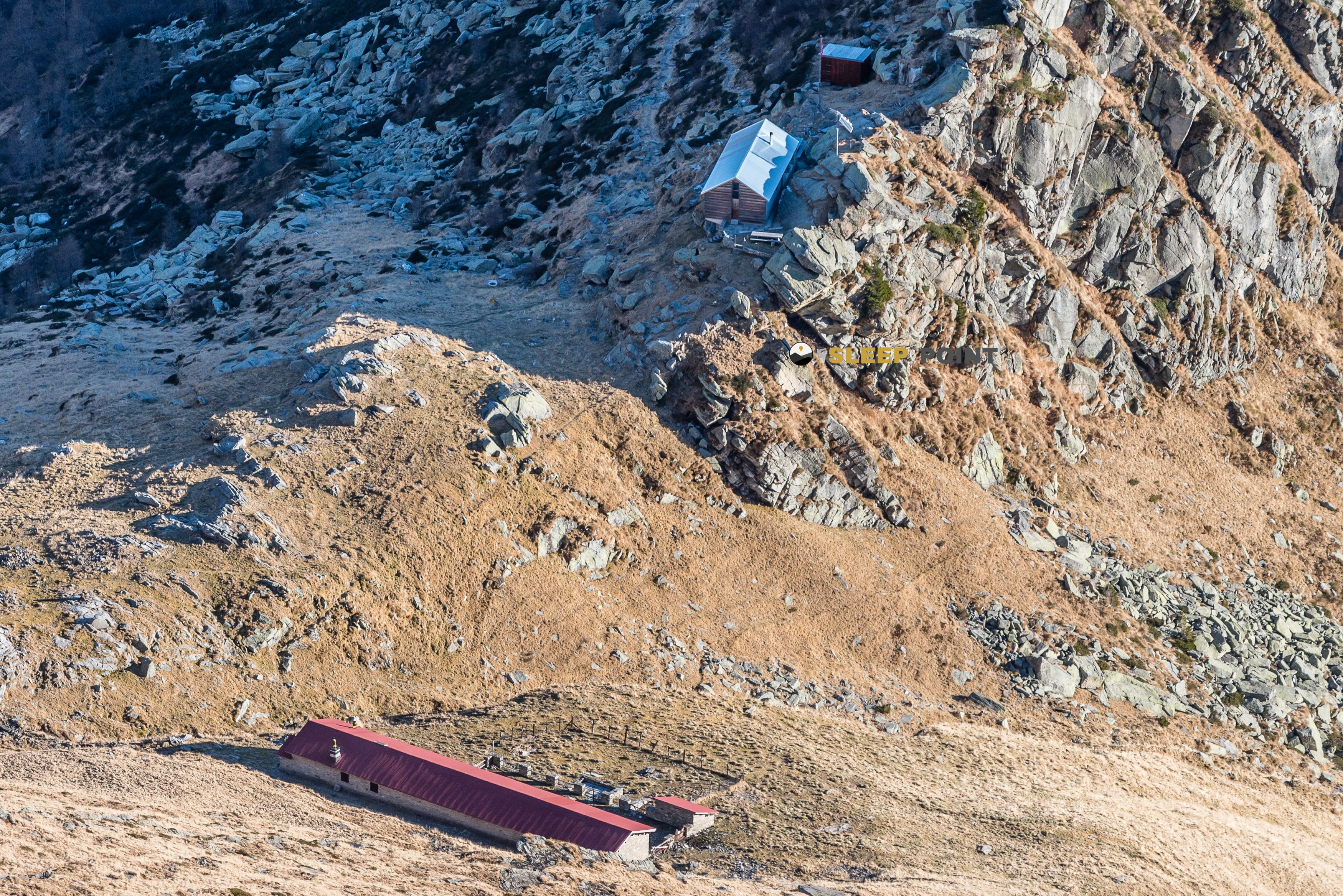
Located at 1870 meters, the shelter Albagno acts as a strategic node to manage the effort in long-distance voyages. Its position is decisive in deciding the continuity of the day towards the height steps or in seeking to guard against sudden changes in meteorology, allowing to fracture the demanding levels before facing the upper cords.
The surrounding relief, defined by summits such as the Cima dell'Uomo or Gaggio , it forms a technical terrain typical of the high mountain where the orientation is priority. The aspects that connect to this point require a solid knowledge of the environment, as the link paths present a continuity that depends directly on the conditions of the ground and the visibility.
With regard to mountain logistics, the presence of water points at very short distance from the building facilitates the planning of the activity. However, the progression to areas such as Gnosca or Sementine requires maintaining the autonomy necessary to face significant sections without intermediate support, always ensuring the reserves before leaving the shelter environment.
Given its location on routes such as Sentiero Riviera this point functions as an essential safety element in the area. It is essential to assess the accumulated fatigue and atmospheric forecasting before committing to the most exposed sections that communicate the different valleys, thus ensuring a safe transition between the different basins of the massif.


Download the app and start looking for the shelter of your next adventure


Find a place to sleep before night falls.