Mountain refuge Refuge Montmalus
We have it listed in the app!
We have it listed in the app!


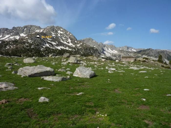
If you are planning a route through refugi de montmalús, gr 11, encamp, ad200, principado de andorra, the Refuge Montmalus refuge is a must-stop. Located at 2438 m above sea level, it offers hikers and climbers a safe place to regain strength. Save its coordinates (42.499, 1.681) in your GPS to stay on course during your journey.
5°C
Feels like: 1.8°C12.1 km/h
Gusts: 31.7 km/h4290 m
Snow lineUV 0.35
Clouds: 100% 24.8 mm
 20.9 km/h
 UV máx: 7.2
 06:17
06:17
 21:26
0 mm
16.1 km/h
UV máx: 8.1
06:16
21:26
0.1 mm
13.2 km/h
UV máx: 7.35
06:16
21:27
0 mm
9.2 km/h
UV máx: 6.8
06:16
21:28
0.9 mm
16.8 km/h
UV máx: 8.3
06:16
21:28
3 mm
15.7 km/h
UV máx: 7.85
06:15
21:29
0 mm
5.2 km/h
UV máx: 7.9
06:15
21:29
21:26
0 mm
16.1 km/h
UV máx: 8.1
06:16
21:26
0.1 mm
13.2 km/h
UV máx: 7.35
06:16
21:27
0 mm
9.2 km/h
UV máx: 6.8
06:16
21:28
0.9 mm
16.8 km/h
UV máx: 8.3
06:16
21:28
3 mm
15.7 km/h
UV máx: 7.85
06:15
21:29
0 mm
5.2 km/h
UV máx: 7.9
06:15
21:29
At 2438 meters, Refuge Montmalus allows to plan a day of a clearly alpine environment in the Encamp sector, within the network of free shelters in Andorra. The altitude marks the character of the place: open terrain, fast time changes and cold nights even outside the most stable season. In this context, it is appropriate to arrive with sufficient autonomy and with the water planned in advance. The nearest registered source is just over 2 km, a data relevant to anyone who wants to spend the night or link stages without depending on finding immediate water next to the shelter.
Their interest is not limited to the spot coat. The location fits well in travel routes like the GR 7 , HRP or GRP La volta a Andorra , so it works mainly as logistical support on long itineraries along the high Andorran mountain. It is also within an environment of forthcoming summits and cords, with references such as the Tosseta de Vallcivera , Pic de Calm Colomer or Roc de Lliçà which help to place it in a landscape of wide divisive and relief, close to the area of the Cerdaña and of mountains such as the Tossa Plana de Lles . More than a safe haven with comfortable access or a purely hiker use, it fits better in exits where it is already assumed level, orientation on mountain terrain and exposure to changing conditions of high levels.


📏 2 Km
⛰️ 2480 m

📏 2.4 Km
⛰️ 2068 m

📏 2.8 Km
⛰️ 2430 m

📏 3 Km
⛰️ 2300 m

📏 3.5 Km
⛰️ 2265 m
📏 3.7 Km
⛰️ 2250 m

📏 3.7 Km
⛰️ 2230 m

📏 3.7 Km
⛰️ 2425 m
Download the app and start looking for the shelter of your next adventure


Find a place to sleep before night falls.


