Mountain refuge Refuge des Princes
We have it listed in the app!
We have it listed in the app!
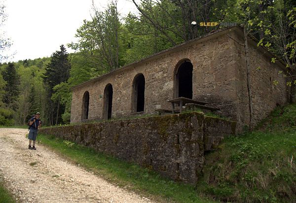

Discover the vastness of refuge des princes, chemin de fonderesse, laratte, mornans, die, drôme, auvergne-rhône-alpes, francia metropolitana, 26460, francia by spending the night at the Refuge des Princes refuge. It sits at 907 meters, offering a unique balcony over the natural landscape. Find it on the map at latitude 44.642 and longitude 5.151.
13.2°C
Feels like: 11.3°C7.6 km/h
Gusts: 27 km/h4190 m
Snow lineUV 0
Clouds: 100% 28.6 mm
 17.5 km/h
 UV máx: 4.15
 05:55
05:55
 21:19
0 mm
24.4 km/h
UV máx: 6.85
05:55
21:20
0 mm
10.4 km/h
UV máx: 7.6
05:54
21:21
0 mm
8.9 km/h
UV máx: 7.5
05:54
21:21
0 mm
13.8 km/h
UV máx: 7.45
05:54
21:22
1.2 mm
23.2 km/h
UV máx: 6.25
05:54
21:23
0 mm
13.3 km/h
UV máx: 7.35
05:53
21:23
21:19
0 mm
24.4 km/h
UV máx: 6.85
05:55
21:20
0 mm
10.4 km/h
UV máx: 7.6
05:54
21:21
0 mm
8.9 km/h
UV máx: 7.5
05:54
21:21
0 mm
13.8 km/h
UV máx: 7.45
05:54
21:22
1.2 mm
23.2 km/h
UV máx: 6.25
05:54
21:23
0 mm
13.3 km/h
UV máx: 7.35
05:53
21:23
In this part of the Drôme, between small cores and paths linking medium slopes with more marked reliefs, Refuge des Princes it fits better as a step-by-step support or as a resource to shorten a day than as an isolated high mountain shelter. Its height, 907 meters, places it in a transitional terrain where the management of the effort depends less on the altitude and more on the type of route chosen, on the continuity of the road and on the actual length of the stage.
The environment of Mornans and the Die-Saillans sector connects it with a varied network of trails. The local routes and also the GR 95 , on the itinerary between Saillans and Lus-la-Croix-Haute, so that it can make sense within a long journey or as a point of withdrawal if the day is longer than expected. In this practical role, it is appropriate to read the map well before leaving: it is not the same to use it as a basis for moving on the roads of the sector as to reserve it as a link within a linear route.
To the next relief there are references such as Le Pradou , Roche Courbe , Le Veyou or Le Signal , summits that help to understand the mountainous character of the area without turning this shelter into a clearly alpine point. They are moderate to serious levels according to the choice of access, with land that may require continuity of march and good orientation if several crests are linked or secondary paths are combined.
In logistics, the most useful data is the presence of a source at about 1.7 km, reasonable but not immediate distance if you get just water or if you plan to live with autonomy. It is therefore appropriate not to have a supply in the shelter itself without first checking. In long days, especially if used as a refuge in the journey, it is worth providing sufficient water from the beginning and keeping room for time changes or early withdrawal to the inhabited valleys of the environment.


📏 2.3 Km
⛰️ 1207 m

📏 5.8 Km
⛰️ 500 m

📏 8.2 Km
⛰️ 873 m

📏 12 Km
⛰️ 851 m

📏 13.4 Km
⛰️ 850 m

📏 18.2 Km
⛰️ 815 m

📏 24 Km
⛰️ 560 m

📏 24.1 Km
⛰️ 750 m
Download the app and start looking for the shelter of your next adventure


Find a place to sleep before night falls.


