Mountain refuge Maison de la forêt
We have it listed in the app!
We have it listed in the app!


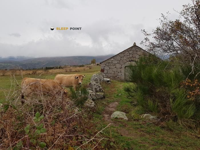
The mountains of mende, lozère, occitania, francia metropolitana, 48000, francia hide essential places like the Maison de la forêt refuge. Situated at an elevation of 1028 meters, it offers protection and rest. Its exact coordinates are 44.505, 3.508.
10.4°C
Feels like: 9.7°C1.1 km/h
Gusts: 11.9 km/h4020 m
Snow lineUV 0
Clouds: 100% 15.1 mm
 12.4 km/h
 UV máx: 0.9
 06:02
06:02
 21:25
0 mm
17.6 km/h
UV máx: 7.4
06:02
21:26
0 mm
15.9 km/h
UV máx: 7.5
06:02
21:27
0 mm
8 km/h
UV máx: 6.65
06:01
21:28
1.65 mm
12.8 km/h
UV máx: 7.5
06:01
21:28
0.3 mm
21.7 km/h
UV máx: 6.7
06:01
21:29
0 mm
10.5 km/h
UV máx: 7.45
06:00
21:29
21:25
0 mm
17.6 km/h
UV máx: 7.4
06:02
21:26
0 mm
15.9 km/h
UV máx: 7.5
06:02
21:27
0 mm
8 km/h
UV máx: 6.65
06:01
21:28
1.65 mm
12.8 km/h
UV máx: 7.5
06:01
21:28
0.3 mm
21.7 km/h
UV máx: 6.7
06:01
21:29
0 mm
10.5 km/h
UV máx: 7.45
06:00
21:29
In the environment of Mega , within the Lozère and the United Nations Occitania , Maison de la forêt It fits better as a transitional coat than as a destination in itself. Its position, at about 1.028 meters, places it in a moderate level where the wooded terrain and the loops surrounding the city make it possible to propose a reasonable withdrawal if the day is extended, changes the weather or it is necessary to cut the stage before entering into longer routes.
The most clear geographical reference is the relationship with the immediate reliefs of Mende. Very close appears Mont Mimat which helps to understand the character of the sector: it is not a high mountain, but a landscape of half mountain with alternation of forest, roads and smooth but continuous elevations. In this context, this shelter can be used to order the approach from the valley and to link hiking routes that travel the area, such as the Tour du Causse de Sauveterre without the need to turn the output into a single long run.
Its practical usefulness appears especially when time and tiredness are valued. For those who advance through this part of the cause or through the roads that connect Mende with the nearby altiplanes, having an intermediate guard point may be relevant if the progression becomes slower than expected. It can also fit into liaison days towards sectors such as Lanuéjols where distances depend very much on the chosen route and local deviations.
In terms of logistics, there is a source at about 770 meters, a reasonable distance on the map but that should be interpreted with caution: in mountain and half mountain, this proximity does not replace the need to leave with sufficient water or to confirm the real state of the point of supply. As there is no useful data on interior equipment or services, the point is to raise the day with basic autonomy and scope for plan changes.
By guidance and access, Maison de la forêt has an interest especially for trails that need support in passing routes, a withdrawal option or a way to divide stages in the Mende environment. More than a base of summits, it works as a practical reference in a transitional territory between inhabited valley, nearby mountain and different paths.


📏 16 Km
⛰️ 1060 m

📏 20.5 Km
⛰️ 620 m

📏 20.8 Km
⛰️ 1460 m

📏 21.9 Km
⛰️ 1524 m

📏 22.1 Km
⛰️ 910 m

📏 24.1 Km
⛰️ 950 m

📏 24.5 Km
⛰️ 920 m
📏 25 Km
⛰️ 1095 m
Download the app and start looking for the shelter of your next adventure


Find a place to sleep before night falls.


