Mountain refuge Gîte l'Hospitalité
We have it listed in the app!
We have it listed in the app!


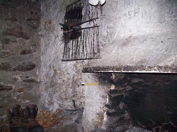
The mountains of chemin du rey, l'hospitalet-près-l'andorre, foix, ariège, occitania, francia metropolitana, 09390, francia hide essential places like the Gîte l'Hospitalité refuge. Situated at an elevation of 1440 meters, it offers protection and rest. Its exact coordinates are 42.587, 1.798.
8.8°C
Feels like: 7.6°C1.1 km/h
Gusts: 12.2 km/h4480 m
Snow lineUV 0
Clouds: 100% 22.4 mm
 20.6 km/h
 UV máx: 5.5
 06:16
06:16
 21:25
0.7 mm
15 km/h
UV máx: 7.9
06:16
21:26
0 mm
10 km/h
UV máx: 6.55
06:15
21:27
2 mm
7.1 km/h
UV máx: 7.1
06:15
21:27
3.6 mm
20.1 km/h
UV máx: 8
06:15
21:28
0.3 mm
15.4 km/h
UV máx: 2.4
06:15
21:29
0 mm
11.1 km/h
UV máx: 7.8
06:14
21:29
21:25
0.7 mm
15 km/h
UV máx: 7.9
06:16
21:26
0 mm
10 km/h
UV máx: 6.55
06:15
21:27
2 mm
7.1 km/h
UV máx: 7.1
06:15
21:27
3.6 mm
20.1 km/h
UV máx: 8
06:15
21:28
0.3 mm
15.4 km/h
UV máx: 2.4
06:15
21:29
0 mm
11.1 km/h
UV máx: 7.8
06:14
21:29
Between the high Ariège valley and the proximity of Andorra, Gîte l'Hospitalité it fits better as a transit support than as an isolated crest shelter. Its location, in L'Hospitalet-près-l 'Andorre and at 1,440 meters, it places it in a clearly mountainous strip, marked by high climate, water courses and the natural connection between pirenaic slopes. In this area, the relief works as a step: it moves towards hills, ports and basin changes rather than a single goal.
For those who travel long-distance routes, their interest is in serving as a comfortable link within a wider progression. The HRP and GR 7 , two references that help to understand their role within the trekking of this sector of the Ariège. It is also within the scope of connection with the return to Andorra, so it can make sense as a stop or short detour if you are to reorganize a day, divide stage or resolve a stretch between France and the Andorran side.
The surrounding terrain maintains an alpine character without being at the high level. Summits like Pic Mercader or Pic de Querforc relatively close, they reinforce this closed mountain reading and access to higher sectors. It is not appropriate to interpret the altitude of the building as a guarantee of simple land: in this part of the Pyrenees the weather can change quickly and the steps between valleys make the day very difficult.
The immediate logistics highlights the presence of several very close sources, a few meters away, a useful data for planning water without walking away from the environment of the shelter. Even so, in the mountains it is always appropriate to check flow and state on the ground. If used as a support point to link routes, it is reasonable to arrive with sufficient autonomy and with the well-closed itinerary, especially in cold periods or with unstable time.


📏 0.1 Km
⛰️ 1427 m

📏 0.5 Km
⛰️ 1705 m

📏 1.7 Km
⛰️ 2130 m

📏 2.2 Km
⛰️ 2060 m

📏 2.6 Km
⛰️ 2479 m
📏 3.5 Km
⛰️ 2100 m

📏 3.8 Km
⛰️ 2165 m

📏 4.1 Km
⛰️ 1768 m
Download the app and start looking for the shelter of your next adventure


Find a place to sleep before night falls.


