Mountain refuge Cabane forestière forêt domaniale de l'Hospitalet
We have it listed in the app!
We have it listed in the app!


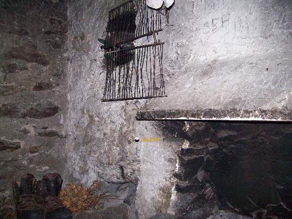
The Cabane forestière forêt domaniale de l'Hospitalet refuge stands at 1705 meters above sea level, overlooking the surroundings of cabane forestière forêt domaniale de l'hospitalet, n 22, l'hospitalet-près-l'andorre, foix, ariège, occitania, francia metropolitana, 09390, francia. It is a key spot for mountaineers looking to spend the night or take a break. Its coordinates (42.585, 1.803) place it in a strategic position for exploring the peaks and trails of the region.
10°C
Feels like: 7.3°C6.2 km/h
Gusts: 23 km/h4430 m
Snow lineUV 0
Clouds: 100% 29 mm
29 mm
 19.9 km/h
 UV máx: 5.1
 06:16
06:16
 21:25
0.2 mm
14.4 km/h
UV máx: 8.15
06:16
21:26
0.3 mm
10.7 km/h
UV máx: 7
06:15
21:27
0 mm
7.3 km/h
UV máx: 6.9
06:15
21:27
0.3 mm
20.6 km/h
UV máx: 8.1
06:15
21:28
1.5 mm
14.6 km/h
UV máx: 7.75
06:15
21:29
0 mm
11.1 km/h
UV máx: 7.95
06:14
21:29
21:25
0.2 mm
14.4 km/h
UV máx: 8.15
06:16
21:26
0.3 mm
10.7 km/h
UV máx: 7
06:15
21:27
0 mm
7.3 km/h
UV máx: 6.9
06:15
21:27
0.3 mm
20.6 km/h
UV máx: 8.1
06:15
21:28
1.5 mm
14.6 km/h
UV máx: 7.75
06:15
21:29
0 mm
11.1 km/h
UV máx: 7.95
06:14
21:29
In the high Ariège, next to L'Hospitalet-près-l 'Andorre , this forest cabin is located 1.705 meters within the forêt domaniale de l'Hospitalet, on the French side near the axis of the Pimorent cabbage . This position places it in a border mountain sector where the relief gains height quickly and where the forest gives way, above, to a more open and mineral terrain.
The access moves in a clearly pirenaic context, with a high valley environment and mountain climate. Although no specific routes are detailed, the altitude and environment make you think of an approach that already requires some mountain logic, especially if there is snow, humidity or fog. It is not appropriate to interpret it as a safe haven for any walk: its utility fits better with exits in which mountain land is assumed, rapid changes of time and need to be well oriented in a sector exposed to variable conditions.
Because of its location, it can be especially useful for those who seek simple support in the way of the valley and the hillsides that ascend towards nearby summits such as the Pic Mercader or Pic de Querforc , both relatively close in a straight line. More than for a great journey defined in the data, it stands out as a point of support for mountaineers with autonomy who want to early in this part of the Ariège or divide a day in a middle and high mountain environment.
The geographical framework also helps to understand its role: L'Hospitalet-près-l 'Andorre is a natural door between the high Ariège valley and the steps towards the Cerdaña and Andorra. This gives the area a mountain corridor character, with a mixture of forest, rails and hillsides that rise to border cords. In this type of terrain, meteorology can condition much more than distance.
There are several sources identified at about 500 meters, a useful reference on paper, but in mountain it should not be dependent on it without prior verification. If a night or long exit is proposed from here, it is reasonable to carry basic autonomy of water, clothing and sufficient margin for changes of time or state of the ground.


📏 0.5 Km
⛰️ 1440 m

📏 0.5 Km
⛰️ 1427 m

📏 1.5 Km
⛰️ 2130 m

📏 2.2 Km
⛰️ 2479 m

📏 2.7 Km
⛰️ 2060 m
📏 4 Km
⛰️ 2100 m

📏 4.2 Km
⛰️ 1980 m

📏 4.2 Km
⛰️ 1975 m
Download the app and start looking for the shelter of your next adventure


Find a place to sleep before night falls.


