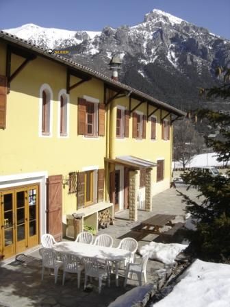
Mountain refuge Chapelle Saint Pierre
We have it listed in the app!
We have it listed in the app!


The Chapelle Saint Pierre refuge stands at 1012 meters above sea level, overlooking the surroundings of chapelle saint-pierre, m 2565, le figaret, utelle, niza, alpes marítimos, provenza-alpes-costa azul, francia metropolitana, 06450, francia. It is a key spot for mountaineers looking to spend the night or take a break. Its coordinates (43.923, 7.286) place it in a strategic position for exploring the peaks and trails of the region.
14.3°C
Feels like: 12.5°C6.5 km/h
Gusts: 11.9 km/h4280 m
Snow lineUV 0
Clouds: 98% 7.5 mm
 16.2 km/h
 UV máx: 7.05
 05:50
05:50
 21:08
0.7 mm
16.6 km/h
UV máx: 7.1
05:49
21:09
0 mm
10.2 km/h
UV máx: 7.1
05:49
21:09
0 mm
9.9 km/h
UV máx: 7.5
05:48
21:10
1.05 mm
9.5 km/h
UV máx: 7.65
05:48
21:11
0 mm
14.8 km/h
UV máx: 7.1
05:48
21:11
1.5 mm
10.3 km/h
UV máx: 7.4
05:48
21:12
21:08
0.7 mm
16.6 km/h
UV máx: 7.1
05:49
21:09
0 mm
10.2 km/h
UV máx: 7.1
05:49
21:09
0 mm
9.9 km/h
UV máx: 7.5
05:48
21:10
1.05 mm
9.5 km/h
UV máx: 7.65
05:48
21:11
0 mm
14.8 km/h
UV máx: 7.1
05:48
21:11
1.5 mm
10.3 km/h
UV máx: 7.4
05:48
21:12
Here the first precaution is not the level, but the autonomy . Although there are several sources in the environment, the nearest one is about 1.5 km away, so it is not appropriate to have immediate water next to the coat. It is also an area where the practical information available on the interior and the equipment is limited, so this free shelter fits better as basic support within a well-planned day than as a point to reach without margin.
At about 1.012 meters, in the end of Utelle and within the French Maritime Alps, the environment moves between medium-mountain Mediterranean slopes and reliefs that are being hardened as you gain height. This change is well appreciated in the network of nearby itineraries: access can start in more friendly terrain, between roads and forest, and then move to more open, stony or crest sections according to the chosen direction. In this area, the orientation of the slope and exposure to the sun or wind have a significant impact on the progression, especially when collars or nearby peaks are linked.
That is why their interest depends not only on the building, but on how it is placed on several routes. They are close to long-range, such as GR 52A , linked to the Sentier panoramique du Mercantour, and the GR 510 in addition to local routes to the Madone d'Utelle, the Mine de l'Eguisse or the Brec d'Utelle . If you move along a main route, you can make up for it when you want to divide stage or have an intermediate point before you enter a more exposed terrain; less when the priority is to maintain a rapid and light progression along the axis of the itinerary.
The next highlight reinforces that transitional character. Very close to it are elevations such as the Cime de Bonvillars and the Cime de Roccassièra, while something further stands out Le Castel Ginesté or Brec d'Utelle himself. It is not so much a question of presenting the shelter as a basis for great ascension, but as a useful reference on a fragmented mountain, with frequent orientation changes and routes that can alternate forest, clear lome and more mineral sections.
In practice, Chapelle Saint Pierre is more useful for those who already carry the determined logistics: water planned, realistic time and capacity to adapt to the field. In a sector with several signposted routes but with very different uses, its role is simple support to link itineraries or break the day, especially when it is interested to better manage the exposure of each side and not to rush the journey to the next inhabited core.


📏 1.3 Km
⛰️ 1220 m

📏 3.4 Km
⛰️ 1089 m

📏 4 Km
⛰️ 660 m

📏 6.2 Km
⛰️ 1412 m

📏 7.1 Km
⛰️ 1261 m

📏 10.1 Km
⛰️ 1682 m
📏 17.2 Km
⛰️ 1300 m

📏 18.8 Km
⛰️ 500 m
Download the app and start looking for the shelter of your next adventure


Find a place to sleep before night falls.


