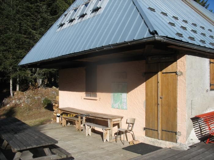
Mountain refuge Chalet Lamigue (ancien chalet des Turres Haut)
We have it listed in the app!
We have it listed in the app!


Located in the heart of chalet lamigue, chemin du refuge du creux de lachat, chalets du creux de lachat, arith, chambéry, saboya, auvergne-rhône-alpes, francia metropolitana, 73340, francia, the Chalet Lamigue (ancien chalet des Turres Haut) refuge offers shelter at 1350 meters above sea level. Ideal for trekking and nature lovers, this mountain shelter (Lat: 45.705, Lon: 6.03) is the perfect starting point or resting place for local routes.
8.8°C
Feels like: 6.9°C2.1 km/h
Gusts: 7.2 km/h3980 m
Snow lineUV 0
Clouds: 46% 0 mm
0 mm
 14 km/h
 UV máx: 6.9
 05:48
05:48
 21:19
38.4 mm
18.5 km/h
UV máx: 4.55
05:48
21:20
9.9 mm
11.3 km/h
UV máx: 6.5
05:47
21:21
0 mm
14.7 km/h
UV máx: 7.4
05:47
21:21
0 mm
7.4 km/h
UV máx: 7.3
05:47
21:22
0.6 mm
7.8 km/h
UV máx: 7.25
05:46
21:23
10.8 mm
9.4 km/h
UV máx: 5.75
05:46
21:23
21:19
38.4 mm
18.5 km/h
UV máx: 4.55
05:48
21:20
9.9 mm
11.3 km/h
UV máx: 6.5
05:47
21:21
0 mm
14.7 km/h
UV máx: 7.4
05:47
21:21
0 mm
7.4 km/h
UV máx: 7.3
05:47
21:22
0.6 mm
7.8 km/h
UV máx: 7.25
05:46
21:23
10.8 mm
9.4 km/h
UV máx: 5.75
05:46
21:23
In this part of Savoy, where different-scale hiking routes match, Chalet Lamigue (ancien chalet des Turres Haut) it is mainly in the form of day support and reference point in the sector of Creux de Lachat, within the term of Arith. Their practical interest is increased if the GR 96 or linking local tours around the area, because it allows you to read the map better and to assess whether it is appropriate to deviate from the main route to win an intermediate coat to half a mountain.
The height of 1350 meters places it in a atmosphere of soft but clearly mountainous relief, closer to high pastures, lomas and small highlights than to a valley shelter. In the surroundings, useful references such as La Culaz, Croix des Bergers or the nearby Tours, in addition to the axis of the Mont Revard , which help to place the villa within an open and time-changing terrain. It should not be interpreted as a high-mountain pirenaica shelter or as a basis for great ascension, but as a simple resource in a traffic zone with limited information on equipment.
To plan the day, attention should be paid to water. The nearest reference is just over a mile, in the environment of Prolongement de la Fontaine Froide and there are other points at a greater distance, but that does not replace an autonomy strategy: it is preferable to go out with sufficient water and confirm on the ground the real state of the sources. If this villa is used as a support between the routes of the sector or as a guard within a journey along the roads of the massif, the most sensible decision is to have time margin, stable weather and ability to continue without relying on undocumented services.


📏 1.1 Km
⛰️ 1350 m
📏 1.3 Km
⛰️ 1300 m

📏 1.3 Km
⛰️ 1295 m

📏 1.4 Km
⛰️ 1325 m

📏 1.7 Km
⛰️ 995 m

📏 2 Km
⛰️ 1361 m

📏 4.4 Km
⛰️ 1245 m

📏 4.9 Km
⛰️ 1109 m
Download the app and start looking for the shelter of your next adventure


Find a place to sleep before night falls.


