Mountain refuge Cabanes de la Selle (Hte Bléone)

We have it listed in the app!


            Mountain refuge Cabanes de la Selle (Hte Bléone) in prads, prads-haute-bléone, digne-les-bains, alpes de alta provenza, provenza-alpes-costa azul, francia metropolitana, 04420, francia
Five orange stars in a horizontal row representing a five-star rating.

Cabanes de la Selle (Hte Bléone)

Lat: 44.221xxx – Lon: 6.52xxx
📍 prads, prads-haute-bléone, digne-les-bains, alpes de alta provenza, provenza-alpes-costa azul, francia metropolitana, 04420, francia
Cabanes de la Selle (Hte Bléone)

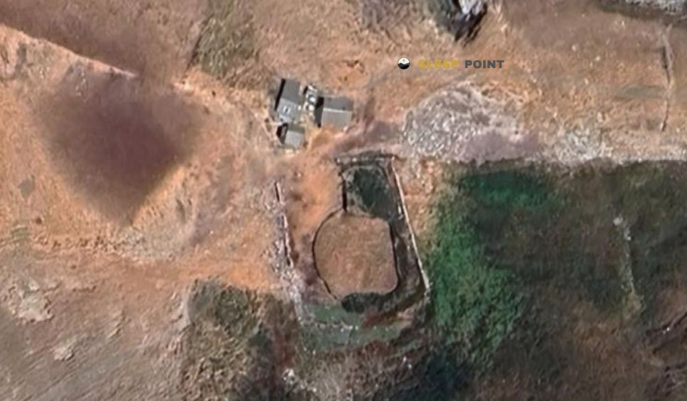
Discover the vastness of prads, prads-haute-bléone, digne-les-bains, alpes de alta provenza, provenza-alpes-costa azul, francia metropolitana, 04420, francia by spending the night at the Cabanes de la Selle (Hte Bléone) refuge. It sits at 1909 meters, offering a unique balcony over the natural landscape. Find it on the map at latitude 44.221 and longitude 6.52.

See more
See more
Usuario

Lucas Martinez

Premium user

Live weather: Cabanes de la Selle (Hte Bléone)

Before heading to Cabanes de la Selle (Hte Bléone), check the weather: we currently have 11.7°C (feels like 8.8°C). With wind gusts reaching 11.9 km/h and a freezing level around 4260 meters, the daytime high will not exceed 15.2°C.
Temperature

11.7°C

Feels like: 8.8°C
Wind

2.3 km/h

Gusts: 11.9 km/h
Freezing level 0°

4260 m

Snow line
Sky & UV

UV 0

Clouds: 100%

Next 48 hours evolution

7-day forecast

04/06
15.2° 5.4°
16 mm 19.8 km/h UV máx: 7.3
05:51 21:12
05/06
12.4° 4.1°
0.6 mm 19 km/h UV máx: 7.65
05:51 21:13
06/06
15.3° 7.1°
0 mm 16.8 km/h UV máx: 8.1
05:51 21:14
07/06
16.2° 8.7°
0 mm 15.2 km/h UV máx: 7.75
05:50 21:14
08/06
17.9° 10°
0 mm 17.9 km/h UV máx: 7.45
05:50 21:15
09/06
17.5° 9.5°
0 mm 20.3 km/h UV máx: 7.25
05:50 21:16
10/06
17.2° 8.5°
0 mm 13.3 km/h UV máx: 7.8
05:50 21:16

High ladders, open relief and an already clearly mountainous environment mark the Haute-Bléone in the Alpes de Alta Provence. In this context, the Cabans de la Selle (Hte Bléone) at 1,909 metres, within the term of Prads-Haute-Bléone , in a strip where the valley begins to give way to drier, stony and exposed grounds of higher levels.

More than a destination in itself, this free shelter works as a useful reference to focus on the map and understand the organization of the ground. Its position helps to read the transition between valley funds and high areas that look to nearby summits like Sommet de Valdemars or Mourre Gros . This proximity to reliefs above 2,500 meters gives it an alpine character, even if there is no data here to link it to specific signposted routes.

For hiking and mountain in the area, its usefulness seems to be more linked to the timely support, to divide a day or to serve as a walking coat than to a clearly documented network of routes. The absence of defined near routes advises not to plan specific links, stages or promotions without detailed mapping and prior field check. In such a sector, the navigation and reading of relief weigh as much as the distance.

Reasonable autonomy is also needed. Although there are invented sources in the wide environment, the nearest one is more than 4 kilometres away, so it is not wise to take immediate water from the shelter. The altitude, exposure and possible time variation in this part of the Alpine Provence reinforce the need to leave with a margin in water, shelter and adaptive capacity.

Anyone who consults this cabane as a support point will find above all a useful reference in a little banalized mountain sector, where the shelter helps to structure the day and to be located between the Bléone valley and the high lomas that close its header.

Nearby peaks

Le Gros Tapi

2374 m
Lat: 44.2303 Lon: 6.5937

La Tête Noire

2560 m
Lat: 44.2648 Lon: 6.547

Mourre Gros

2652 m
Lat: 44.2489 Lon: 6.5404

Le Mourre de Simance

2511 m
Lat: 44.2009 Lon: 6.5329

Sommet de Valdemars

2559 m
Lat: 44.2378 Lon: 6.5417

Sommet de Rougnouse

2504 m
Lat: 44.2598 Lon: 6.5433

Montagne de Vachière

2361 m
Lat: 44.1881 Lon: 6.5357

Sangraure

2559 m
Lat: 44.2104 Lon: 6.5368

Nearby water fountains

Fuente

4.42 Km
Lat: 44.2104 Lon: 6.5368

Fuente

6.96 Km
Lat: 44.2104 Lon: 6.5368

Fuente

7.77 Km
Lat: 44.2104 Lon: 6.5368

Fuente

7.8 Km
Lat: 44.2104 Lon: 6.5368

Fuente

7.96 Km
Lat: 44.2104 Lon: 6.5368

Fuente

8.2 Km
Lat: 44.2104 Lon: 6.5368

Fuente

8.22 Km
Lat: 44.2104 Lon: 6.5368

Fuente

8.5 Km
Lat: 44.2104 Lon: 6.5368
FAQ

Frequently asked questions

Pregunta frecuente
Is it necessary to carry a GPS to reach the Cabanes de la Selle (Hte Bléone) refuge?
It is always highly recommended to carry a GPS device, a route track, or a topographic map in the mountains. You can use the coordinates 44.221, 6.52 to locate this refuge precisely.
Pregunta frecuente
In which municipality or region is the Cabanes de la Selle (Hte Bléone) refuge located?
This refuge is located within the municipality of Prads-Haute-Bléone, belonging to the community or region of Provenza-Alpes-Costa Azul.
Pregunta frecuente
Are there other mountain refuges near Cabanes de la Selle (Hte Bléone)?
Yes, nearby you can find other options to spend the night or take shelter. El refugio más próximo es el Cabane de Sangraure, que se encuentra a aproximadamente 2.8 km de distancia.
More areas

Other areas

Collaborative

Together we improve

image

Send your photos

You can upload photos of shelters and update their status so other users know if they can go there.

Get started
Get started
image

Rate the shelter

Leave your comments to rate the shelter’s condition. In the mountains, we look after each other.

Get started
Get started
image

Add new ones

Did we miss any? Publish the shelters you know so everyone can use them.

Get started
Get started
Download for free from the Apple App Store and Play Store.

Download the app and start looking for the shelter of your next adventure

Aplicación móvil para encontrar refugios de montaña donde dormir
Aplicación móvil para encontrar refugios de montaña donde dormir.
Mapa interactivo de refugios de montaña en los Pirineos dentro de la app
Mapa de refugios de montaña para senderismo y trekking en la app.
Pantalla con información de refugio de montaña con altitud capacidad y servicios
Pantalla con información de refugio de montaña con altitud capacidad y servicios.
Detalles de refugio de montaña con servicios y meteorología en aplicación móvil
Detalles de refugio de montaña con servicios y meteorología en aplicación móvil.
Aplicación para explorar refugios de montaña mediante mapa interactivo
Aplicación para explorar refugios de montaña mediante mapa interactivo.
Ficha completa de refugio de montaña con opiniones y servicios
Ficha completa de refugio de montaña con opiniones y servicios.
Información detallada de refugio en app para montañeros
Información detallada de refugio en app para montañeros.
Listado de refugios de montaña para senderismo y trekking
Listado de refugios de montaña para senderismo y trekking.
Explorar refugios de montaña desde una aplicación móvil
Explorar refugios de montaña desde una aplicación móvil.