Mountain refuge Cabane du Courrau d'Artigue
We have it listed in the app!
We have it listed in the app!


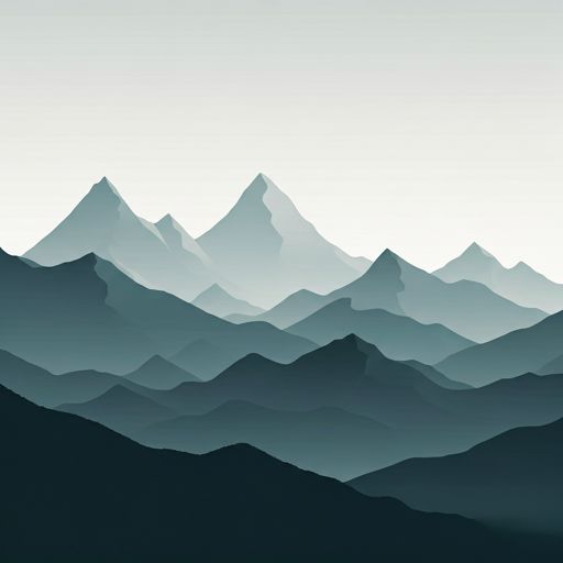
The Cabane du Courrau d'Artigue refuge stands at 1170 meters above sea level, overlooking the surroundings of cabane du courrau d artigue, chemin de mouras, fos, saint-gaudens, alto garona, occitania, francia metropolitana, 31440, francia. It is a key spot for mountaineers looking to spend the night or take a break. Its coordinates (42.85, 0.775) place it in a strategic position for exploring the peaks and trails of the region.
11.2°C
Feels like: 10.4°C5.6 km/h
Gusts: 9.4 km/h4460 m
Snow lineUV 0
Clouds: 80% 16.5 mm
 9.6 km/h
 UV máx: 4.05
 06:19
06:19
 21:30
0 mm
6.8 km/h
UV máx: 7.8
06:19
21:31
0.8 mm
9.4 km/h
UV máx: 7
06:18
21:32
1.8 mm
6.8 km/h
UV máx: 7.6
06:18
21:32
4.2 mm
8.3 km/h
UV máx: 7.25
06:18
21:33
2.4 mm
6.8 km/h
UV máx: 2.5
06:18
21:34
0 mm
8.2 km/h
UV máx: 7.65
06:17
21:34
21:30
0 mm
6.8 km/h
UV máx: 7.8
06:19
21:31
0.8 mm
9.4 km/h
UV máx: 7
06:18
21:32
1.8 mm
6.8 km/h
UV máx: 7.6
06:18
21:32
4.2 mm
8.3 km/h
UV máx: 7.25
06:18
21:33
2.4 mm
6.8 km/h
UV máx: 2.5
06:18
21:34
0 mm
8.2 km/h
UV máx: 7.65
06:17
21:34
Cabane du Courrau d'Artigue at 1,170 metres in the environment of Fos it is located on the northern pirenaica side, in a sector of half-humid mountain and forest that serves as a transition to more open topes and summits. It is an interesting location for those looking for a protected stop before gaining height towards the border cords, with a landscape that combines closed mountain, clear of grass and rounded reliefs that gradually become hardened as they approach the crests.
The approach is expected to move by path and mountain track, without immediate high mountain environment in the cabin itself, but with nearby levels that can make the day demanding if it is linked with summits. From here, the shelter works well as a small base camp to ascend to Tuc de Comagrana , very close, or propose more ambitious exits towards the Pica de Horadic and Cap de la Pique already above 2,000 meters. It is also within reach of the Pic de Pale Bidau and Cap de Gauch , which gives a lot of play for full-time travel or circulars.
In terms of orientation, the cabin is well positioned to link with large routes of the Pyrenees sector. The closeness of the GR 10 makes it useful for mountaineers on the way, while the axis of the GR 211 and its variants bring the connection to the Val d'Aran . This combination of local routes and long-range trails makes the area a more strategic point of passage than its altitude suggests.
It is not necessary to rely on the logistics: although there are several sources in the environment, the nearest ones are more than 3 km away, so it is advisable to get there with sufficient water or confirm flows according to time. In days of rain, fog or wet cold, this sector may feel more severe than expected, and if it is to continue to high levels it is worth anticipating rapid changes in time and slippery terrain.


📏 1 Km
⛰️ 1430 m

📏 1.1 Km
⛰️ 1450 m

📏 1.7 Km
⛰️ 1660 m

📏 2.4 Km
⛰️ 1410 m
📏 2.6 Km
⛰️ 1640 m

📏 3.6 Km
⛰️ 1240 m

📏 4.1 Km
⛰️ 1800 m

📏 4.3 Km
⛰️ 1090 m
Download the app and start looking for the shelter of your next adventure


Find a place to sleep before night falls.


