Mountain refuge Cabane du col de l Arrech (de Bethmale)

We have it listed in the app!


            Mountain refuge Cabane du col de l Arrech (de Bethmale) in cabanes du col de l'arrech de bethmale - castillonais, route forestière de larrech, moulis, saint-girons, ariège, occitania, francia metropolitana, 09800, francia
Five orange stars in a horizontal row representing a five-star rating.

Cabane du col de l Arrech (de Bethmale)

Lat: 42.899xxx – Lon: 1.084xxx
📍 cabanes du col de l'arrech de bethmale - castillonais, route forestière de larrech, moulis, saint-girons, ariège, occitania, francia metropolitana, 09800, francia
Cabane du col de l Arrech (de Bethmale)

If you are looking for total disconnection, venture into cabanes du col de l'arrech de bethmale - castillonais, route forestière de larrech, moulis, saint-girons, ariège, occitania, francia metropolitana, 09800, francia until you reach the Cabane du col de l Arrech (de Bethmale) refuge, positioned at 1410 meters. Use your device to navigate to the exact point (42.899, 1.084) to find this alpine shelter.

See more
See more
Usuario

Lucas Martinez

Premium user

Live weather: Cabane du col de l Arrech (de Bethmale)

Before heading to Cabane du col de l Arrech (de Bethmale), check the weather: we currently have 11.5°C (feels like 11.3°C). With wind gusts reaching 6.8 km/h and a freezing level around 4530 meters, the daytime high will not exceed 16.7°C.
Temperature

11.5°C

Feels like: 11.3°C
Wind

3.8 km/h

Gusts: 6.8 km/h
Freezing level 0°

4530 m

Snow line
Sky & UV

UV 0

Clouds: 100%

Next 48 hours evolution

7-day forecast

03/06
16.7° 5.5°
0 mm 14.4 km/h UV máx: 7.9
06:18 21:29
04/06
13.2° 5.8°
22.8 mm 16.2 km/h UV máx: 4.4
06:18 21:29
05/06
10.5° 3.1°
0 mm 13.1 km/h UV máx: 7.7
06:17 21:30
06/06
15.6° 5.9°
0.5 mm 15.5 km/h UV máx: 6.45
06:17 21:31
07/06
20.1°
0.75 mm 9.7 km/h UV máx: 7.2
06:17 21:31
08/06
13.2° 8.9°
4.5 mm 10.9 km/h UV máx: 7.45
06:17 21:32
09/06
9.4°
3 mm 5.4 km/h UV máx: 1.9
06:16 21:33

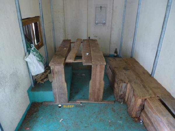
In the field of Bethlehem , within the Ariège and in the surroundings of Moulis, the Cabane du col de l Arrech (de Bethmale) It is located 1410 meters in a half-mountain pirenaic strip that works as a transition between valley, herbous cords and more open reliefs. This position makes it particularly useful for those who plan long days on foot and need a point of support in an area where the ground already forces to think about orientation, meteorology and basic autonomy.

His interest is more in the logic of passage than in the proximity to a single objective. In this sector they combine itineraries like the GR 10 , Chemin du Piémont Pyrénéen and wide routes linked to the Réserve Naturelle du Mont Valier , in addition to local circles such as the Pic de la Pène or the Grand tour SourRoque. This is why it fits well with well-used trails to link strands and with mountaineers who want to divide the day before they gain height or go through the hills and hills of the Couserans. It can also serve as a reference for exits to nearby summits such as the Cap de Bouirech at 1874 m, or Pic de Midi de Bordes which help to understand the character of the land: mountains of moderate altitude, exposed to the change of time and with routes that can be extended according to the chosen route.

Water planning should be done with margin. The registered sources do not appear next to the shelter, but several kilometres away, so it is not wise to have immediate supply on the roof. In a height like this, and in an area open to the wind and to the Atlantic humidity, time can change quickly and tighten both the approach and the continuation of the route. More than a shelter for improvised stays, this site makes sense for those who arrive with the thought-out day, knows the map of the sector of Bethmale and previews water, material and alternative descent.

Hiking routes from the refuge

16

Chemin du Piémont Pyrénéen

↔ Variable distance
Local

Grand circuit dans la Réserve Naturelle du Mont Valier

↔ Variable distance
GR 10

La traversée des Pyrénées - sec.4

↔ Variable distance
17

Chemin du Piémont Pyrénéen

↔ Variable distance
Local

Boucle du Pic de la Pène

↔ Variable distance
Local

Grand tour Sourroque

↔ Variable distance

Nearby peaks

Pic de Midi de Bordes

1762 m
Lat: 42.8578 Lon: 1.042

Cap de Bouirech (Bouirex)

1874 m
Lat: 42.8687 Lon: 1.1165

Tuc Bidau

1077 m
Lat: 42.9412 Lon: 1.124

Pale de l'herbe

1149 m
Lat: 42.9393 Lon: 1.1301

Tuce de Miliaques

1233 m
Lat: 42.936 Lon: 1.134

Tuc de Closet

1208 m
Lat: 42.9323 Lon: 1.1392

Cap d'Aruille

1252 m
Lat: 42.9289 Lon: 1.1441

Tuc de Courtade

1198 m
Lat: 42.9186 Lon: 1.0889

Nearby water fountains

Fuente

3.82 Km
Lat: 42.9186 Lon: 1.0889

Fuente

4.25 Km
Lat: 42.9186 Lon: 1.0889

Fuente

4.26 Km
Lat: 42.9186 Lon: 1.0889

Fuente

4.35 Km
Lat: 42.9186 Lon: 1.0889

Fuente

4.47 Km
Lat: 42.9186 Lon: 1.0889

Fuente

4.68 Km
Lat: 42.9186 Lon: 1.0889

Fuente

4.69 Km
Lat: 42.9186 Lon: 1.0889

Fuente

4.73 Km
Lat: 42.9186 Lon: 1.0889
FAQ

Frequently asked questions

Pregunta frecuente
In which municipality or region is the Cabane du col de l Arrech (de Bethmale) refuge located?
This refuge is located within the municipality of Moulis, belonging to the community or region of Occitania.
Pregunta frecuente
Are there other mountain refuges near Cabane du col de l Arrech (de Bethmale)?
Yes, nearby you can find other options to spend the night or take shelter. El refugio más próximo es el Cabane du col de l'Arrech (de Bethmale), que se encuentra a aproximadamente 0.1 km de distancia.
Pregunta frecuente
At what exact altitude is the Cabane du col de l Arrech (de Bethmale) refuge located?
The Cabane du col de l Arrech (de Bethmale) refuge is located at an altitude of 1410 meters above sea level, in the natural surroundings of cabanes du col de l'arrech de bethmale - castillonais, route forestière de larrech, moulis, saint-girons, ariège, occitania, francia metropolitana, 09800, francia.
More areas

Other areas

Collaborative

Together we improve

image

Send your photos

You can upload photos of shelters and update their status so other users know if they can go there.

Get started
Get started
image

Rate the shelter

Leave your comments to rate the shelter’s condition. In the mountains, we look after each other.

Get started
Get started
image

Add new ones

Did we miss any? Publish the shelters you know so everyone can use them.

Get started
Get started
Download for free from the Apple App Store and Play Store.

Download the app and start looking for the shelter of your next adventure

Aplicación móvil para encontrar refugios de montaña donde dormir
Aplicación móvil para encontrar refugios de montaña donde dormir.
Mapa interactivo de refugios de montaña en los Pirineos dentro de la app
Mapa de refugios de montaña para senderismo y trekking en la app.
Pantalla con información de refugio de montaña con altitud capacidad y servicios
Pantalla con información de refugio de montaña con altitud capacidad y servicios.
Detalles de refugio de montaña con servicios y meteorología en aplicación móvil
Detalles de refugio de montaña con servicios y meteorología en aplicación móvil.
Aplicación para explorar refugios de montaña mediante mapa interactivo
Aplicación para explorar refugios de montaña mediante mapa interactivo.
Ficha completa de refugio de montaña con opiniones y servicios
Ficha completa de refugio de montaña con opiniones y servicios.
Información detallada de refugio en app para montañeros
Información detallada de refugio en app para montañeros.
Listado de refugios de montaña para senderismo y trekking
Listado de refugios de montaña para senderismo y trekking.
Explorar refugios de montaña desde una aplicación móvil
Explorar refugios de montaña desde una aplicación móvil.