Mountain refuge Cabane du col de l'Arrech (de Bethmale)
We have it listed in the app!
We have it listed in the app!

If you are looking for total disconnection, venture into route forestière de larrech, arrien-en-bethmale, saint-girons, ariège, occitania, francia metropolitana, 09800, francia until you reach the Cabane du col de l'Arrech (de Bethmale) refuge, positioned at 1418 meters. Use your device to navigate to the exact point (42.898, 1.083) to find this alpine shelter.
8.7°C
Feels like: 7.9°C2.7 km/h
Gusts: 6.5 km/h4180 m
Snow lineUV 0
Clouds: 100% 26.7 mm
 19.7 km/h
 UV máx: 4.6
 06:18
06:18
 21:29
0.5 mm
13 km/h
UV máx: 7.35
06:17
21:30
2.6 mm
12.8 km/h
UV máx: 7.5
06:17
21:31
0.4 mm
9.5 km/h
UV máx: 6.9
06:17
21:31
7.2 mm
12.9 km/h
UV máx: 7.75
06:17
21:32
6.9 mm
7.3 km/h
UV máx: 2.8
06:16
21:33
0 mm
8.1 km/h
UV máx: 7.65
06:16
21:33
21:29
0.5 mm
13 km/h
UV máx: 7.35
06:17
21:30
2.6 mm
12.8 km/h
UV máx: 7.5
06:17
21:31
0.4 mm
9.5 km/h
UV máx: 6.9
06:17
21:31
7.2 mm
12.9 km/h
UV máx: 7.75
06:17
21:32
6.9 mm
7.3 km/h
UV máx: 2.8
06:16
21:33
0 mm
8.1 km/h
UV máx: 7.65
06:16
21:33
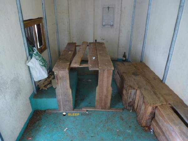
The Cabane du col de l'Arrech (de Bethmale) , located at 1418 m in the environment of Arrien-en-Bethmale , takes a step of half a mountain very useful to move between wooded slopes and open cords of the Couserans. The landscape here blends forest environment, grass clear and a natural balcony sensation on the wavy relief of Bethlehem , more of a transition than of a high hard mountain, but with sufficient pyrenees to serve as a basis for long days.
The approach is usually developed by track or mountain path without great technical difficulties, although the accumulated gap and mud can harden the march according to the time. Being on a hill, the shelter is also exposed to the wind and to rapid changes of time, something to take into account even on seemingly simple tours. It is not appropriate to rely on water: although there are several sources in the sector, none appears immediately to the shelter, so it is recommended to arrive with sufficient reserve or confirm flows before overnight.
As a base camp, this cabin allows to link routes of journey as well known as the GR 10 , Chemin du Piémont Pyrénéen and the great circuit of the Réserve Naturelle du Mont Valier . It also fits well in more local exits, such as the Bouchle du Pic de la Pène or Grand tour SourRoque , which makes it a strategic point to combine linear stages and circular routes.
From this collar you can propose ascension to nearby summits such as the Cap de Bouirech (1874 m), about 4.25 km, or Pic de Midi de Bordes (1762 m), about 5.6 km, very logical targets for a day with light backpack. The transit of trails can be notable due to the proximity of large routes, but the site continues to keep a fairly isolated air, especially outside the strong season and with changing weather.


📏 0.1 Km
⛰️ 1410 m

📏 1.2 Km
⛰️ 1470 m

📏 3.1 Km
⛰️ 1610 m

📏 3.1 Km
⛰️ 1612 m

📏 3.3 Km
⛰️ 1335 m

📏 3.4 Km
⛰️ 1347 m

📏 4.1 Km
⛰️ 1074 m

📏 5.1 Km
⛰️ 1700 m
Download the app and start looking for the shelter of your next adventure


Find a place to sleep before night falls.


