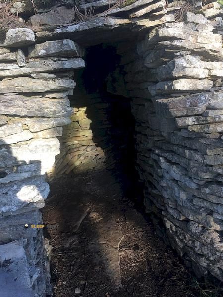
Mountain refuge Cabane de Montmain
We have it listed in the app!
We have it listed in the app!


Protected by the wild surroundings of cabane de montmain, route de détain, rolle, ternant, beaune, côte-d'or, borgoña-franco condado, francia metropolitana, 21220, francia, the Cabane de Montmain refuge is your best ally at 582 meters of elevation. Once you reach its coordinates (47.215, 4.826), you can enjoy a well-deserved mountain rest.
14.2°C
Feels like: 10.5°C27.4 km/h
Gusts: 49.3 km/h3060 m
Snow lineUV 0.55
Clouds: 100% 3.4 mm
 30.5 km/h
 UV máx: 2.8
 05:46
05:46
 21:31
0 mm
18.4 km/h
UV máx: 5.65
05:46
21:32
0.05 mm
22.9 km/h
UV máx: 6.9
05:46
21:32
0 mm
13.8 km/h
UV máx: 6.1
05:45
21:33
0.9 mm
14.7 km/h
UV máx: 6.45
05:45
21:34
0.3 mm
20.2 km/h
UV máx: 5.45
05:45
21:35
0 mm
11.8 km/h
UV máx: 7.15
05:44
21:35
21:31
0 mm
18.4 km/h
UV máx: 5.65
05:46
21:32
0.05 mm
22.9 km/h
UV máx: 6.9
05:46
21:32
0 mm
13.8 km/h
UV máx: 6.1
05:45
21:33
0.9 mm
14.7 km/h
UV máx: 6.45
05:45
21:34
0.3 mm
20.2 km/h
UV máx: 5.45
05:45
21:35
0 mm
11.8 km/h
UV máx: 7.15
05:44
21:35
The approach runs through low and undulating terrain. At only 582 meters of altitude, the Cabane de Montmain it does not respond to the model of high mountain pirenaica, but it can perform a clear function as a coat or point of retreat on a day of hiking in the field of Ternant , in Burgundy - Franco Condado . At this point, the decisive factor is not usually snow or the alpine environment, but the management of the route, the accumulated tiredness and the time changes in an open and transition area between rural roads, lomas and forest masses.
Their practical interest is increased by the presence of signposted itineraries in the environment. The close one Sentier Bernard Quarteaux fits into short or medium outputs, while the GR 7 place this free haven within a wider, useful, senderist geography for those who need to reorganize the march, shorten a stage or have a fixed reference in the middle of a long journey. There are no data that link you to concrete ascension or to a mountain circus or cordal, so you should read it above all as road support and not as a basis for summits.
The environment corresponds to the department of Côte-d'Or, with moderate relief and orientation more linked to roads, crosses and continuity of the itinerary than to mountain steps. This same configuration makes it important to review well map and layout before leaving, especially if it is expected to end late or with unstable weather. It is also not necessary to have immediate water: the registered sources are several kilometres away, so it is reasonable to have sufficient autonomy and to plan the day thinking about that margin.


📏 7.7 Km
⛰️ 510 m

📏 8.4 Km
⛰️ 430 m

📏 8.7 Km
⛰️ 465 m

📏 9.5 Km
⛰️ 300 m

📏 9.9 Km
⛰️ 463 m

📏 13.3 Km
⛰️ 315 m
📏 13.8 Km
⛰️ 405 m

📏 14.8 Km
⛰️ 380 m
Download the app and start looking for the shelter of your next adventure


Find a place to sleep before night falls.


