Mountain refuge Cabaña en el Pico Cueto Boñar

We have it listed in the app!


            Mountain refuge Cabaña en el Pico Cueto Boñar in pr le-55, boñar, león, castilla y león, 24846, españa
Five orange stars in a horizontal row representing a five-star rating.

Cabaña en el Pico Cueto Boñar

Lat: 42.885xxx – Lon: -5.354xxx
📍 pr le-55, boñar, león, castilla y león, 24846, españa
Cabaña en el Pico Cueto Boñar

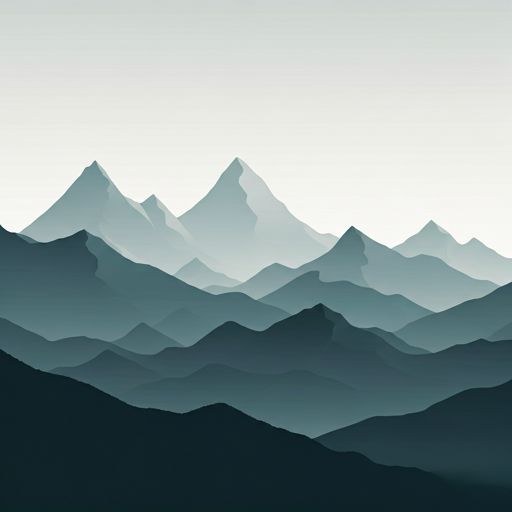
Discover the vastness of pr le-55, boñar, león, castilla y león, 24846, españa by spending the night at the Cabaña en el Pico Cueto Boñar refuge. It sits at 1585 meters, offering a unique balcony over the natural landscape. Find it on the map at latitude 42.885 and longitude -5.354.

See more
See more
Usuario

Lucas Martinez

Premium user

Live weather: Cabaña en el Pico Cueto Boñar

At the moment, conditions in Cabaña en el Pico Cueto Boñar (1585m) show 12°C (feels like 10.4°C). Wind is blowing at 2.5 km/h with gusts up to 2.9 km/h. Today, a high of 13°C is expected and the freezing level is at 4310 meters.
Temperature

12°C

Feels like: 10.4°C
Wind

2.5 km/h

Gusts: 2.9 km/h
Freezing level 0°

4310 m

Snow line
Sky & UV

UV 0

Clouds: 71%

Next 48 hours evolution

7-day forecast

04/06
13° 3.8°
0 mm 21.2 km/h UV máx: 7.85
06:44 21:55
05/06
15.6° 1.9°
0 mm 18.4 km/h UV máx: 7.3
06:43 21:56
06/06
19.1° 7.7°
0 mm 13.6 km/h UV máx: 8
06:43 21:56
07/06
21.8° 8.3°
0 mm 10.7 km/h UV máx: 7.8
06:43 21:57
08/06
15.2°
0 mm 19.8 km/h UV máx: 7.55
06:42 21:58
09/06
15.1° 4.8°
0 mm 15.9 km/h UV máx: 7.8
06:42 21:58
10/06
19.7° 6.9°
0 mm 12.6 km/h UV máx: 7.75
06:42 21:59

Direct exposure to the elements and weather variability mark the environment of the Cabin in the Pico Cueto Boñar , a construction located at 1585 meters altitude at the Leonesa Eastern Mountain . Access from the municipality of Nail or the town of Oville requires a constant progression by slopes where the vegetation gives way to a more clear and vulnerable mountain terrain. This location requires prior technical planning, as the approach along trails such as PR-LE 55 requires efficient effort management and precise map guidance. The structure is raised as an indispensable visual reference point in the water divisive, facilitating the navigation between reliefs such as the Pico Muelas and Halt de la Cabaña especially when conditions of visibility make it difficult to recognize the ground.

In terms of logistics, the free shelter and mountain autonomy are critical factors for any user. The absence of immediate water resources requires the transport of sufficient water for all activity, as the nearest sources are located more than two kilometres away and at lower levels. Its role as a point of escape or withdrawal is fundamental for those who travel on routes such as Forgotten Way or routes linked to River Perma , offering an option to protect against sudden changes in time. As a facility without basic services, security depends strictly on self-sufficiency and the ability to manage breaks in a significant geographical isolation environment, where the weather forecast must be constant.

Hiking routes from the refuge

PR-LE 56

Por el río Porma

↔ Variable distance
Local

Camino Olvidado (Puente Almuhey-La Robla)

↔ Variable distance

Nearby peaks

Peñón del Arca

1193.99 m
Lat: 42.9002 Lon: -5.3202

Pico Muelas

1575.74 m
Lat: 42.8744 Lon: -5.3735

Pico Candanedo

1355.75 m
Lat: 42.9113 Lon: -5.2949

Peña de la Arbellosa

1380.06 m
Lat: 42.9332 Lon: -5.3337

Alto de la Cabaña

1208.12 m
Lat: 42.8998 Lon: -5.3338

Pico de la Carva

1374.69 m
Lat: 42.8953 Lon: -5.2971

Alto de la Campayagua

1646.12 m
Lat: 42.9158 Lon: -5.3812

Peña del Tejo

1675.46 m
Lat: 42.8998 Lon: -5.3705

Nearby water fountains

Fuente

2.66 Km
Lat: 42.8998 Lon: -5.3705

Caño

2.7 Km
Lat: 42.8998 Lon: -5.3705

Fuente

2.78 Km
Lat: 42.8998 Lon: -5.3705

Fuente

2.8 Km
Lat: 42.8998 Lon: -5.3705

Fuente

3.34 Km
Lat: 42.8998 Lon: -5.3705

Fuente

3.8 Km
Lat: 42.8998 Lon: -5.3705

Fuente

4.58 Km
Lat: 42.8998 Lon: -5.3705

Fuente

4.7 Km
Lat: 42.8998 Lon: -5.3705
FAQ

Frequently asked questions

Pregunta frecuente
What are the GPS coordinates of the Cabaña en el Pico Cueto Boñar refuge?
To locate the Cabaña en el Pico Cueto Boñar refuge on your GPS or map, use the following coordinates: Latitude 42.885 and Longitude -5.354.
Pregunta frecuente
Is it necessary to carry a GPS to reach the Cabaña en el Pico Cueto Boñar refuge?
It is always highly recommended to carry a GPS device, a route track, or a topographic map in the mountains. You can use the coordinates 42.885, -5.354 to locate this refuge precisely.
Pregunta frecuente
In which municipality or region is the Cabaña en el Pico Cueto Boñar refuge located?
This refuge is located within the municipality of Boñar, belonging to the community or region of Castilla y León.
More areas

Other areas

Collaborative

Together we improve

image

Send your photos

You can upload photos of shelters and update their status so other users know if they can go there.

Get started
Get started
image

Rate the shelter

Leave your comments to rate the shelter’s condition. In the mountains, we look after each other.

Get started
Get started
image

Add new ones

Did we miss any? Publish the shelters you know so everyone can use them.

Get started
Get started
Download for free from the Apple App Store and Play Store.

Download the app and start looking for the shelter of your next adventure

Aplicación móvil para encontrar refugios de montaña donde dormir
Aplicación móvil para encontrar refugios de montaña donde dormir.
Mapa interactivo de refugios de montaña en los Pirineos dentro de la app
Mapa de refugios de montaña para senderismo y trekking en la app.
Pantalla con información de refugio de montaña con altitud capacidad y servicios
Pantalla con información de refugio de montaña con altitud capacidad y servicios.
Detalles de refugio de montaña con servicios y meteorología en aplicación móvil
Detalles de refugio de montaña con servicios y meteorología en aplicación móvil.
Aplicación para explorar refugios de montaña mediante mapa interactivo
Aplicación para explorar refugios de montaña mediante mapa interactivo.
Ficha completa de refugio de montaña con opiniones y servicios
Ficha completa de refugio de montaña con opiniones y servicios.
Información detallada de refugio en app para montañeros
Información detallada de refugio en app para montañeros.
Listado de refugios de montaña para senderismo y trekking
Listado de refugios de montaña para senderismo y trekking.
Explorar refugios de montaña desde una aplicación móvil
Explorar refugios de montaña desde una aplicación móvil.