Mountain refuge Ancien four à pain de Valabres

We have it listed in the app!


            Mountain refuge Ancien four à pain de Valabres in ancien four à pain de valabres, le moulin, valabres, roure, niza, alpes marítimos, provenza-alpes-costa azul, francia metropolitana, 06420, francia
Five orange stars in a horizontal row representing a five-star rating.

Ancien four à pain de Valabres

Lat: 44.142xxx – Lon: 7.09xxx
📍 ancien four à pain de valabres, le moulin, valabres, roure, niza, alpes marítimos, provenza-alpes-costa azul, francia metropolitana, 06420, francia
Ancien four à pain de Valabres

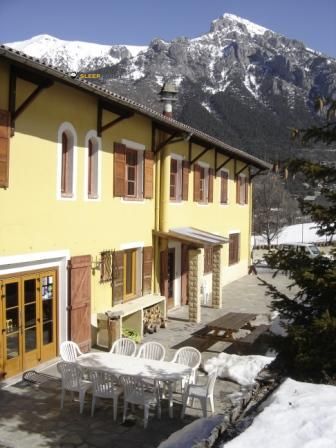
Prepare your backpack and head to ancien four à pain de valabres, le moulin, valabres, roure, niza, alpes marítimos, provenza-alpes-costa azul, francia metropolitana, 06420, francia. There you will find the Ancien four à pain de Valabres refuge at 1230 meters of elevation. An essential stop along the way (Lat: 44.142, Lon: 7.09) for any mountain enthusiast.

See more
See more
Usuario

Lucas Martinez

Premium user

Live weather: Ancien four à pain de Valabres

Before heading to Ancien four à pain de Valabres, check the weather: we currently have 14.6°C (feels like 13.8°C). With wind gusts reaching 10.8 km/h and a freezing level around 4240 meters, the daytime high will not exceed 20.6°C.
Temperature

14.6°C

Feels like: 13.8°C
Wind

5.4 km/h

Gusts: 10.8 km/h
Freezing level 0°

4240 m

Snow line
Sky & UV

UV 0

Clouds: 100%

Next 48 hours evolution

7-day forecast

03/06
20.6° 11.2°
0 mm 14 km/h UV máx: 7.6
05:50 21:09
04/06
19.4° 12°
12.2 mm 13.7 km/h UV máx: 7.65
05:49 21:10
05/06
18.2° 9.5°
0 mm 12.8 km/h UV máx: 7.5
05:49 21:10
06/06
21.5° 10°
0 mm 14 km/h UV máx: 6.9
05:49 21:11
07/06
22° 11.8°
0 mm 12.9 km/h UV máx: 7.65
05:48 21:12
08/06
20.3° 13.4°
14.7 mm 12.1 km/h UV máx: 7.9
05:48 21:12
09/06
22.6° 13.4°
0 mm 23 km/h UV máx: 7.05
05:48 21:13

From the environment of Valabres , within the term of Roure , this old bread oven works mainly as a walking coat and useful reference to move along the half-mountain that links with wider sector itineraries. The closeness of the GR 52A , known as Sentier panoramique du Mercantour, places the place in a strip where the progression can change quite according to the hillside you step on: more open and sunny sections alternate with guidelines that better retain moisture or cold, something to take into account already from a moderate level of 1,230 meters. It is not an extreme altitude, but it is enough for time to change quickly if you gain height to the next cords. In the planning also adds a practical detail: there is a very close source, practically next to the coat, although in the mountain it is appropriate not to take for granted its flow without checking it before.

His interest grows as he looks around. Up there are reliefs like Mont Gravières , Cime de Sistron or Mont Saint-Sauveur , summits that draw an increasingly alpine terrain and that make this point a reasonable basis for one-day departures or to break through the local routes of Valabres and Roure. The approach and continuity of the advance will depend much on the change of orientation, the insolation and the state of the path, especially on routes that seek secondary hills or crest. This is why it is necessary to read this shelter more as logistical support than as a destination in itself: a low point of start or guard from which to organize the effort before entering longer slopes, exposed to the wind and with levels already specific to the Mercantour mountain.

Hiking routes from the refuge

GR 52A

Le Sentier panoramique du Mercantour

↔ 217 km
39

Rochers de Valabres

↔ Variable distance
38

Mont Gravières

↔ Variable distance
35

Circuit de Roure

↔ Variable distance
34

Circuit de la Couletta

↔ Variable distance
33

Boucle de Vignols

↔ Variable distance
32

Circuit de Sainte-Eurosie

↔ Variable distance
30

Baisse de Druos

↔ Variable distance

Nearby peaks

Mont Autcellier

2204 m
Lat: 44.1301 Lon: 7.0425

Mont Saint-Sauveur

2711 m
Lat: 44.1643 Lon: 7.135

Montagne Haute

2341 m
Lat: 44.1567 Lon: 7.024

Mont Gravières

2331 m
Lat: 44.1491 Lon: 7.0575

Cime de Sistron

2603 m
Lat: 44.1733 Lon: 7.1243

Cime de Méné

2477 m
Lat: 44.1893 Lon: 7.1129

Cime de Merlier

2575 m
Lat: 44.1809 Lon: 7.1191

Tête de Croscayre

1768 m
Lat: 44.1336 Lon: 7.0803

Nearby water fountains

Fuente

10 m
Lat: 44.1336 Lon: 7.0803

Fuente

3.04 Km
Lat: 44.1336 Lon: 7.0803

Fuente

3.48 Km
Lat: 44.1336 Lon: 7.0803

Fuente

5.06 Km
Lat: 44.1336 Lon: 7.0803

Fuente

5.26 Km
Lat: 44.1336 Lon: 7.0803

Fuente

5.72 Km
Lat: 44.1336 Lon: 7.0803

Fuente

5.72 Km
Lat: 44.1336 Lon: 7.0803

Fuente

5.79 Km
Lat: 44.1336 Lon: 7.0803
FAQ

Frequently asked questions

Pregunta frecuente
Is it necessary to carry a GPS to reach the Ancien four à pain de Valabres refuge?
It is always highly recommended to carry a GPS device, a route track, or a topographic map in the mountains. You can use the coordinates 44.142, 7.09 to locate this refuge precisely.
Pregunta frecuente
In which municipality or region is the Ancien four à pain de Valabres refuge located?
This refuge is located within the municipality of Roure, belonging to the community or region of Provenza-Alpes-Costa Azul.
Pregunta frecuente
Are there other mountain refuges near Ancien four à pain de Valabres?
Yes, nearby you can find other options to spend the night or take shelter. El refugio más próximo es el Abri en tôle de Valabres, que se encuentra a aproximadamente 0 km de distancia.
More areas

Other areas

Collaborative

Together we improve

image

Send your photos

You can upload photos of shelters and update their status so other users know if they can go there.

Get started
Get started
image

Rate the shelter

Leave your comments to rate the shelter’s condition. In the mountains, we look after each other.

Get started
Get started
image

Add new ones

Did we miss any? Publish the shelters you know so everyone can use them.

Get started
Get started
Download for free from the Apple App Store and Play Store.

Download the app and start looking for the shelter of your next adventure

Aplicación móvil para encontrar refugios de montaña donde dormir
Aplicación móvil para encontrar refugios de montaña donde dormir.
Mapa interactivo de refugios de montaña en los Pirineos dentro de la app
Mapa de refugios de montaña para senderismo y trekking en la app.
Pantalla con información de refugio de montaña con altitud capacidad y servicios
Pantalla con información de refugio de montaña con altitud capacidad y servicios.
Detalles de refugio de montaña con servicios y meteorología en aplicación móvil
Detalles de refugio de montaña con servicios y meteorología en aplicación móvil.
Aplicación para explorar refugios de montaña mediante mapa interactivo
Aplicación para explorar refugios de montaña mediante mapa interactivo.
Ficha completa de refugio de montaña con opiniones y servicios
Ficha completa de refugio de montaña con opiniones y servicios.
Información detallada de refugio en app para montañeros
Información detallada de refugio en app para montañeros.
Listado de refugios de montaña para senderismo y trekking
Listado de refugios de montaña para senderismo y trekking.
Explorar refugios de montaña desde una aplicación móvil
Explorar refugios de montaña desde una aplicación móvil.