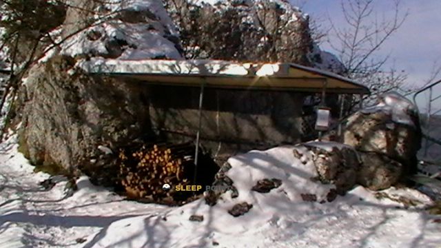
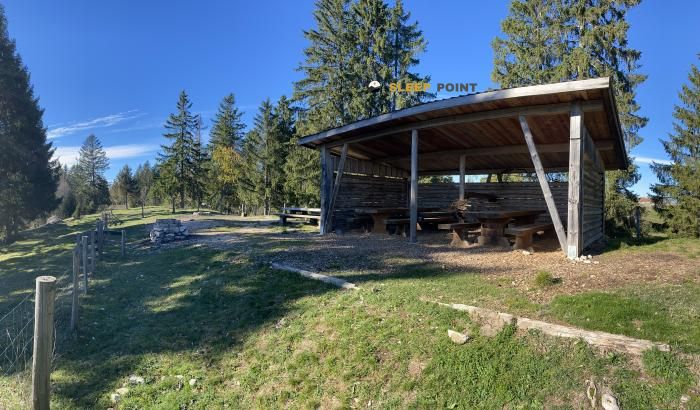
Mountain refuge Abri Pâturage du Droit
We have it listed in the app!
We have it listed in the app!

If you are looking for total disconnection, venture into 2, prés aux liattes, tramelan, arrondissement administratif du jura bernois, région administrative du jura bernois, berna, 2720, suiza until you reach the Abri Pâturage du Droit refuge, positioned at 1097 meters. Use your device to navigate to the exact point (47.233, 7.113) to find this alpine shelter.
10.4°C
Feels like: 7.8°C10.4 km/h
Gusts: 28.4 km/h3760 m
Snow lineUV 0
Clouds: 98% 16.1 mm
 21.6 km/h
 UV máx: 5.7
 05:37
05:37
 21:22
2.5 mm
18.1 km/h
UV máx: 4.35
05:37
21:22
0 mm
16.1 km/h
UV máx: 7.15
05:36
21:23
0 mm
15.3 km/h
UV máx: 6.55
05:36
21:24
3.15 mm
11.7 km/h
UV máx: 6.9
05:36
21:25
10.5 mm
17.1 km/h
UV máx: 3.55
05:35
21:25
0 mm
14 km/h
UV máx: 7.1
05:35
21:26
21:22
2.5 mm
18.1 km/h
UV máx: 4.35
05:37
21:22
0 mm
16.1 km/h
UV máx: 7.15
05:36
21:23
0 mm
15.3 km/h
UV máx: 6.55
05:36
21:24
3.15 mm
11.7 km/h
UV máx: 6.9
05:36
21:25
10.5 mm
17.1 km/h
UV máx: 3.55
05:35
21:25
0 mm
14 km/h
UV máx: 7.1
05:35
21:26
Discrete passage rather than destiny in itself. Abri Pâturage du Droit at 1097 meters, it fits into the wavy landscape of the Bernese Jura, in the Tramelan environment, where the reliefs are not abrupt but open, exposed and very dependent on weather.
Its position places it in a local transit area between high pastures, hiking paths and small elevations that organize the orientation on the ground. References such as Montbaptir and Montagne du Droit , modest peaks in altitude but useful to understand the character of the sector: soft crests, interspersed forest and tours that link communes of the Bernes Jura to the edge of Franches- Montagnes.
In this context, the coat may have an interest especially as a point guard during a day on the network of itineraries leaving Tramelan, La Chaux-des-Breuleux or the surroundings of Les Reussilles. It does not seem to be a refuge associated with high altitude or alpine ascension, but rather through senderist paths where a small deviation only compensates if protection or an intermediate reference is needed on open ground.
The orientation in the area often depends more on the continuity of slopes, clear and forest edges than on high mountain milestones. It is therefore appropriate to read the map well and not to rely on a rapid progression if there is fog, wind or changing visibility, rather relevant conditions on these plateau and Jurasian lomas.
In the logistics, there is a source located just over 1.3 km, reasonable but not immediate distance. This advises not to have water next to the coat and to leave with sufficient autonomy as planned. It should also be put forward as simple support within a half-mountain day, more useful for its protective function than as a basis for channelling long or multi-day highways.


Download the app and start looking for the shelter of your next adventure


Find a place to sleep before night falls.