Mountain refuge Combioz

We have it listed in the app!


            Mountain refuge Combioz in combioz, 31, chemin des skieurs, malleray, valbirse, arrondissement administratif du jura bernois, région administrative du jura bernois, berna, 2735, suiza
Five orange stars in a horizontal row representing a five-star rating.

Combioz

Lat: 47.265xxx – Lon: 7.266xxx
📍 combioz, 31, chemin des skieurs, malleray, valbirse, arrondissement administratif du jura bernois, région administrative du jura bernois, berna, 2735, suiza
Combioz

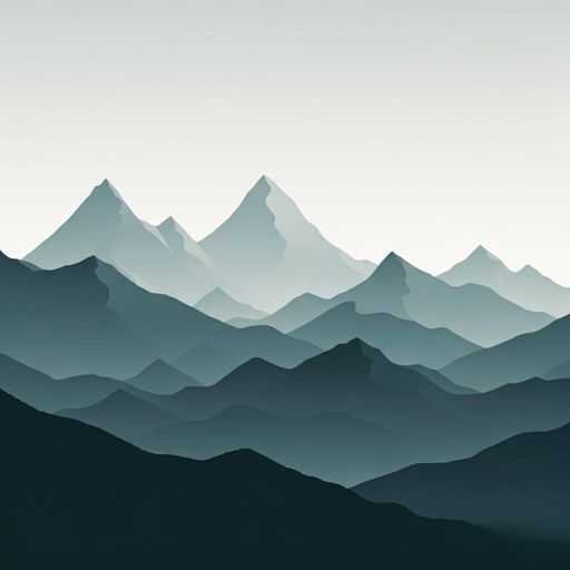
With a privileged location in combioz, 31, chemin des skieurs, malleray, valbirse, arrondissement administratif du jura bernois, région administrative du jura bernois, berna, 2735, suiza, the Combioz refuge awaits you at 1306 meters of altitude. Note its position (47.265, 7.266) before starting your route through the mountain range or massif.

See more
See more
Usuario

Lucas Martinez

Premium user

Live weather: Combioz

With 9% cloud coverage, the Combioz shelter reports 8.9°C and a feels-like temperature of 5.7°C. Breeze at 13.2 km/h with possible gusts of 48.6 km/h. The freezing altitude is at 3490 m and the maximum will reach 12.2°C.
Temperature

8.9°C

Feels like: 5.7°C
Wind

13.2 km/h

Gusts: 48.6 km/h
Freezing level 0°

3490 m

Snow line
Sky & UV

UV 0

Clouds: 9%

Next 48 hours evolution

7-day forecast

03/06
12.2° 6.5°
5.2 mm 20.9 km/h UV máx: 6.8
05:37 21:20
04/06
12.7° 7.6°
10 mm 22.9 km/h UV máx: 5.7
05:37 21:21
05/06
11.3° 5.9°
2.12 mm 15.2 km/h UV máx: 4.75
05:36 21:22
06/06
15.8° 6.5°
0.7 mm 14.4 km/h UV máx: 7.2
05:36 21:23
07/06
16.5° 7.1°
0 mm 14.4 km/h UV máx: 6.55
05:35 21:24
08/06
21.4° 8.8°
0 mm 5.9 km/h UV máx: 6.9
05:35 21:24
09/06
13.3° 7.4°
7.2 mm 16.3 km/h UV máx: 3.45
05:35 21:25

Link on the crest

On a day of ascending or crossing the heights of the Belgian Jura, Combioz It fits better as a point of passage than as an isolated destination. Its location, above Malleray and within the municipality of Valsiar, is close to the hiking routes that link Pré La Vigne, Soulce, Sur la Côte and Les Ecorreresses, as well as the passage of the European route E4 . This network of roads makes sense when the day is extended, the weather changes or should be divided into two more manageable sections.

Moron, Montoz and autonomy

At 1306 meters, it is very close to elevations like Moron , just a few hundred meters, and relatively close to Montoz and Montagne de Moutier. It is not a great high mountain resort, but a useful support in relief of crest and half mountain, where wind, fog or a rapid change of time can weigh more than altitude. This is why its practical usefulness appears mainly when linking nearby summits or reorganizing a stage if the tiredness, time or state of the ground advise shortening.

The exit should be considered with some autonomy. There are sources registered at a reasonable distance, the closest to about 1.78 km, but not next to the shelter, so it is not wise to have immediate water on arrival. In this sector of the canton of Bern it is interesting to review foresight, visibility and route before leaving, especially if it is to be used as support on the journey. It also helps to take time to focus on local links and not depend on a single downsizing or continuation option.

Hiking routes from the refuge

E4

European long distance path E4 - part Switzerland

↔ Variable distance
Local

Les Ecorcheresses - fixme

↔ Variable distance
Local

Les Ecorcheresses - Pré La Vigne

↔ Variable distance
Local

Pré La Vigne - Sur la Côte

↔ Variable distance
Local

Pré La Vigne - Soulce

↔ Variable distance
Local

Pré La Vigne - fixme

↔ Variable distance
Local

Sur la Côte - fixme

↔ Variable distance
Local

Le Pichoux - Sornetan

↔ Variable distance

Nearby peaks

Moron

1336 m
Lat: 47.2624 Lon: 7.2634

Montoz

1328 m
Lat: 47.2173 Lon: 7.2742

Montagne de Moutier

1169 m
Lat: 47.2913 Lon: 7.319

Les Bâmattes

1055 m
Lat: 47.2868 Lon: 7.2593

Montaigu

1195 m
Lat: 47.2689 Lon: 7.2655

Le Noir Bos

1103 m
Lat: 47.2694 Lon: 7.251

Les Craux

1124 m
Lat: 47.2618 Lon: 7.2184

Sur la Rive

1312 m
Lat: 47.218 Lon: 7.2945

Nearby water fountains

Fuente

1.78 Km
Lat: 47.218 Lon: 7.2945

Fuente

1.85 Km
Lat: 47.218 Lon: 7.2945

Fuente

1.92 Km
Lat: 47.218 Lon: 7.2945

Fuente

2.02 Km
Lat: 47.218 Lon: 7.2945

Fuente

2.09 Km
Lat: 47.218 Lon: 7.2945

Fuente

2.12 Km
Lat: 47.218 Lon: 7.2945

Fuente

2.13 Km
Lat: 47.218 Lon: 7.2945

Fuente

2.14 Km
Lat: 47.218 Lon: 7.2945
FAQ

Frequently asked questions

Pregunta frecuente
Are there other mountain refuges near Combioz?
Yes, nearby you can find other options to spend the night or take shelter. El refugio más próximo es el Cabane forestière de Plan-Marti, que se encuentra a aproximadamente 2.2 km de distancia.
Pregunta frecuente
At what exact altitude is the Combioz refuge located?
The Combioz refuge is located at an altitude of 1306 meters above sea level, in the natural surroundings of combioz, 31, chemin des skieurs, malleray, valbirse, arrondissement administratif du jura bernois, région administrative du jura bernois, berna, 2735, suiza.
Pregunta frecuente
What are the GPS coordinates of the Combioz refuge?
To locate the Combioz refuge on your GPS or map, use the following coordinates: Latitude 47.265 and Longitude 7.266.
More areas

Other areas

Collaborative

Together we improve

image

Send your photos

You can upload photos of shelters and update their status so other users know if they can go there.

Get started
Get started
image

Rate the shelter

Leave your comments to rate the shelter’s condition. In the mountains, we look after each other.

Get started
Get started
image

Add new ones

Did we miss any? Publish the shelters you know so everyone can use them.

Get started
Get started
Download for free from the Apple App Store and Play Store.

Download the app and start looking for the shelter of your next adventure

Aplicación móvil para encontrar refugios de montaña donde dormir
Aplicación móvil para encontrar refugios de montaña donde dormir.
Mapa interactivo de refugios de montaña en los Pirineos dentro de la app
Mapa de refugios de montaña para senderismo y trekking en la app.
Pantalla con información de refugio de montaña con altitud capacidad y servicios
Pantalla con información de refugio de montaña con altitud capacidad y servicios.
Detalles de refugio de montaña con servicios y meteorología en aplicación móvil
Detalles de refugio de montaña con servicios y meteorología en aplicación móvil.
Aplicación para explorar refugios de montaña mediante mapa interactivo
Aplicación para explorar refugios de montaña mediante mapa interactivo.
Ficha completa de refugio de montaña con opiniones y servicios
Ficha completa de refugio de montaña con opiniones y servicios.
Información detallada de refugio en app para montañeros
Información detallada de refugio en app para montañeros.
Listado de refugios de montaña para senderismo y trekking
Listado de refugios de montaña para senderismo y trekking.
Explorar refugios de montaña desde una aplicación móvil
Explorar refugios de montaña desde una aplicación móvil.