Mountain refuge Cabane du Serpent
We have it listed in the app!
We have it listed in the app!
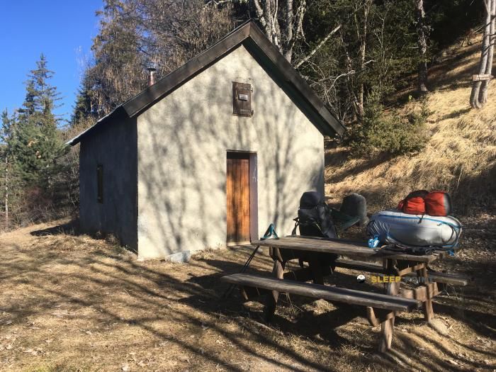

Prepare your backpack and head to le fau, seyne, digne-les-bains, alpes de alta provenza, provenza-alpes-costa azul, francia metropolitana, 04140, francia. There you will find the Cabane du Serpent refuge at 1695 meters of elevation. An essential stop along the way (Lat: 44.352, Lon: 6.415) for any mountain enthusiast.
12.1°C
Feels like: 10.6°C1.4 km/h
Gusts: 10.1 km/h4010 m
Snow lineUV 1.4
Clouds: 68% 15.7 mm
 17.3 km/h
 UV máx: 7.1
 05:51
05:51
 21:13
1.1 mm
9.4 km/h
UV máx: 7.8
05:51
21:14
0 mm
13.2 km/h
UV máx: 8
05:50
21:15
0 mm
11.6 km/h
UV máx: 6.8
05:50
21:15
0 mm
17.7 km/h
UV máx: 7.8
05:50
21:16
0 mm
14.3 km/h
UV máx: 7.6
05:49
21:17
0 mm
10.5 km/h
UV máx: 7.7
05:49
21:17
21:13
1.1 mm
9.4 km/h
UV máx: 7.8
05:51
21:14
0 mm
13.2 km/h
UV máx: 8
05:50
21:15
0 mm
11.6 km/h
UV máx: 6.8
05:50
21:15
0 mm
17.7 km/h
UV máx: 7.8
05:50
21:16
0 mm
14.3 km/h
UV máx: 7.6
05:49
21:17
0 mm
10.5 km/h
UV máx: 7.7
05:49
21:17
In the environment of Seyne within the Alpes de Alta Provence, this small mountain reference is located at 1,695 meters in a range of medium-high mountain that already forces to read the relief well. It does not appear associated here with specific identified routes, so it should be understood more as ground support than as a stop linked to a closed route. The orientation in this area depends a lot on how loops, side changes and open slope access are chained, which can change progression according to weather and visibility.
Cabane du Serpent it is under a set of summits that give it a clearly mountainous character. Very close the Pic de Bernardez , less than two kilometres in a straight line, and around there appear reliefs like Pic de Savernes , L'Aiguilette , Roche Close or La Mournière . More than an obvious basis for a single ascension, the shelter fits into a landscape of cords and nearby elevations where exposure changes can be made quickly, especially with wind, fog or wet soil.
From a practical point of view, your interest is to offer a fixed point of reference in an area where the land wins alpine entity without yet entering extreme heights. It can be used to plan a day with margin, split efforts or have a safe option within a wider way out of the sector. In the absence of clear data on close routes in this file, it is not wise to associate it with specific routes, stages or accesses.
Logistics requires attention. Although there are several invented sources in the area, the nearest one is about 3.7 km, a distance sufficient not to take for granted the water supply during the march or upon arrival. Therefore, for any road planning it is necessary to leave with reasonable autonomy and to confirm on the ground both access and actual water availability, especially in dry periods.
It is also a place where relative isolation weighs more than transit. There is no information here about indoor equipment or services, so the correct reading is that of a useful mountain shelter as basic support in a serious relief area, with nearby summits and with need to prepare well guidance, water and weather margin.


📏 2.3 Km
⛰️ 2066 m

📏 3.9 Km
⛰️ 1721 m

📏 5.4 Km
⛰️ 1670 m

📏 5.5 Km
⛰️ 1970 m

📏 5.7 Km
⛰️ 1745 m
📏 5.7 Km
⛰️ 1424 m

📏 6.6 Km
⛰️ 2250 m

📏 7 Km
⛰️ 1570 m
Download the app and start looking for the shelter of your next adventure


Find a place to sleep before night falls.


