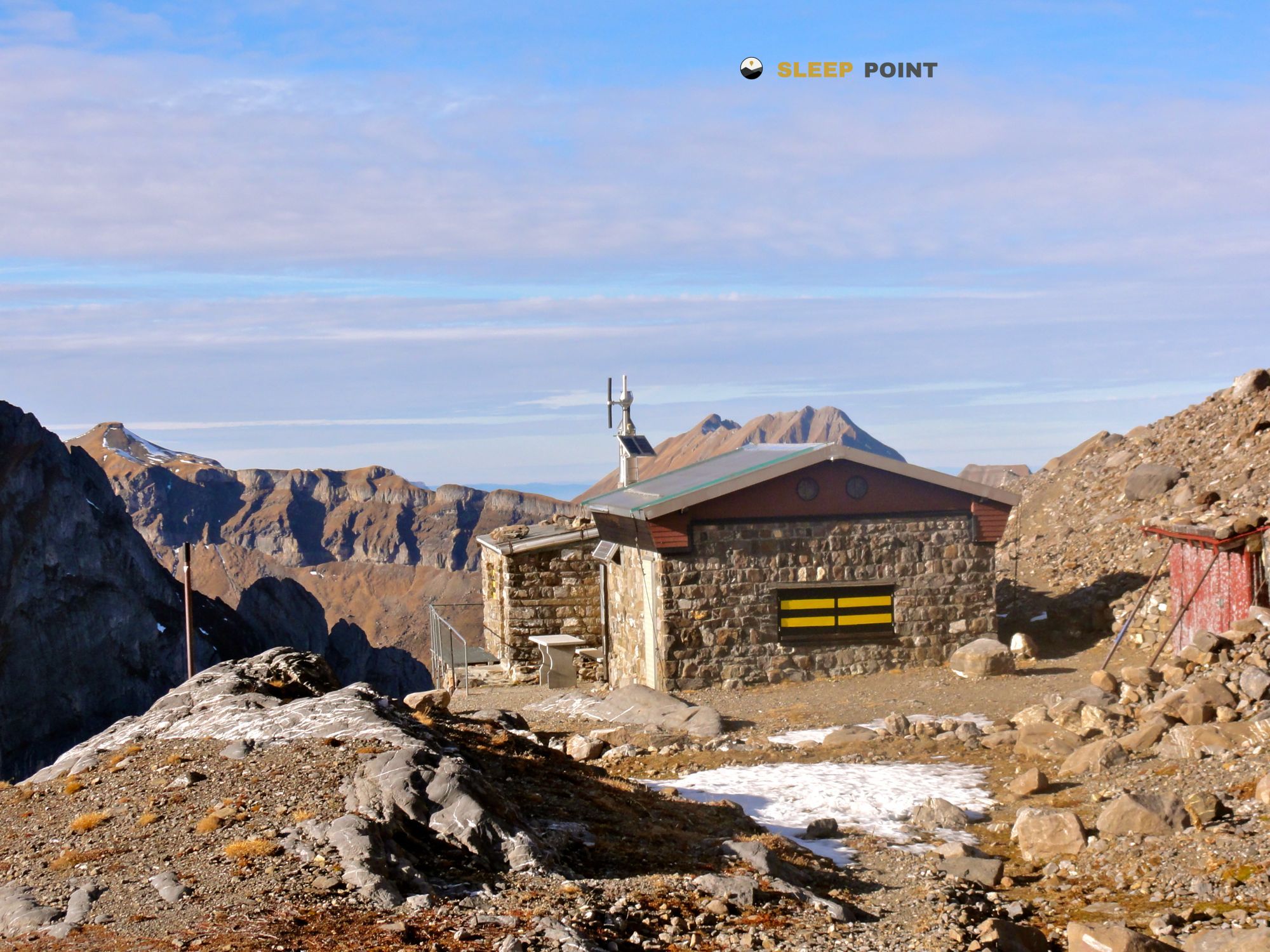
Mountain refuge Schutzhütte Surenen Eggen
We have it listed in the app!
We have it listed in the app!


Discover the Schutzhütte Surenen Eggen refuge, an alpine shelter located at 2250 meters in the area of schutzhütte surenen-eggen, biwaldalp-gitschenhörelihütte, isenthal, uri, 6461, suiza. Whether you are on a multi-day trek or a day hike, this point (46.835, 8.546) will provide the peace and shelter you seek in the mountains.
8.6°C
Feels like: 6.4°C3.6 km/h
Gusts: 30.6 km/h3420 m
Snow lineUV 4.2
Clouds: 89% 30.5 mm
 20.7 km/h
 UV máx: 5.55
 05:33
05:33
 21:14
8.6 mm
17.1 km/h
UV máx: 4.6
05:33
21:15
3.6 mm
7.6 km/h
UV máx: 5.65
05:32
21:16
0 mm
6.6 km/h
UV máx: 6.2
05:32
21:17
0 mm
9.4 km/h
UV máx: 7.45
05:32
21:17
7.8 mm
12 km/h
UV máx: 1.3
05:31
21:18
3.6 mm
11 km/h
UV máx: 7.05
05:31
21:19
21:14
8.6 mm
17.1 km/h
UV máx: 4.6
05:33
21:15
3.6 mm
7.6 km/h
UV máx: 5.65
05:32
21:16
0 mm
6.6 km/h
UV máx: 6.2
05:32
21:17
0 mm
9.4 km/h
UV máx: 7.45
05:32
21:17
7.8 mm
12 km/h
UV máx: 1.3
05:31
21:18
3.6 mm
11 km/h
UV máx: 7.05
05:31
21:19
In the upper part of Isenthal , inside the canton of Uri , this coat is located 2250 meters in a clearly alpine strip, above the comfortable valley terrain and already close to slopes, crests and steps where meteorology changes quickly. Its position fits well in support of walking and mountain hiking routes that cross the area, with references such as the E1 , Gottardo Wanderweg or the Gitschenen environment. More than an isolated destination, it works as a point of passage or a point of protection in a sector where it is appropriate to read the map well and to share the effort, because the final approach moves in an open environment, with less protection against the wind, fog or a sudden drop in temperature.
Schutzhütte Surenen Eggen is also under a powerful relief, with close peaks as Brunnistock , Urirostock and, somewhat further away, Gross Spannort or Schlossberg, which helps to understand the mountainous character of the place: ground of height, very marked vertical references and feeling of being in the transition between demanding paths and a already clearly alpine environment. In this context, water management deserves attention. The nearest registered sources are more than 2.7 km away, so it is not appropriate to have immediate supply next to the shelter. If it is proposed as support for a long day or as a link between itineraries, it is reasonable to go out with sufficient autonomy and to anticipate time changes, especially if there is low cloud or irregular visibility, as in such areas the orientation can be complicated quickly.


Download the app and start looking for the shelter of your next adventure


Find a place to sleep before night falls.