Mountain refuge Sunniggrathütte
We have it listed in the app!
We have it listed in the app!
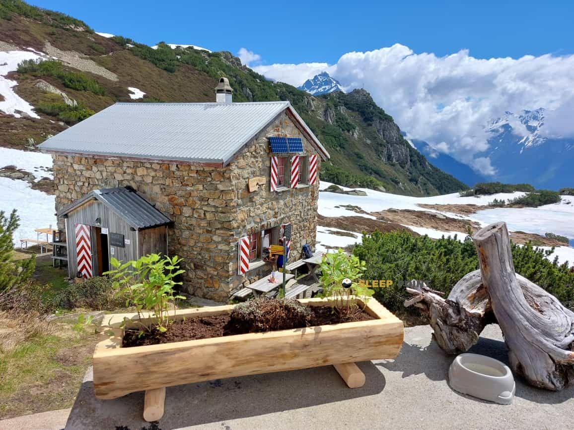

Protected by the wild surroundings of bergrestaurant sunniggratli, 1, sunniggrätli, gurtnellen, uri, 6476, suiza, the Sunniggrathütte refuge is your best ally at 1977 meters of elevation. Once you reach its coordinates (46.783, 8.634), you can enjoy a well-deserved mountain rest.
4.1°C
Feels like: 1.9°C1.8 km/h
Gusts: 6.5 km/h3820 m
Snow lineUV 0
Clouds: 100% 11.2 mm
 16.9 km/h
 UV máx: 5.35
 05:33
05:33
 21:14
6.3 mm
11.4 km/h
UV máx: 6.35
05:33
21:14
3.5 mm
9.7 km/h
UV máx: 7.45
05:32
21:15
0 mm
7.4 km/h
UV máx: 6.5
05:32
21:16
1.65 mm
9.4 km/h
UV máx: 7.25
05:31
21:17
10.8 mm
10.3 km/h
UV máx: 1.1
05:31
21:17
0 mm
9.9 km/h
UV máx: 7.5
05:31
21:18
21:14
6.3 mm
11.4 km/h
UV máx: 6.35
05:33
21:14
3.5 mm
9.7 km/h
UV máx: 7.45
05:32
21:15
0 mm
7.4 km/h
UV máx: 6.5
05:32
21:16
1.65 mm
9.4 km/h
UV máx: 7.25
05:31
21:17
10.8 mm
10.3 km/h
UV máx: 1.1
05:31
21:17
0 mm
9.9 km/h
UV máx: 7.5
05:31
21:18
In the field of Gurtnellen , inside the canton of Uri , Sunniggrathütte is located on the side of Sunniggrätli, at 1,977 meters, on a point that already marks a clearly montane environment and a more sensitive exposure to rapid time changes. The general reference of the Reuss Valley helps to place it in central Switzerland, between very tight valley funds and fast-growing slopes. This position makes it, above all, a medium and high mountain support for days in tilted terrain, where the orientation and management of the effort weigh more than the simple distance.
More than a network of documented concrete itineraries, this shelter stands out for its logistical function. It serves as a safe and pause point in an area where the information available on nearby routes is limited, so it is appropriate to propose the exit with map, previous layout and time margin. The altitude is not extreme, but is sufficient to meet with fog, wind or fast cooling outside the most stable season. In such places, a short day on paper can be complicated if the ground is wet, if there are snow remains or if the visibility falls.
The issue of water deserves special attention. The nearest registered sources are from about 2.3 km, and the rest are also located at similar or higher distances. This does not allow for immediate supply next to the shelter, so water autonomy must be part of the planning from the beginning. For hiking in this area of Uri, especially if heat, long load or itinerary changes are expected, it is more prudent to go out with enough water and not depend on finding a comfortable recharge point in the vicinity.
It is also appropriate to understand this enclave as a shelter of basic support, not as a basis from which to deduct ascent or specific traverses without additional information. In the absence of clear references to nearby routes and associated summits in the available data, it is reasonable to use it as a geographical and protective reference within autonomous planning. In Swiss mountain, and in an environment like Gurtnellen's, that means reviewing meteorology, mapping and general state of the ground before leaving.


Download the app and start looking for the shelter of your next adventure


Find a place to sleep before night falls.