Mountain refuge Refugio de Gola

We have it listed in the app!


            Mountain refuge Refugio de  Gola in refugi de l'estany de la gola, camí de l'estany de la gola, la guingueta d'Àneu, pallars sobirá, lérida, cataluña, 25588, españa
Five orange stars in a horizontal row representing a five-star rating.

Refugio de Gola

Lat: 42.681xxx – Lon: 1.171xxx
📍 refugi de l'estany de la gola, camí de l'estany de la gola, la guingueta d'Àneu, pallars sobirá, lérida, cataluña, 25588, españa
Refugio de Gola

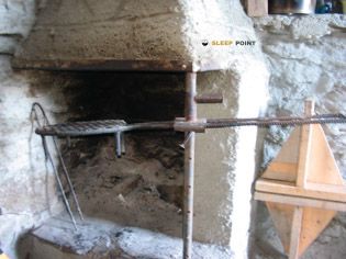
If you are planning a route through refugi de l'estany de la gola, camí de l'estany de la gola, la guingueta d'Àneu, pallars sobirá, lérida, cataluña, 25588, españa, the Refugio de Gola refuge is a must-stop. Located at 2100 m above sea level, it offers hikers and climbers a safe place to regain strength. Save its coordinates (42.681, 1.171) in your GPS to stay on course during your journey.

See more
See more
Usuario

Lucas Martinez

Premium user

Live weather: Refugio de Gola

Live weather from Refugio de Gola shows 8.8°C and skies with 100% cloudiness. Wind is blowing at 13.2 km/h, lowering the feels-like temperature to 5.8°C. For high-altitude trips, the freezing level is at 4410 m and the maximum temperature will be 11.5°C.
Temperature

8.8°C

Feels like: 5.8°C
Wind

13.2 km/h

Gusts: 27 km/h
Freezing level 0°

4410 m

Snow line
Sky & UV

UV 3.1

Clouds: 100%

Next 48 hours evolution

7-day forecast

04/06
11.5° 2.2°
4.88 mm 25.5 km/h UV máx: 4.45
06:18 21:28
05/06
10.1° 0.2°
0 mm 21.3 km/h UV máx: 7.95
06:18 21:29
06/06
13.1° 2.6°
0 mm 7.2 km/h UV máx: 6.55
06:18 21:30
07/06
15.5° 5.7°
0 mm 13.7 km/h UV máx: 7.85
06:17 21:30
08/06
18.8° 7.2°
1.5 mm 10.6 km/h UV máx: 7.6
06:17 21:31
09/06
9.2° 1.5°
2.1 mm 6.8 km/h UV máx: 6.2
06:17 21:31
10/06
15.5° 1.5°
1.8 mm 9.3 km/h UV máx: 7.8
06:17 21:32

At the head of the Guingueta d'Áneu, next to the road of stany de la Gola and within the scope of Parc Natural de l'Alt Pirineu , Gola Refuge It fits mainly on mountain tours with a journey logic. Its position, about 2100 meters away, places it in a strip where the land already has a clearly alpine character and where the shelter can serve to fail long days or to gain height before linking steps and hills of the area.

It is especially useful for mountaineers who move on continuity routes, rather than for a short walk. In this sector, references such as Porta del Cel , several stages of the HRP , the route of the Port of Salau or the link of Tavascan to the Coll of Tavascan, so its value is to function as intermediate support within open routes, with distance and variable level according to the chosen route. It can also make sense as a basis for moving towards nearby summits of the Mont-roig , Walk me or pic de la Gallina , always within a high mountain context where the orientation, weather and state of the ground weigh more than the closeness in a straight line.

It is appropriate to plan with autonomy. Although several invented sources appear in the area, the nearest ones are more than 4 km away, so it is not wise to have immediate water next to the shelter without prior confirmation. In a passing area like this, exposed to rapid time changes and long walkways between valleys, it is reasonable to arrive with sufficient water, food and equipment for mountain terrain, especially if used as a link between stages or as a starting point to higher levels.

Hiking routes from the refuge

Porta del Cel

Porta del Cel

↔ Variable distance
HRP

HRP Étape 25

↔ Variable distance
HRP

HRP Étape 26

↔ Variable distance
HRP

HRP Étape 27

↔ Variable distance
Local

route du Port de Salau

↔ Variable distance
GR T 58

Tavascan - Coll de Tavascan

↔ Variable distance
HRP Var.

HRP Variante 27.1

↔ Variable distance
Ramat de Camins

Ramat de Camins. Etapa 9 : Espot => Esterri d'Àneu

↔ 15.3 km

Nearby peaks

Mont-roig

2864.4 m
Lat: 42.7107 Lon: 1.1768

Pic de Bassiero

2543.8 m
Lat: 42.7243 Lon: 1.1405

Pic du Portanech

2559 m
Lat: 42.7169 Lon: 1.1524

Pic de la Tartera

2846.3 m
Lat: 42.7082 Lon: 1.171

Campirme

2632.7 m
Lat: 42.6595 Lon: 1.1936

Pic de la Gallina

2756.5 m
Lat: 42.7012 Lon: 1.1761

Pic Major de la Gallina

2754 m
Lat: 42.6989 Lon: 1.1749

Pic Inferior de la Gallina

2726 m
Lat: 42.6979 Lon: 1.1751

Nearby water fountains

Fuente

4.16 Km
Lat: 42.6979 Lon: 1.1751

Font de la Morera

4.18 Km
Lat: 42.6979 Lon: 1.1751

Fuente

5.39 Km
Lat: 42.6979 Lon: 1.1751

Fuente

5.97 Km
Lat: 42.6979 Lon: 1.1751

Fuente

6.94 Km
Lat: 42.6979 Lon: 1.1751

Fuente

6.98 Km
Lat: 42.6979 Lon: 1.1751

Font

7.11 Km
Lat: 42.6979 Lon: 1.1751

Fuente

7.11 Km
Lat: 42.6979 Lon: 1.1751
FAQ

Frequently asked questions

Pregunta frecuente
In which municipality or region is the Refugio de Gola refuge located?
This refuge is located within the municipality of la Guingueta d'Àneu, belonging to the community or region of Cataluña.
Pregunta frecuente
Are there other mountain refuges near Refugio de Gola?
Yes, nearby you can find other options to spend the night or take shelter. El refugio más próximo es el Refuge de l'Estany de la Gola, que se encuentra a aproximadamente 0 km de distancia.
Pregunta frecuente
At what exact altitude is the Refugio de Gola refuge located?
The Refugio de Gola refuge is located at an altitude of 2100 meters above sea level, in the natural surroundings of refugi de l'estany de la gola, camí de l'estany de la gola, la guingueta d'Àneu, pallars sobirá, lérida, cataluña, 25588, españa.
More areas

Other areas

Collaborative

Together we improve

image

Send your photos

You can upload photos of shelters and update their status so other users know if they can go there.

Get started
Get started
image

Rate the shelter

Leave your comments to rate the shelter’s condition. In the mountains, we look after each other.

Get started
Get started
image

Add new ones

Did we miss any? Publish the shelters you know so everyone can use them.

Get started
Get started
Download for free from the Apple App Store and Play Store.

Download the app and start looking for the shelter of your next adventure

Aplicación móvil para encontrar refugios de montaña donde dormir
Aplicación móvil para encontrar refugios de montaña donde dormir.
Mapa interactivo de refugios de montaña en los Pirineos dentro de la app
Mapa de refugios de montaña para senderismo y trekking en la app.
Pantalla con información de refugio de montaña con altitud capacidad y servicios
Pantalla con información de refugio de montaña con altitud capacidad y servicios.
Detalles de refugio de montaña con servicios y meteorología en aplicación móvil
Detalles de refugio de montaña con servicios y meteorología en aplicación móvil.
Aplicación para explorar refugios de montaña mediante mapa interactivo
Aplicación para explorar refugios de montaña mediante mapa interactivo.
Ficha completa de refugio de montaña con opiniones y servicios
Ficha completa de refugio de montaña con opiniones y servicios.
Información detallada de refugio en app para montañeros
Información detallada de refugio en app para montañeros.
Listado de refugios de montaña para senderismo y trekking
Listado de refugios de montaña para senderismo y trekking.
Explorar refugios de montaña desde una aplicación móvil
Explorar refugios de montaña desde una aplicación móvil.