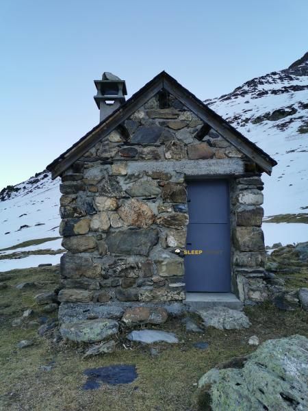
Mountain refuge Chalet - Refuge de Pailha
We have it listed in the app!
We have it listed in the app!


With a privileged location in sentier des balcons, gavarnie, gavarnie-gèdre, argelès-gazost, altos pirineos, occitania, francia metropolitana, 65120, francia, the Chalet - Refuge de Pailha refuge awaits you at 1748 meters of altitude. Note its position (42.72, 0.001) before starting your route through the mountain range or massif.
9.6°C
Feels like: 7.5°C5.4 km/h
Gusts: 6.1 km/h4480 m
Snow lineUV 0
Clouds: 80% 8.2 mm
 12.5 km/h
 UV máx: 6.5
 06:23
06:23
 21:33
0 mm
12.2 km/h
UV máx: 8.1
06:22
21:34
0 mm
5.4 km/h
UV máx: 7.75
06:22
21:34
0.45 mm
8.8 km/h
UV máx: 8.1
06:22
21:35
0 mm
16.2 km/h
UV máx: 8.25
06:22
21:36
0 mm
13.8 km/h
UV máx: 6.85
06:21
21:36
0 mm
12 km/h
UV máx: 7.8
06:21
21:37
21:33
0 mm
12.2 km/h
UV máx: 8.1
06:22
21:34
0 mm
5.4 km/h
UV máx: 7.75
06:22
21:34
0.45 mm
8.8 km/h
UV máx: 8.1
06:22
21:35
0 mm
16.2 km/h
UV máx: 8.25
06:22
21:36
0 mm
13.8 km/h
UV máx: 6.85
06:21
21:36
0 mm
12 km/h
UV máx: 7.8
06:21
21:37
At 1,748 metres, the Chalet - Refuge de Pailha remains in a mountain strip where the land already clearly points to alpine environment, although it still works as a link between valley itineraries and higher routes. In the term of Gavarnie-Gèdre , on the senier des balcons of Gavarnie, its position helps to read the relief well: towards the immediate environment powerful references are raised as the Pimené and Grand Astazou while the set of border summits and large calcareous walls reinforces the high mountain character of this part of the Pyrenees.
More than just an isolated coat, this shelter fits as a point of passage or reorganisation of the day in an area where balconies, circuses and accesses to hills converge. Its location is useful for those who move between the Gavarnie and the reliefs that link with the Cirque de Gavarnie or for those who follow the HRP in stages of crossing. In this context, it can make sense both as intermediate support to continue route and to propose an approach to nearby summits, always within mountain planning and not as immediate or comfortable access.
The map reading here matters. The shelter is located in an area where changes in orientation between slopes, balconies and valley headers can condition progression, especially by linking to high steps or by leaving the most obvious itineraries. The presence of tops such as the Pic de la Pahule or, further to the bottom, the axis of Monte Perdido and the Cylinder of Marboré, helps to understand the general disposition of the terrain, although it is not appropriate to interpret this visual closeness as easy access.
In practical planning, there is a source pointed at about 230 meters, a relevant data to adjust water load without taking for granted anything else. Since no details of equipment or internal conditions are provided, it is reasonable to propose the exit with autonomy, to review weather forecast and to confirm on the ground the state of access and the shelter itself.


📏 0 Km
⛰️ 1750 m

📏 0.6 Km
⛰️ 1850 m

📏 0.9 Km
⛰️ 2027 m
📏 1.2 Km
⛰️ 1904 m

📏 1.2 Km
⛰️ 1905 m

📏 1.5 Km
⛰️ 1800 m

📏 2.9 Km
⛰️ 1500 m

📏 2.9 Km
⛰️ 1495 m
Download the app and start looking for the shelter of your next adventure


Find a place to sleep before night falls.


