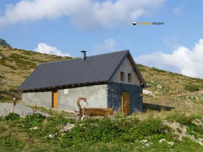
Mountain refuge Chalet de Chizeraz
We have it listed in the app!
We have it listed in the app!


The Chalet de Chizeraz refuge acts as a base camp for the summits and routes of chalet de chizeraz, sentier des ardoisières, cevins, albertville, saboya, auvergne-rhône-alpes, francia metropolitana, 73540, francia. At 1986 meters of elevation, its coordinates (45.624, 6.523) represent safety after a long day of effort.
6.6°C
Feels like: 4°C3.3 km/h
Gusts: 21.2 km/h3890 m
Snow lineUV 0
Clouds: 98% 31.7 mm
 16.9 km/h
 UV máx: 5.7
 05:46
05:46
 21:17
2.7 mm
9 km/h
UV máx: 5.6
05:46
21:18
0 mm
13.7 km/h
UV máx: 7.7
05:45
21:19
0.4 mm
9.2 km/h
UV máx: 7.7
05:45
21:20
0.45 mm
15.7 km/h
UV máx: 7.45
05:45
21:20
13.2 mm
12.8 km/h
UV máx: 1.5
05:44
21:21
0 mm
11.1 km/h
UV máx: 7.5
05:44
21:22
21:17
2.7 mm
9 km/h
UV máx: 5.6
05:46
21:18
0 mm
13.7 km/h
UV máx: 7.7
05:45
21:19
0.4 mm
9.2 km/h
UV máx: 7.7
05:45
21:20
0.45 mm
15.7 km/h
UV máx: 7.45
05:45
21:20
13.2 mm
12.8 km/h
UV máx: 1.5
05:44
21:21
0 mm
11.1 km/h
UV máx: 7.5
05:44
21:22
Open ladders, medium and high mountain relief and a height close to 2,000 meters define the environment of the Villa of Chizeraz in the sector of Cevins, within the Savoy of Albertville. At 1,986 meters, this coat is left in a strip where time changes quickly and where the day is best planned with a margin for wind, fog or thermal descent. Its location, linked to the sentier des ardoisières, helps to place it on the map as a clear reference on a mountain of long routes and less obvious crosses when the visibility gets worse.
More than a simple point of passage, it works as useful support for linking tours of the Beaufortain environment and stages of Grand Tour de Tarentaise , in addition to local variants that connect forests, lomas and steps between valleys. It is also close to the mountain axis that leads to summits like Le Grand Mont , which reinforces its role in long days where effort and orientation should be divided. Access requires reading of the ground and a physical condition that is consistent with mountain levels, although the available data do not allow setting exact times or hardness of the itinerary.
To plan with caution, it is interesting to think about real autonomy. There is a source pointed out practically next to the shelter, but in mountain the availability may vary according to time and conditions, so it is not appropriate to depend only on that point without margin. As a free shelter, its usefulness is mainly to provide shelter within an exposed and wide area, not to guarantee benefits. Wear enough water, coat clothes, lighting, mapping and capacity to solve time changes better fits the character of this enclave than an improvised approach.


📏 2.2 Km
⛰️ 1990 m

📏 2.7 Km
⛰️ 1989 m

📏 3.1 Km
⛰️ 1810 m

📏 3.1 Km
⛰️ 2020 m

📏 3.1 Km
⛰️ 1781 m

📏 3.3 Km
⛰️ 1819 m

📏 3.7 Km
⛰️ 2080 m

📏 3.7 Km
⛰️ 1520 m
Download the app and start looking for the shelter of your next adventure


Find a place to sleep before night falls.


