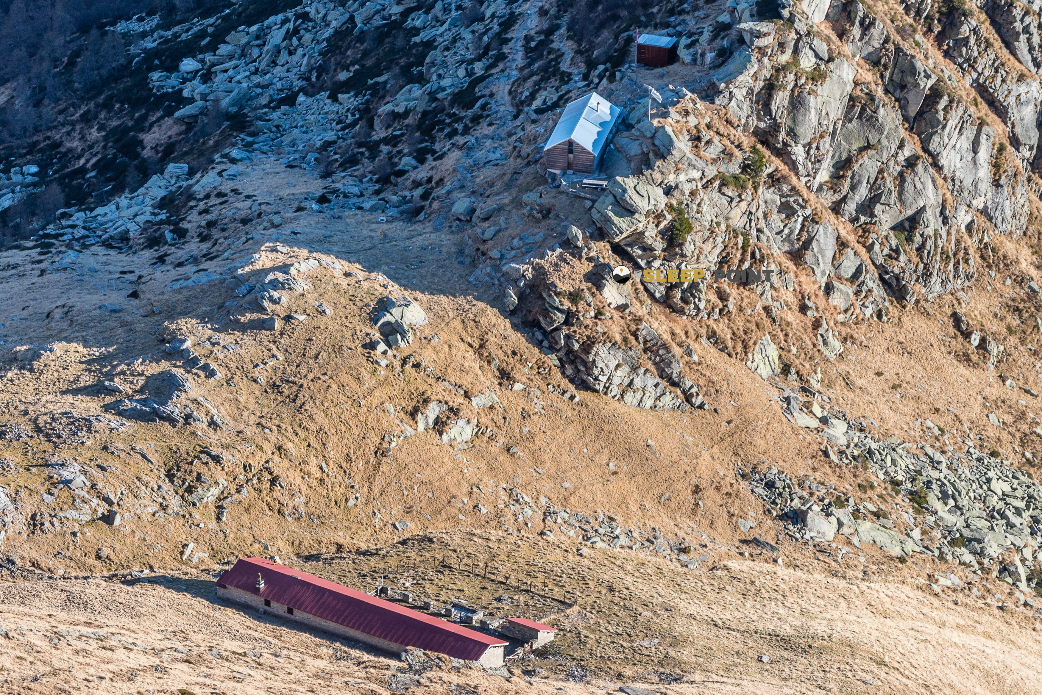
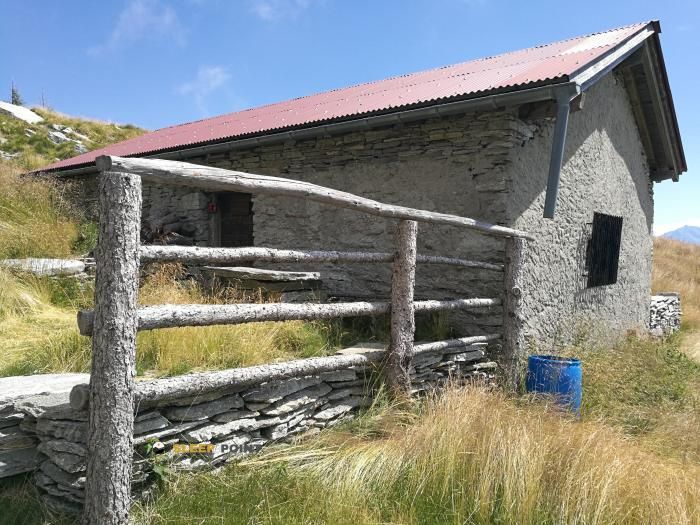
Mountain refuge Capanna Orino
We have it listed in the app!
We have it listed in the app!


Conquering the trails of al caneggio, malacarne, gudo, bellinzona, circolo di bellinzona, distretto di bellinzona, tesino, 6515, suiza is easier with the Capanna Orino refuge. Located at 1395 m (coordinates 46.197, 8.933), it is the ideal shelter against harsh mountain weather.
11.9°C
Feels like: 8.6°C11 km/h
Gusts: 16.9 km/h3380 m
Snow lineUV 0
Clouds: 0% 0.1 mm
 15.9 km/h
 UV máx: 7.25
 05:35
05:35
 21:09
30.9 mm
11.6 km/h
UV máx: 5.9
05:34
21:10
21.6 mm
24.3 km/h
UV máx: 7.25
05:34
21:11
34.6 mm
9.7 km/h
UV máx: 7.1
05:33
21:12
0 mm
8 km/h
UV máx: 7.05
05:33
21:12
0.9 mm
9.9 km/h
UV máx: 7.15
05:33
21:13
10.5 mm
13.4 km/h
UV máx: 5.45
05:32
21:14
21:09
30.9 mm
11.6 km/h
UV máx: 5.9
05:34
21:10
21.6 mm
24.3 km/h
UV máx: 7.25
05:34
21:11
34.6 mm
9.7 km/h
UV máx: 7.1
05:33
21:12
0 mm
8 km/h
UV máx: 7.05
05:33
21:12
0.9 mm
9.9 km/h
UV máx: 7.15
05:33
21:13
10.5 mm
13.4 km/h
UV máx: 5.45
05:32
21:14
The most useful thing when preparing the climb to Capanna Orino is to take a mountain day in which it is necessary to measure the effort from the beginning. The shelter is located in the surroundings of Caneggio and Malacarne, over the area of Gudo and Bellinzona, in the canton of Tesino, 1395 metres. This level does not make it a high mountain shelter on its own, but it does place it in a strip where the accumulated gap, the moisture of the forest and the time changes can mark a lot of the real sense of demand. It is therefore more practical to read it as an intermediate or withdrawal point than a simple isolated destination.
Its position fits well in a prudent planning: it allows to order the approach, to assess how the group or the march itself responds and to decide whether to continue to higher levels or to close the day. In the environment there are summits such as Sassariente or the Cima di Sassello, which help to understand the relief of the area and the mountainous character of the sector, but it is not appropriate to automatically raise them as an extension of the day without reviewing conditions and available energy. The European route also passes through this area E1 , along with local trails that connect with Bellinzona and other Tesino cores, so that the shelter can serve as a link or escape within longer routes. For logistics, the most relevant data is the presence of a source practically next to the shelter and others within 2 km, something useful to adjust water load without being overtrusted if conditions change. As there are no details of equipment or interior state, it is reasonable to arrive with sufficient autonomy and with the well-measured itinerary before leaving.


Download the app and start looking for the shelter of your next adventure


Find a place to sleep before night falls.