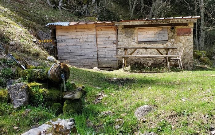
Mountain refuge Cabane de la Combe du crêt
We have it listed in the app!
We have it listed in the app!


Protected by the wild surroundings of route des montagnes de lans, les jailleux, lans-en-vercors, grenoble, isère, auvergne-rhône-alpes, francia metropolitana, 38250, francia, the Cabane de la Combe du crêt refuge is your best ally at 1280 meters of elevation. Once you reach its coordinates (45.116, 5.598), you can enjoy a well-deserved mountain rest.
12.5°C
Feels like: 11.4°C4.4 km/h
Gusts: 20.9 km/h3470 m
Snow lineUV 1.6
Clouds: 100% 32.9 mm
 12.2 km/h
 UV máx: 3.2
 05:52
05:52
 21:19
2.1 mm
14.3 km/h
UV máx: 4.95
05:51
21:20
0 mm
7.3 km/h
UV máx: 7.55
05:51
21:21
0 mm
8.3 km/h
UV máx: 7.1
05:51
21:21
0 mm
18.8 km/h
UV máx: 7.4
05:50
21:22
0.9 mm
12.5 km/h
UV máx: 3.85
05:50
21:23
0 mm
14.1 km/h
UV máx: 7.3
05:50
21:23
21:19
2.1 mm
14.3 km/h
UV máx: 4.95
05:51
21:20
0 mm
7.3 km/h
UV máx: 7.55
05:51
21:21
0 mm
8.3 km/h
UV máx: 7.1
05:51
21:21
0 mm
18.8 km/h
UV máx: 7.4
05:50
21:22
0.9 mm
12.5 km/h
UV máx: 3.85
05:50
21:23
0 mm
14.1 km/h
UV máx: 7.3
05:50
21:23
At 1,280 metres, the Cabane de la Combe du crêt is at a point where time can change quickly and where a simple day on the map can be hardened by moisture, wind or fog. In the environment of Lans-en-Vercors , inside the massif of Vercors , works above all as support for an autonomous mountain exit, more useful to protect or fail the effort than to propose a stay with services.
The near relief helps to place it: to the area references are raised like the Croix des Ramées , Roche Rousse or Moucherotte , summits and highlights that draw a land of looms, forests and limestone peaks very specific to this sector of Isère. This combination of half-height and broken relief forces you to read the map well and not to be trusted with the orientation, especially if you enter or leave with reduced visibility.
As a free shelter, its role fits better in a prudent planning: it can serve as an intermediate point on a local journey or as a reference for a day of ascension in the environment, but there is no data here to present concrete itineraries or closed links. This is why it should be proposed as a support coat within an output already studied, not as the only planning element.
In the logistics, the water should not be assumed within the shelter. If several relatively close sources appear, with one to about 880 meters, although their flow rate may vary according to time and conditions. To have sufficient autonomy and to confirm on the ground both access and actual water availability remains the most sensible option in this French mountain area.


Download the app and start looking for the shelter of your next adventure


Find a place to sleep before night falls.