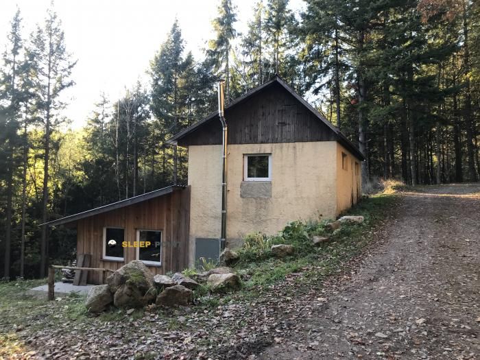
Mountain refuge Abri des Haxes
We have it listed in the app!
We have it listed in the app!


Located at 870 m above sea level, the Abri des Haxes refuge is a true haven of peace in abri des haxes, route des häxes, belmont, molsheim, bajo-rin, gran este, francia metropolitana, 67130, francia. Connect with nature and use its coordinates (48.41, 7.24) to guide your steps to its door.
11.9°C
Feels like: 9.1°C15.6 km/h
Gusts: 58.3 km/h3510 m
Snow lineUV 0
Clouds: 99% 3.2 mm
 21.9 km/h
 UV máx: 4.4
 05:32
05:32
 21:26
0.2 mm
15 km/h
UV máx: 5.8
05:31
21:27
0.9 mm
13.8 km/h
UV máx: 6.9
05:31
21:28
0 mm
18.9 km/h
UV máx: 6.15
05:30
21:29
1.05 mm
18.1 km/h
UV máx: 6.2
05:30
21:29
9.3 mm
20 km/h
UV máx: 6.35
05:30
21:30
0 mm
9.3 km/h
UV máx: 6.7
05:29
21:31
21:26
0.2 mm
15 km/h
UV máx: 5.8
05:31
21:27
0.9 mm
13.8 km/h
UV máx: 6.9
05:31
21:28
0 mm
18.9 km/h
UV máx: 6.15
05:30
21:29
1.05 mm
18.1 km/h
UV máx: 6.2
05:30
21:29
9.3 mm
20 km/h
UV máx: 6.35
05:30
21:30
0 mm
9.3 km/h
UV máx: 6.7
05:29
21:31
When time changes fast, a coat like Abri des Haxes It makes sense for its position on half the forest mountain, in the surroundings of Belmont and the route des Häxes, within the massif of the Vosgos. At 870 meters, it does not respond to the high-altitude pyrenaic shelter pattern, but it does respond to the useful point of protection in an area where fog, rain or wind can complicate a long day on crest and lome trails.
The nearby relief helps you read your function. Very close they rise as Champ du Fou which exceeds 1,000 meters, along with other forest elevations such as La Schleiffe or Roffling. This set draws a medium mountain terrain, with changes in orientation, sections exposed to weather and routes where it is appropriate to have clear the return or the next point of coat before leaving. That is why this shelter fits better as tactical support than as a destiny in itself.
It is also of interest to those who plan stage on signposted routes. In their surroundings they pass the GR 5 , GR 532 , GR 531 in addition to the Sentier des Ducs and local tours such as the Tour du Climont. It does not involve direct access or immediate continuity from the door, but it does make it a practical reference within a wide network, especially if close routes are linked or a safe alternative is sought in case of worsening.
In the logistics part, there is a source at about 580 meters, a reasonable distance for planning, although it is not appropriate to take its flow for granted at any time. If the day depends on that point of water, it is preferable to leave with sufficient margin. The information available does not make it possible to refine more on internal equipment or services, so the sensible decision is to maintain basic autonomy and not to have more support than the coat itself.
Within the Belmont sector, Abri des Haxes functions mainly as a safety reference and road organisation. Its value is to offer an intermediate option in mountain terrain of the Vosgos, near soft but exposed summits and within an area with several long-range paths where meteorology can change the plan quickly.


📏 1.6 Km
⛰️ 680 m

📏 2.7 Km
⛰️ 1090 m

📏 3.6 Km
⛰️ 980 m

📏 3.6 Km
⛰️ 590 m

📏 3.9 Km
⛰️ 950 m
📏 3.9 Km
⛰️ 710 m

📏 4.4 Km
⛰️ 718 m

📏 5 Km
⛰️ 970 m
Download the app and start looking for the shelter of your next adventure


Find a place to sleep before night falls.


