Mountain refuge Refugio de Montolaye

We have it listed in the app!


            Mountain refuge Refugio de Montolaye in refugio de montolaye, carretera de puente almuhey a carretera de boca de huérgano a límite de provincia de palencia, prioro, león, castilla y león, 24885, españa
Five orange stars in a horizontal row representing a five-star rating.

Refugio de Montolaye

Lat: 42.921xxx – Lon: -4.949xxx
📍 refugio de montolaye, carretera de puente almuhey a carretera de boca de huérgano a límite de provincia de palencia, prioro, león, castilla y león, 24885, españa
Refugio de Montolaye

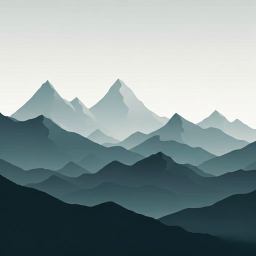
Located in the heart of refugio de montolaye, carretera de puente almuhey a carretera de boca de huérgano a límite de provincia de palencia, prioro, león, castilla y león, 24885, españa, the Refugio de Montolaye refuge offers shelter at 1218 meters above sea level. Ideal for trekking and nature lovers, this mountain shelter (Lat: 42.921, Lon: -4.949) is the perfect starting point or resting place for local routes.

See more
See more
Usuario

Lucas Martinez

Premium user

Live weather: Refugio de Montolaye

At the moment, conditions in Refugio de Montolaye (1218m) show 11.6°C (feels like 10.8°C). Wind is blowing at 7.4 km/h with gusts up to 15.1 km/h. Today, a high of 13.8°C is expected and the freezing level is at 4300 meters.
Temperature

11.6°C

Feels like: 10.8°C
Wind

7.4 km/h

Gusts: 15.1 km/h
Freezing level 0°

4300 m

Snow line
Sky & UV

UV 0

Clouds: 17%

Next 48 hours evolution

7-day forecast

04/06
13.8° 5.9°
0.1 mm 18.6 km/h UV máx: 7.95
06:42 21:54
05/06
17.6° 3.6°
0 mm 18.2 km/h UV máx: 7.35
06:42 21:54
06/06
20.8° 9.9°
0 mm 10.7 km/h UV máx: 7.95
06:41 21:55
07/06
24.2° 10.9°
0 mm 10.2 km/h UV máx: 7.9
06:41 21:56
08/06
16.6° 8.6°
0 mm 21.7 km/h UV máx: 7.85
06:41 21:56
09/06
17.1° 7.3°
0 mm 17.4 km/h UV máx: 7.8
06:40 21:57
10/06
21.9° 9.2°
0 mm 11.1 km/h UV máx: 7.7
06:40 21:57

The hillsides that ascend from the Prioro environment draw a relief where the deciduous forest gradually gives way to the formations of shrubs and limestone outflows of the Riaño Mountain. In this transition strip, located at 1218 meters of altitude, the ground becomes more exposed as the divisive is won towards elevations such as the Cotorro del Burro or the Coto de los Cestos. The Refuge of Montolaye is located at this strategic point, serving as a reference for those who travel between the Latvian valleys and the first foothills of the massif. Its location allows to observe the drastic change between the thickness of the lower areas and the verticality of the crests, offering a functional guard in an area marked by the alternation of pastures, pedestres and small hills that define the character of this aspect of the Cantabria Range.

Connectivity between slopes and mountain logistics

The position of this structure is key to logistics on long distance routes, as it is located at the intersection of historical and sports tracks of great relevance such as the Royal Leonese Oriental Canyon or the Historical Path GR 1. These paths facilitate the fluid passage between different basins and valleys, making construction a necessary support to divide demanding days or seek protection from sudden weather changes. For water supply, the Pallet Fountain is located about 400 metres away, which is a fundamental resource given the shortage of hydration points in the upper cord. Because of its free haven, it is essential that the mountaineers maintain total autonomy in terms of overnight equipment, lighting and feeding, always ensuring planning that takes into account the variability of the terrain and the weather exposure at these altitudes.

Hiking routes from the refuge

PRC-LE 25

Puerto de Horcadas

↔ 6 km
PRC-LE 33

Matapiojos

↔ 7.5 km
PR-LE 53

Cañada Real Leonesa Oriental

↔ 4 km
PRC-LE 34

Arbillos

↔ 9.3 km
PR-LE 54

Valverde de la Sierra-Barniedo de la Reina

↔ Variable distance
GR 1

Sendero Histórico: León

↔ Variable distance
Local

Camino Vadiniense

↔ Variable distance
PRC-LE 52

Collado El Baile

↔ 10.5 km

Nearby peaks

Coto Alto

1244 m
Lat: 42.9032 Lon: -4.9712

Canto de la Cerra

1302 m
Lat: 42.9432 Lon: -4.9979

Loma Valmañida

1347 m
Lat: 42.947 Lon: -4.9302

El Cotorro

1183 m
Lat: 42.8982 Lon: -4.9621

Cotorro del Burro

1468 m
Lat: 42.9293 Lon: -4.954

Coto de los Cestos

1275 m
Lat: 42.9061 Lon: -4.9619

Cueto de Valdecolina

1394 m
Lat: 42.9477 Lon: -4.9951

Peña del Águila

1342.19 m
Lat: 42.8699 Lon: -4.9553

Nearby water fountains

Fuente de las Palinas

417 m
Lat: 42.8699 Lon: -4.9553

Fuente

3.48 Km
Lat: 42.8699 Lon: -4.9553

Fuente

3.61 Km
Lat: 42.8699 Lon: -4.9553

Fuente de la Vega

4.58 Km
Lat: 42.8699 Lon: -4.9553

Fuente

4.73 Km
Lat: 42.8699 Lon: -4.9553

Fuente

5.09 Km
Lat: 42.8699 Lon: -4.9553

Fuente

5.71 Km
Lat: 42.8699 Lon: -4.9553

Fuente

7.32 Km
Lat: 42.8699 Lon: -4.9553
FAQ

Frequently asked questions

Pregunta frecuente
Is it necessary to carry a GPS to reach the Refugio de Montolaye refuge?
It is always highly recommended to carry a GPS device, a route track, or a topographic map in the mountains. You can use the coordinates 42.921, -4.949 to locate this refuge precisely.
Pregunta frecuente
In which municipality or region is the Refugio de Montolaye refuge located?
This refuge is located within the municipality of Prioro, belonging to the community or region of Castilla y León.
Pregunta frecuente
Are there other mountain refuges near Refugio de Montolaye?
Yes, nearby you can find other options to spend the night or take shelter. El refugio más próximo es el Refugio de la Buhiria, que se encuentra a aproximadamente 2.1 km de distancia.
More areas

Other areas

Collaborative

Together we improve

image

Send your photos

You can upload photos of shelters and update their status so other users know if they can go there.

Get started
Get started
image

Rate the shelter

Leave your comments to rate the shelter’s condition. In the mountains, we look after each other.

Get started
Get started
image

Add new ones

Did we miss any? Publish the shelters you know so everyone can use them.

Get started
Get started
Download for free from the Apple App Store and Play Store.

Download the app and start looking for the shelter of your next adventure

Aplicación móvil para encontrar refugios de montaña donde dormir
Aplicación móvil para encontrar refugios de montaña donde dormir.
Mapa interactivo de refugios de montaña en los Pirineos dentro de la app
Mapa de refugios de montaña para senderismo y trekking en la app.
Pantalla con información de refugio de montaña con altitud capacidad y servicios
Pantalla con información de refugio de montaña con altitud capacidad y servicios.
Detalles de refugio de montaña con servicios y meteorología en aplicación móvil
Detalles de refugio de montaña con servicios y meteorología en aplicación móvil.
Aplicación para explorar refugios de montaña mediante mapa interactivo
Aplicación para explorar refugios de montaña mediante mapa interactivo.
Ficha completa de refugio de montaña con opiniones y servicios
Ficha completa de refugio de montaña con opiniones y servicios.
Información detallada de refugio en app para montañeros
Información detallada de refugio en app para montañeros.
Listado de refugios de montaña para senderismo y trekking
Listado de refugios de montaña para senderismo y trekking.
Explorar refugios de montaña desde una aplicación móvil
Explorar refugios de montaña desde una aplicación móvil.