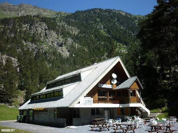
Mountain refuge Refugio de Fruitiére
We have it listed in the app!
We have it listed in the app!


Prepare your backpack and head to la fruitière, chemin des pères, la raillère, cauterets, argelès-gazost, altos pirineos, occitania, francia metropolitana, 65110, francia. There you will find the Refugio de Fruitiére refuge at 1371 meters of elevation. An essential stop along the way (Lat: 42.853, Lon: -0.098) for any mountain enthusiast.
13.7°C
Feels like: 11.7°C10.8 km/h
Gusts: 29.5 km/h4200 m
Snow lineUV 0
Clouds: 58% 8.8 mm
 12.2 km/h
 UV máx: 2.2
 06:23
06:23
 21:34
0.1 mm
10.3 km/h
UV máx: 6.05
06:22
21:35
0.6 mm
9.3 km/h
UV máx: 7.1
06:22
21:35
0 mm
10.5 km/h
UV máx: 7.85
06:22
21:36
4.8 mm
10.7 km/h
UV máx: 8
06:21
21:37
1.5 mm
10.8 km/h
UV máx: 2.75
06:21
21:37
0.6 mm
9.2 km/h
UV máx: 7.65
06:21
21:38
21:34
0.1 mm
10.3 km/h
UV máx: 6.05
06:22
21:35
0.6 mm
9.3 km/h
UV máx: 7.1
06:22
21:35
0 mm
10.5 km/h
UV máx: 7.85
06:22
21:36
4.8 mm
10.7 km/h
UV máx: 8
06:21
21:37
1.5 mm
10.8 km/h
UV máx: 2.75
06:21
21:37
0.6 mm
9.2 km/h
UV máx: 7.65
06:21
21:38
In the mountain head of Causets next to the axis of passage leading to Pont d'Espagne and the high valleys of the National Park of the Pyrenees, the Refugio de Fruitiére it fits mainly as logistical support in transit days. Its position, at 1,371 meters, places it in a strip where they still connect very frequent itineraries with routes that already point to longer and chained terrain. From here, close routes are well understood as the Chemin des Cascades dans le Val de Jéret access to the lac de Gaube and the continuation by the vallée du Marcadau in direction of the Wallon refuge. It can also make sense within the HRP not so much as the end of a great ascension, but as a useful point to order a stage, divide efforts or link valleys.
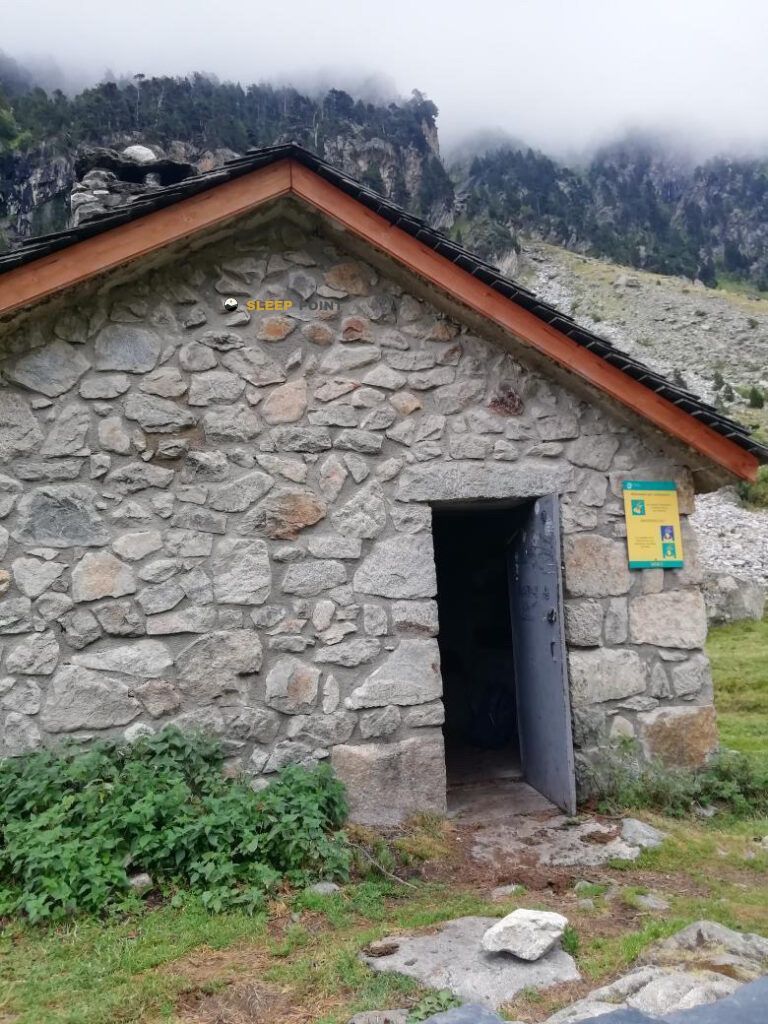
For those who prepare the day with practical criteria, the most relevant data is the presence of a very close source, about 17 meters from the shelter. However, in the mountains it is appropriate not to take for granted its flow or potability without checking the situation on the ground, especially if a long stage is proposed towards Marcadau, Estom or the Oulettes de Gaube environment. The nearby network of itineraries offers several continuity options, but the published distances are variable, so this shelter is better interpreted as a pass reference than a closed destination. This combination of known access, route crossing and reasonable autonomy makes it particularly useful for trails who want to adjust water, rest and link between routes without depending on rigid mileage calculations.


Download the app and start looking for the shelter of your next adventure


Find a place to sleep before night falls.