Mountain refuge Refuge du Grammont

We have it listed in the app!


            Mountain refuge Refuge du Grammont in chemin du lac, taney, vouvry, monthey, vallés, 1896, suiza
Five orange stars in a horizontal row representing a five-star rating.

Refuge du Grammont

Lat: 46.346xxx – Lon: 6.832xxx
📍 chemin du lac, taney, vouvry, monthey, vallés, 1896, suiza
Refuge du Grammont

The Refuge du Grammont refuge (chemin du lac, taney, vouvry, monthey, vallés, 1896, suiza) is a classic meeting point for mountaineers and hikers. At 1400 meters, its coordinates 46.346, 6.832 mark the end of a stage or the beginning of a new adventure.

See more
See more
Usuario

Lucas Martinez

Premium user

Live weather: Refuge du Grammont

Before heading to Refuge du Grammont, check the weather: we currently have 8.8°C (feels like 5.6°C). With wind gusts reaching 23 km/h and a freezing level around 3860 meters, the daytime high will not exceed 14.1°C.
Temperature

8.8°C

Feels like: 5.6°C
Wind

8.4 km/h

Gusts: 23 km/h
Freezing level 0°

3860 m

Snow line
Sky & UV

UV 0

Clouds: 94%

Next 48 hours evolution

7-day forecast

04/06
14.1° 6.5°
29.5 mm 22.8 km/h UV máx: 5.1
05:42 21:19
05/06
9.3°
6.3 mm 12.3 km/h UV máx: 6.9
05:42 21:20
06/06
16.6° 6.4°
0.2 mm 16.1 km/h UV máx: 7.45
05:41 21:21
07/06
16.4° 9.3°
1.2 mm 8.2 km/h UV máx: 6.85
05:41 21:21
08/06
20.5° 11.6°
3.9 mm 10.5 km/h UV máx: 6.95
05:40 21:22
09/06
13.9° 8.4°
21.6 mm 8.7 km/h UV máx: 3.8
05:40 21:23
10/06
15.5° 6.5°
0.9 mm 6.9 km/h UV máx: 7.25
05:40 21:23

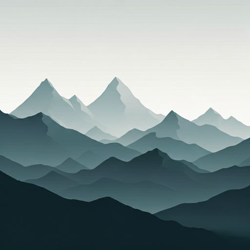
Mountain pass more than isolated destination. The Refuge du Grammont , at the end of Vouvry and at about 1,400 meters of altitude, it fits well in this profile: a free shelter that serves to break days on the Valencian side near the Léman and to provide continuity to medium and long distance routes. In their surroundings they combine tours known as the Via Francigena or Balcon du Léman so it can function as a support on the way, but without losing the character of a mountain shelter where it is necessary to reach with margin, autonomy and realistic planning. The access is moved on a transition ground between forest, hillside and more open relief, with a very marked orientation towards the cords that separate this area from the lacustre edge and the steps towards higher levels.

The most clear mountain reference around the shelter is the summit of Grammont , very close online and dominant over the sector, along with other nearby reliefs such as Blancsex or Sex du Palatieu, which help to understand their role as a base of passage under a well-defined cord. There is no data here for specific services, so it is reasonable to put it as a simple coat and not as a equipped shelter. In the logistics it does stand out an important point: there is a very close source, a few meters away, in addition to others in the immediate environment, something useful for water management, although in the mountain it is always necessary to check flow and conditions before it depends on it. By altitude and location, meteorology can quickly change and tighten both the approach and any link to nearby hills or summits.

Hiking routes from the refuge

70

Via Francigena

↔ Variable distance
Local

Les Bords de Dranse

↔ Variable distance
Local

Balcon du Léman

↔ Variable distance
Local

Tour des Portes du Soleil

↔ Variable distance
Local

Torgon village - Torgon/La Jorette

↔ Variable distance
Local

Plan du Croix - Recon

↔ Variable distance
Local

Dent d'Oche

↔ Variable distance
Local

Chemin de la Mossette

↔ Variable distance

Nearby peaks

Tête de Charousse

2003 m
Lat: 46.3434 Lon: 6.7642

Pointe de l'Aritte

1626 m
Lat: 46.3754 Lon: 6.779

Le Bron

1528 m
Lat: 46.3786 Lon: 6.7875

Grammont

2172 m
Lat: 46.3574 Lon: 6.8212

Sex du Palatieu

1757 m
Lat: 46.3256 Lon: 6.8293

Blancsex

1747 m
Lat: 46.3268 Lon: 6.8365

Le Planellet

1695 m
Lat: 46.3225 Lon: 6.8508

La Jorette

1643 m
Lat: 46.3039 Lon: 6.8584

Nearby water fountains

Fuente

30 m
Lat: 46.3039 Lon: 6.8584

Fuente

220 m
Lat: 46.3039 Lon: 6.8584

Fuente

557 m
Lat: 46.3039 Lon: 6.8584

Fuente

823 m
Lat: 46.3039 Lon: 6.8584

Fuente

1.58 Km
Lat: 46.3039 Lon: 6.8584

Fuente

1.89 Km
Lat: 46.3039 Lon: 6.8584

Fuente

3.92 Km
Lat: 46.3039 Lon: 6.8584

Fuente

3.92 Km
Lat: 46.3039 Lon: 6.8584
FAQ

Frequently asked questions

Pregunta frecuente
At what exact altitude is the Refuge du Grammont refuge located?
The Refuge du Grammont refuge is located at an altitude of 1400 meters above sea level, in the natural surroundings of chemin du lac, taney, vouvry, monthey, vallés, 1896, suiza.
Pregunta frecuente
What are the GPS coordinates of the Refuge du Grammont refuge?
To locate the Refuge du Grammont refuge on your GPS or map, use the following coordinates: Latitude 46.346 and Longitude 6.832.
Pregunta frecuente
Is it necessary to carry a GPS to reach the Refuge du Grammont refuge?
It is always highly recommended to carry a GPS device, a route track, or a topographic map in the mountains. You can use the coordinates 46.346, 6.832 to locate this refuge precisely.
More areas

Other areas

Collaborative

Together we improve

image

Send your photos

You can upload photos of shelters and update their status so other users know if they can go there.

Get started
Get started
image

Rate the shelter

Leave your comments to rate the shelter’s condition. In the mountains, we look after each other.

Get started
Get started
image

Add new ones

Did we miss any? Publish the shelters you know so everyone can use them.

Get started
Get started
Download for free from the Apple App Store and Play Store.

Download the app and start looking for the shelter of your next adventure

Aplicación móvil para encontrar refugios de montaña donde dormir
Aplicación móvil para encontrar refugios de montaña donde dormir.
Mapa interactivo de refugios de montaña en los Pirineos dentro de la app
Mapa de refugios de montaña para senderismo y trekking en la app.
Pantalla con información de refugio de montaña con altitud capacidad y servicios
Pantalla con información de refugio de montaña con altitud capacidad y servicios.
Detalles de refugio de montaña con servicios y meteorología en aplicación móvil
Detalles de refugio de montaña con servicios y meteorología en aplicación móvil.
Aplicación para explorar refugios de montaña mediante mapa interactivo
Aplicación para explorar refugios de montaña mediante mapa interactivo.
Ficha completa de refugio de montaña con opiniones y servicios
Ficha completa de refugio de montaña con opiniones y servicios.
Información detallada de refugio en app para montañeros
Información detallada de refugio en app para montañeros.
Listado de refugios de montaña para senderismo y trekking
Listado de refugios de montaña para senderismo y trekking.
Explorar refugios de montaña desde una aplicación móvil
Explorar refugios de montaña desde una aplicación móvil.