Mountain refuge Refuge de la Estiva

We have it listed in the app!


            Mountain refuge Refuge de la Estiva in refugio de la estiva, pista de la estiva, bielsa, sobrarbe, huesca, aragón, españa
Five orange stars in a horizontal row representing a five-star rating.

Refuge de la Estiva

Lat: 42.684xxx – Lon: 0.107xxx
📍 refugio de la estiva, pista de la estiva, bielsa, sobrarbe, huesca, aragón, españa
Refuge de la Estiva

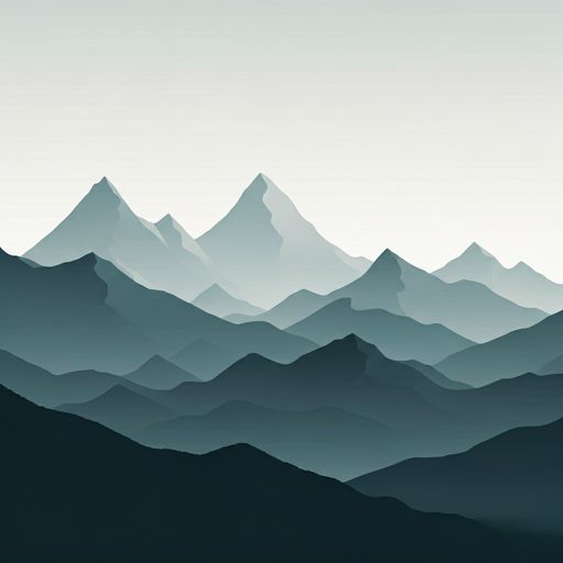
With a privileged location in refugio de la estiva, pista de la estiva, bielsa, sobrarbe, huesca, aragón, españa, the Refuge de la Estiva refuge awaits you at 2100 meters of altitude. Note its position (42.684, 0.107) before starting your route through the mountain range or massif.

See more
See more
Usuario

Lucas Martinez

Premium user

Live weather: Refuge de la Estiva

Attention hikers heading to Refuge de la Estiva: current conditions are 7.5°C (feels like 5.4°C due to 4.1 km/h wind). Beware of gusts up to 7.6 km/h. Snow level at 4330 m, UV index at 0, and an expected high of 11.4°C.
Temperature

7.5°C

Feels like: 5.4°C
Wind

4.1 km/h

Gusts: 7.6 km/h
Freezing level 0°

4330 m

Snow line
Sky & UV

UV 0

Clouds: 80%

Next 48 hours evolution

7-day forecast

04/06
11.4°
5.4 mm 23.2 km/h UV máx: 5.7
06:22 21:32
05/06
11° 1.7°
0 mm 16.5 km/h UV máx: 8.1
06:22 21:33
06/06
13.6° 3.8°
0 mm 5.8 km/h UV máx: 7.6
06:22 21:34
07/06
15° 5.8°
0 mm 7.2 km/h UV máx: 8.1
06:21 21:34
08/06
19.3° 8.5°
0 mm 16.3 km/h UV máx: 8.25
06:21 21:35
09/06
15.3° 7.4°
1.8 mm 10.2 km/h UV máx: 7.85
06:21 21:36
10/06
17.4° 6.5°
0 mm 12.9 km/h UV máx: 7.7
06:21 21:36

Between Pineta, La Larri and the border circles

In the mountain that closes the environment of Belarus , this coat appears in a transition area between the relics hanging from La Larri , the head of the valley of Pineta and the great Circus on the French side. The land here already has a clearly alpine character: open slopes, accumulated delevel, changing weather and a sense of isolation that increases as you leave the bottom of the valley. At about 2100 meters, the shelter fits better as a support on a long mountain day than as a simple stop.

Their practical interest is closely linked to crossing and linking routes. The proximity of the route of the HRP and of routes towards the Cirque de Troumuse or Hourquette d'Alans It makes it a useful point to divide stages, link sides or gain height before entering more complex terrain. It also helps to understand the position of the shelter the nearby presence of tops like Lost Mount , The World or Pic de Troumuse , which reinforce the high mountain environment of this whole sector, although their access already belongs to days of entity.

The planning here depends above all on the approach effort. You don't have to think only about the distance, but about the type of terrain, the continuity of the ascent and the exposure to time once you gain height. In this area it is necessary to leave with margin, to anticipate rapid changes of visibility and not to have easy path running rhythms. If the idea is to use the shelter to link stages, it is worth adjusting well load, water and time from the start.

There is a registered source of just over 1.2 km, a useful data that should not replace a reasonable autonomy strategy. In high mountain, the actual availability may vary according to time and conditions, so the wise thing is to get there with enough water or to confirm the state of the nearby points. This same logic serves any overnight in this sector: the more ambitious the later route, the more important it is not to rely on assumptions.

Refuge de la Estiva It therefore fits into an area where the shelter not only resolves one night in height, but also conditions how the day is distributed. In an environment of large levels and links between valleys and circuses, its usefulness is to allow a more orderly progression towards the high mountain of Pineta and the pirenaica divisive.

Hiking routes from the refuge

HRP

HRP Étape 16

↔ Variable distance
HRP

Étape 17

↔ Variable distance
Local

Mont Perdu par la brèche de Roland

↔ Variable distance
Local

Refuge des Espugeuttes et Pimené

↔ Variable distance
Local

Cirque de Troumouse

↔ Variable distance
Local

Vers la Hourquette d'Alans par le Cirque d'Estaubé

↔ Variable distance
Local

Lacs et refuge de Barroude

↔ Variable distance
HRP Var.

HRP Variante 16.1

↔ Variable distance

Nearby peaks

Pic de Troumouse

3085 m
Lat: 42.7224 Lon: 0.1367

Punta de Treserols / Monte Perdido

3349 m
Lat: 42.6755 Lon: 0.0344

Pic de Gabiédou

2809 m
Lat: 42.7163 Lon: 0.0843

Munia / Almunia Gran

3133 m
Lat: 42.7149 Lon: 0.1319

Punta de la Mota

2579 m
Lat: 42.6826 Lon: 0.1782

Pico Inferior de Añisclo / O Zucón

2802 m
Lat: 42.6513 Lon: 0.0792

Pic de Serre de Mourène

3090 m
Lat: 42.7207 Lon: 0.1353

Pico de Rubiñera

3001 m
Lat: 42.704 Lon: 0.1325

Nearby water fountains

Fuente

1.21 Km
Lat: 42.704 Lon: 0.1325

Fuente

1.94 Km
Lat: 42.704 Lon: 0.1325

Fuente

2.45 Km
Lat: 42.704 Lon: 0.1325

Fuente

7.67 Km
Lat: 42.704 Lon: 0.1325

Fuente

7.82 Km
Lat: 42.704 Lon: 0.1325

Fuente

8.56 Km
Lat: 42.704 Lon: 0.1325

Fuente

8.67 Km
Lat: 42.704 Lon: 0.1325

Fuente

8.7 Km
Lat: 42.704 Lon: 0.1325
FAQ

Frequently asked questions

Pregunta frecuente
In which municipality or region is the Refuge de la Estiva refuge located?
This refuge is located within the municipality of Bielsa, belonging to the community or region of Aragón.
Pregunta frecuente
Are there other mountain refuges near Refuge de la Estiva?
Yes, nearby you can find other options to spend the night or take shelter. El refugio más próximo es el Refuge de la Larri, que se encuentra a aproximadamente 1.8 km de distancia.
Pregunta frecuente
At what exact altitude is the Refuge de la Estiva refuge located?
The Refuge de la Estiva refuge is located at an altitude of 2100 meters above sea level, in the natural surroundings of refugio de la estiva, pista de la estiva, bielsa, sobrarbe, huesca, aragón, españa.
More areas

Other areas

Collaborative

Together we improve

image

Send your photos

You can upload photos of shelters and update their status so other users know if they can go there.

Get started
Get started
image

Rate the shelter

Leave your comments to rate the shelter’s condition. In the mountains, we look after each other.

Get started
Get started
image

Add new ones

Did we miss any? Publish the shelters you know so everyone can use them.

Get started
Get started
Download for free from the Apple App Store and Play Store.

Download the app and start looking for the shelter of your next adventure

Aplicación móvil para encontrar refugios de montaña donde dormir
Aplicación móvil para encontrar refugios de montaña donde dormir.
Mapa interactivo de refugios de montaña en los Pirineos dentro de la app
Mapa de refugios de montaña para senderismo y trekking en la app.
Pantalla con información de refugio de montaña con altitud capacidad y servicios
Pantalla con información de refugio de montaña con altitud capacidad y servicios.
Detalles de refugio de montaña con servicios y meteorología en aplicación móvil
Detalles de refugio de montaña con servicios y meteorología en aplicación móvil.
Aplicación para explorar refugios de montaña mediante mapa interactivo
Aplicación para explorar refugios de montaña mediante mapa interactivo.
Ficha completa de refugio de montaña con opiniones y servicios
Ficha completa de refugio de montaña con opiniones y servicios.
Información detallada de refugio en app para montañeros
Información detallada de refugio en app para montañeros.
Listado de refugios de montaña para senderismo y trekking
Listado de refugios de montaña para senderismo y trekking.
Explorar refugios de montaña desde una aplicación móvil
Explorar refugios de montaña desde una aplicación móvil.