Mountain refuge Pensione Venezia

We have it listed in the app!


            Mountain refuge Pensione Venezia in venezia, strada della villette, les forges, courmayeur, valle de aosta, 11013, italia
Five orange stars in a horizontal row representing a five-star rating.

Pensione Venezia

Lat: 45.793xxx – Lon: 6.971xxx
📍 venezia, strada della villette, les forges, courmayeur, valle de aosta, 11013, italia
Pensione Venezia

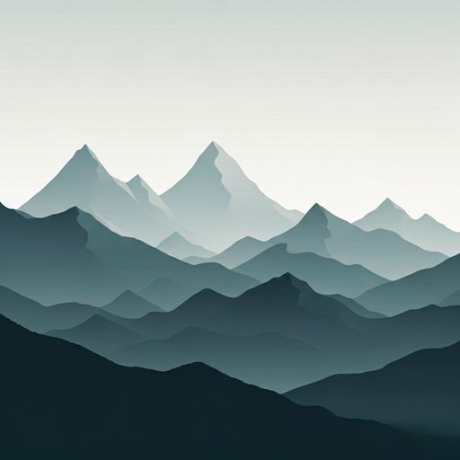
The Pensione Venezia refuge (venezia, strada della villette, les forges, courmayeur, valle de aosta, 11013, italia) is a classic meeting point for mountaineers and hikers. At 1215 meters, its coordinates 45.793, 6.971 mark the end of a stage or the beginning of a new adventure.

See more
See more
Usuario

Lucas Martinez

Premium user

Live weather: Pensione Venezia

Alpine weather summary for Pensione Venezia: temperature at 9.2°C, feels like 7.4°C. Wind at 4 km/h with peaks of 7.9 km/h. UV index at 0 and freezing altitude at 3950 m. Maximum temperatures of 18.4°C in the coming hours.
Temperature

9.2°C

Feels like: 7.4°C
Wind

4 km/h

Gusts: 7.9 km/h
Freezing level 0°

3950 m

Snow line
Sky & UV

UV 0

Clouds: 75%

Next 48 hours evolution

7-day forecast

03/06
18.4° 6.6°
0.9 mm 17.5 km/h UV máx: 7.8
05:44 21:15
04/06
18.6° 7.6°
16.4 mm 14.7 km/h UV máx: 6.8
05:44 21:16
05/06
17.7° 4.6°
0 mm 10.1 km/h UV máx: 7.65
05:43 21:17
06/06
19.1° 9.4°
0 mm 19 km/h UV máx: 7.85
05:43 21:18
07/06
22.7° 10.7°
0 mm 8.2 km/h UV máx: 8
05:42 21:19
08/06
23.2° 11.8°
1.8 mm 7.5 km/h UV máx: 7.25
05:42 21:19
09/06
17.6° 11.6°
0.6 mm 13.7 km/h UV máx: 6.5
05:42 21:20

In the environment of Courmayeur where travel routes are as well known as the Tour du Mont Blanc , Tour du Saint-Bernard and Alta Via 1 de la Valle d'Aosta , Pension Venezia it fits mainly as a support point on a link day or as a withdrawal option to lower levels. Its height, around 1,215 meters, places it outside the strictly glacial environment of the massif, but within a very useful area when the weather changes or when it is appropriate to reorganize a journey without losing the reference of Courmayeur.

Reading the ground around helps to understand that function. Up you rise near reliefs like Mont Chétif , Tête Neyron , Tête du Grand Mont or Testa di Liconi , summits that mark a landscape of steep slopes, orientation changes and rapid transitions between valley bottom and more open terrain. In this western part of the Aosta Valley , very linked to the Mont Blanc massif, these exposure changes can have a significant impact on progression: heat and humidity in low levels, wind in high steps and cloud that can close views and references in a short time.

That is why their interest is not so much dependent on presenting it as a pure alpine base, but as logistical support within longer routes. For those who are linking stages of the TMB or the Alta Via, this point allows to stay close to an important mountain core without leaving the context of crossing. It can also serve to divide days before heading to higher sectors or to temporarily leave crest itineraries and return to a more accessible environment.

The presence of several very close sources, just a few hundred meters away, facilitates the revival of water in this immediate area, although in mountain it is always appropriate to confirm the real state of the water points according to season. This closeness adds practical value if it is reached after a long stage or if it is necessary to reorganize material before continuing.

As a whole, Pension Venezia It makes sense especially for moving mountaineers, rather than as an isolated destination. Its position next to Courmayeur and close to long-distance routes makes it a useful reference when it comes to linking valleys, adjusting plans or looking for a reasonable exit from the high ground without completely breaking the logic of the journey.

Hiking routes from the refuge

Local

Tour du Saint-Bernard

↔ Variable distance
14

Pont Combal - Bivacco Rainetto

↔ 3.737 km
TMB-IP

Tour du Mont Blanc - Itinéraire principal

↔ Variable distance
Local

Tour du Mont Blanc - Variante de la Tête Bernarda

↔ Variable distance
AV1

Alta Via n. 1 della Valle d'Aosta - Tappa 17

↔ 12.000 km
AV1

Alta Via n. 1 della Valle d'Aosta - Tappa 16

↔ 7.500 km
AV2

Alta Via n. 2 della Valle d'Aosta - Tappa 1

↔ 15.000 km
3

Cammino Balteo (Bassa Via della Valle d'Aosta), Tappa 14

↔ 20.082 km

Nearby peaks

Testa d'Arpy

2017 m
Lat: 45.7484 Lon: 7.0005

Mont Chétif

2343 m
Lat: 45.7997 Lon: 6.9488

Tête du Grand Mont

2737 m
Lat: 45.7647 Lon: 6.9469

Testa di Liconi

2929 m
Lat: 45.7973 Lon: 7.0189

Tête Neyron

2044.1 m
Lat: 45.7936 Lon: 6.9326

Tête de la Tronche

2584 m
Lat: 45.822 Lon: 7.0197

Aiguille de Chambave

3089 m
Lat: 45.809 Lon: 7.0354

Testa Bernarda

2533 m
Lat: 45.8257 Lon: 7.014

Nearby water fountains

Fuente

139 m
Lat: 45.8257 Lon: 7.014

Fuente

142 m
Lat: 45.8257 Lon: 7.014

Fuente

197 m
Lat: 45.8257 Lon: 7.014

Fuente

355 m
Lat: 45.8257 Lon: 7.014

Fuente

445 m
Lat: 45.8257 Lon: 7.014

Fuente

454 m
Lat: 45.8257 Lon: 7.014

Fuente

555 m
Lat: 45.8257 Lon: 7.014

Fuente

625 m
Lat: 45.8257 Lon: 7.014
FAQ

Frequently asked questions

Pregunta frecuente
In which municipality or region is the Pensione Venezia refuge located?
This refuge is located within the municipality of Courmayeur, belonging to the community or region of Valle de Aosta.
Pregunta frecuente
Are there other mountain refuges near Pensione Venezia?
Yes, nearby you can find other options to spend the night or take shelter. El refugio más próximo es el Refuge Giorgio Bertone, que se encuentra a aproximadamente 1.9 km de distancia.
Pregunta frecuente
At what exact altitude is the Pensione Venezia refuge located?
The Pensione Venezia refuge is located at an altitude of 1215 meters above sea level, in the natural surroundings of venezia, strada della villette, les forges, courmayeur, valle de aosta, 11013, italia.
More areas

Other areas

Collaborative

Together we improve

image

Send your photos

You can upload photos of shelters and update their status so other users know if they can go there.

Get started
Get started
image

Rate the shelter

Leave your comments to rate the shelter’s condition. In the mountains, we look after each other.

Get started
Get started
image

Add new ones

Did we miss any? Publish the shelters you know so everyone can use them.

Get started
Get started
Download for free from the Apple App Store and Play Store.

Download the app and start looking for the shelter of your next adventure

Aplicación móvil para encontrar refugios de montaña donde dormir
Aplicación móvil para encontrar refugios de montaña donde dormir.
Mapa interactivo de refugios de montaña en los Pirineos dentro de la app
Mapa de refugios de montaña para senderismo y trekking en la app.
Pantalla con información de refugio de montaña con altitud capacidad y servicios
Pantalla con información de refugio de montaña con altitud capacidad y servicios.
Detalles de refugio de montaña con servicios y meteorología en aplicación móvil
Detalles de refugio de montaña con servicios y meteorología en aplicación móvil.
Aplicación para explorar refugios de montaña mediante mapa interactivo
Aplicación para explorar refugios de montaña mediante mapa interactivo.
Ficha completa de refugio de montaña con opiniones y servicios
Ficha completa de refugio de montaña con opiniones y servicios.
Información detallada de refugio en app para montañeros
Información detallada de refugio en app para montañeros.
Listado de refugios de montaña para senderismo y trekking
Listado de refugios de montaña para senderismo y trekking.
Explorar refugios de montaña desde una aplicación móvil
Explorar refugios de montaña desde una aplicación móvil.