Mountain refuge La Guerre

We have it listed in the app!


            Mountain refuge La Guerre in refuge de la guerre, chemin du sapin enroché, le chenit, district du jura-nord vaudois, valdia, 1348, suiza
Five orange stars in a horizontal row representing a five-star rating.

La Guerre

Lat: 46.6xxx – Lon: 6.164xxx
📍 refuge de la guerre, chemin du sapin enroché, le chenit, district du jura-nord vaudois, valdia, 1348, suiza
La Guerre

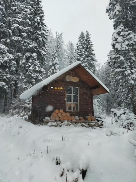
Prepare your backpack and head to refuge de la guerre, chemin du sapin enroché, le chenit, district du jura-nord vaudois, valdia, 1348, suiza. There you will find the La Guerre refuge at 1276 meters of elevation. An essential stop along the way (Lat: 46.6, Lon: 6.164) for any mountain enthusiast.

See more
See more
Usuario

Lucas Martinez

Premium user

Live weather: La Guerre

Alpine weather summary for La Guerre: temperature at 8.5°C, feels like 6.4°C. Wind at 7.4 km/h with peaks of 28.1 km/h. UV index at 0 and freezing altitude at 3900 m. Maximum temperatures of 12.9°C in the coming hours.
Temperature

8.5°C

Feels like: 6.4°C
Wind

7.4 km/h

Gusts: 28.1 km/h
Freezing level 0°

3900 m

Snow line
Sky & UV

UV 0

Clouds: 99%

Next 48 hours evolution

7-day forecast

04/06
12.9° 7.5°
16.5 mm 18.8 km/h UV máx: 5.6
05:44 21:23
05/06
11.2° 5.9°
0 mm 16.6 km/h UV máx: 6.1
05:43 21:24
06/06
16° 6.2°
0 mm 19.7 km/h UV máx: 7.35
05:43 21:24
07/06
17° 7.5°
0 mm 11.9 km/h UV máx: 6.75
05:42 21:25
08/06
19.9° 9.1°
3.75 mm 14.2 km/h UV máx: 6.9
05:42 21:26
09/06
13.8° 7.3°
12.6 mm 15.5 km/h UV máx: 3.7
05:42 21:27
10/06
16.8° 4.4°
0 mm 10.9 km/h UV máx: 7.25
05:42 21:27

Step reference

La Guerre it fits better in a journey planning than in an output based on specific services. In the environment of Le Chenit at 1276 meters, his interest is mainly in the network of itineraries that pass or link through this part of the Jura vaudois, with the presence of the GR 5 Jura and Tour de la Haute Bienne . This makes it a useful mountain shelter to divide days, link paths of different reach or solve a stage on half mountain terrain where the orientation of displacement can easily change according to the chosen route.

Progression and autonomy

This combination of routes suggests a step point rather than a basis for ascension. From here, the progression can be opened to several local axes, and this change of direction influences the speed of the march, the exposure to the wind and the management of the effort, especially if signposted traces of different fields are linked. The closeness of Roche Champion without being a major summit, it helps to place the character of the relief: moderate heights, cords and displacements where the continuity of the itinerary matters more than the pure level.

In logistical terms it is appropriate to be conservative. The invented sources are not next to the shelter: the nearest one is about 3.6 km away, so it is not reasonable to have immediate water in the environment. For a long journey or day, it is wise to leave with sufficient autonomy and to check before departure both the state of the itinerary and the actual availability of supply in the area.

If used as road support, it makes sense to think within the Jura hiker corridor and not as a high mountain isolated shelter. Its value is to order the movement between stages, to offer an intermediate reference in a long-distance area and to allow the itinerary to be adjusted according to the chosen direction and the conditions of the day.

Hiking routes from the refuge

Local

Le Sentier gare - fixme

↔ Variable distance
Local

Le Sentier gare - fixme

↔ Variable distance
GR 5

GR 5 Jura

↔ Variable distance
THB

Tour de la Haute Bienne

↔ Variable distance
Local

La Chaux Sèche

↔ 10.5 km
5

Bougaud

↔ Variable distance
Local

Champagnole Nozeroy Jura

↔ 180 km

Nearby peaks

Roche Champion

1338 m
Lat: 46.59 Lon: 6.1264

Nearby water fountains

Fuente

3.58 Km
Lat: 46.59 Lon: 6.1264

Fuente

3.82 Km
Lat: 46.59 Lon: 6.1264

Fuente

4.11 Km
Lat: 46.59 Lon: 6.1264

Fuente

4.19 Km
Lat: 46.59 Lon: 6.1264

Fuente

4.22 Km
Lat: 46.59 Lon: 6.1264

Fuente

6.64 Km
Lat: 46.59 Lon: 6.1264

Fuente

7.26 Km
Lat: 46.59 Lon: 6.1264

Fuente

7.36 Km
Lat: 46.59 Lon: 6.1264
FAQ

Frequently asked questions

Pregunta frecuente
Is it necessary to carry a GPS to reach the La Guerre refuge?
It is always highly recommended to carry a GPS device, a route track, or a topographic map in the mountains. You can use the coordinates 46.6, 6.164 to locate this refuge precisely.
Pregunta frecuente
In which municipality or region is the La Guerre refuge located?
This refuge is located within the municipality of Le Chenit, belonging to the community or region of Valdia.
Pregunta frecuente
Are there other mountain refuges near La Guerre?
Yes, nearby you can find other options to spend the night or take shelter. El refugio más próximo es el Belle-Combe, que se encuentra a aproximadamente 0.5 km de distancia.
More areas

Other areas

Collaborative

Together we improve

image

Send your photos

You can upload photos of shelters and update their status so other users know if they can go there.

Get started
Get started
image

Rate the shelter

Leave your comments to rate the shelter’s condition. In the mountains, we look after each other.

Get started
Get started
image

Add new ones

Did we miss any? Publish the shelters you know so everyone can use them.

Get started
Get started
Download for free from the Apple App Store and Play Store.

Download the app and start looking for the shelter of your next adventure

Aplicación móvil para encontrar refugios de montaña donde dormir
Aplicación móvil para encontrar refugios de montaña donde dormir.
Mapa interactivo de refugios de montaña en los Pirineos dentro de la app
Mapa de refugios de montaña para senderismo y trekking en la app.
Pantalla con información de refugio de montaña con altitud capacidad y servicios
Pantalla con información de refugio de montaña con altitud capacidad y servicios.
Detalles de refugio de montaña con servicios y meteorología en aplicación móvil
Detalles de refugio de montaña con servicios y meteorología en aplicación móvil.
Aplicación para explorar refugios de montaña mediante mapa interactivo
Aplicación para explorar refugios de montaña mediante mapa interactivo.
Ficha completa de refugio de montaña con opiniones y servicios
Ficha completa de refugio de montaña con opiniones y servicios.
Información detallada de refugio en app para montañeros
Información detallada de refugio en app para montañeros.
Listado de refugios de montaña para senderismo y trekking
Listado de refugios de montaña para senderismo y trekking.
Explorar refugios de montaña desde una aplicación móvil
Explorar refugios de montaña desde una aplicación móvil.