Mountain refuge Kiosque Muller Apffel

We have it listed in the app!


            Mountain refuge Kiosque Muller Apffel in kiosque de gutleutrain, rue du weinberg, heiligenstein, sélestat-erstein, bajo-rin, gran este, francia metropolitana, 67140, francia
Five orange stars in a horizontal row representing a five-star rating.

Kiosque Muller Apffel

Lat: 48.414xxx – Lon: 7.448xxx
📍 kiosque de gutleutrain, rue du weinberg, heiligenstein, sélestat-erstein, bajo-rin, gran este, francia metropolitana, 67140, francia
Kiosque Muller Apffel

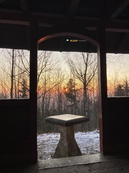
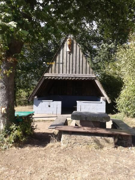
Located in the heart of kiosque de gutleutrain, rue du weinberg, heiligenstein, sélestat-erstein, bajo-rin, gran este, francia metropolitana, 67140, francia, the Kiosque Muller Apffel refuge offers shelter at 308 meters above sea level. Ideal for trekking and nature lovers, this mountain shelter (Lat: 48.414, Lon: 7.448) is the perfect starting point or resting place for local routes.

See more
See more
Usuario

Lucas Martinez

Premium user

Live weather: Kiosque Muller Apffel

Before heading to Kiosque Muller Apffel, check the weather: we currently have 12.5°C (feels like 12.1°C). With wind gusts reaching 7.9 km/h and a freezing level around 3370 meters, the daytime high will not exceed 20.5°C.
Temperature

12.5°C

Feels like: 12.1°C
Wind

4 km/h

Gusts: 7.9 km/h
Freezing level 0°

3370 m

Snow line
Sky & UV

UV 0

Clouds: 97%

Next 48 hours evolution

7-day forecast

04/06
20.5° 12.5°
7.8 mm 22.8 km/h UV máx: 4.2
05:31 21:25
05/06
19.7° 9.8°
0 mm 17.2 km/h UV máx: 5.8
05:30 21:26
06/06
21.7° 11.3°
0.4 mm 12.7 km/h UV máx: 6.9
05:30 21:27
07/06
22.5° 12.7°
0 mm 11.3 km/h UV máx: 6.15
05:30 21:28
08/06
25.3° 12.2°
0 mm 12.3 km/h UV máx: 6.3
05:29 21:29
09/06
20.1° 11.3°
9.6 mm 19.1 km/h UV máx: 6.5
05:29 21:29
10/06
22.1°
0 mm 11.8 km/h UV máx: 6.6
05:28 21:30

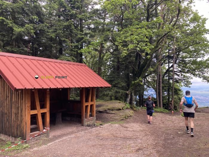
In the alsatian pebble, between Heiligenstein and the hillsides that rise to the Mont Sainte- Odile this free haven is left in a clear transition strip: it is not in high heights, but in a land where the valley leaves way to forest, historical roads and ever more marked reliefs. This position places it close to itineraries that connect the plain to the heights of the Vosgos, useful for those who travel the area without limited to a short walk and need an intermediate point on a day of link.

Kiosque Muller Apffel it fits better in support of movements along the eastern side of the Vosgos than as an isolated destination. In its surroundings, there are traces known as the GR 5 and Sentier du Mur Païen two references that help to read the ground: on the one hand, the great cross of corral; on the other, a journey very linked to the mountain of Sainte-Odile and its lines of wall and forest. From here you can propose a progression between vineyards, mountain foot and low crests, with nearby summits such as La Bloss that reinforce this character of transition between valley and mountain relief. It is precisely because of its moderate altitude that it is better to understand it as a step-by-step shelter or on-time shelter than as an alpine base.

In practical planning, water is one of the most useful data: there is a source less than 900 meters and another one around 1.5 km, something relevant for days in partial autonomy. However, in a safe haven of this kind it is not necessary to have an automatic supply or specific equipment if it has not been established before. The exposure to time in this area can change quickly between the bottom of the valley and the forest slopes, and on long routes along linked paths interest to carry sufficient water, shelter and orientation, especially if the idea is to use it as a point of connection between itineraries and not only as a short stop.

Hiking routes from the refuge

GR 5

GR 5 Vosges, Le Donon - Ballon d'Alsace

↔ Variable distance
Local

Sentier du Mur Païen

↔ Variable distance
Local

Le parcours du vigneron

↔ Variable distance
Local

Promenade circulaire - Ottrott

↔ Variable distance
CCFA

Chemin des Châteaux forts d'Alsace

↔ 450 km
Local

Circuit de l'ex-chemin de fer de la forêt

↔ Variable distance
Local

Tour du Château

↔ Variable distance
Local

Circuit des remparts

↔ Variable distance

Nearby peaks

Mont Sainte-Odile

764 m
Lat: 48.4375 Lon: 7.4045

Kienberg

801 m
Lat: 48.4231 Lon: 7.3809

Einungkopf

505 m
Lat: 48.3918 Lon: 7.3934

Silberberg

441 m
Lat: 48.3977 Lon: 7.4148

La Bloss

826 m
Lat: 48.4262 Lon: 7.4089

Hohenburgerberg

Altitude not available
Lat: 48.4486 Lon: 7.4041

Auf der Kugel

Altitude not available
Lat: 48.4387 Lon: 7.4516

Freiberg

Altitude not available
Lat: 48.4553 Lon: 7.461

Nearby water fountains

Fuente

895 m
Lat: 48.4553 Lon: 7.461

Fuente

1.55 Km
Lat: 48.4553 Lon: 7.461

Fuente

2.11 Km
Lat: 48.4553 Lon: 7.461

Source Sainte-Odile

3.99 Km
Lat: 48.4553 Lon: 7.461

Fuente

4.13 Km
Lat: 48.4553 Lon: 7.461

Fuente

4.14 Km
Lat: 48.4553 Lon: 7.461

Fontaine Lucie (Kaffeebrünnel)

4.57 Km
Lat: 48.4553 Lon: 7.461

Badstube Source

4.66 Km
Lat: 48.4553 Lon: 7.461
FAQ

Frequently asked questions

Pregunta frecuente
At what exact altitude is the Kiosque Muller Apffel refuge located?
The Kiosque Muller Apffel refuge is located at an altitude of 308 meters above sea level, in the natural surroundings of kiosque de gutleutrain, rue du weinberg, heiligenstein, sélestat-erstein, bajo-rin, gran este, francia metropolitana, 67140, francia.
Pregunta frecuente
What are the GPS coordinates of the Kiosque Muller Apffel refuge?
To locate the Kiosque Muller Apffel refuge on your GPS or map, use the following coordinates: Latitude 48.414 and Longitude 7.448.
Pregunta frecuente
Is it necessary to carry a GPS to reach the Kiosque Muller Apffel refuge?
It is always highly recommended to carry a GPS device, a route track, or a topographic map in the mountains. You can use the coordinates 48.414, 7.448 to locate this refuge precisely.
More areas

Other areas

Collaborative

Together we improve

image

Send your photos

You can upload photos of shelters and update their status so other users know if they can go there.

Get started
Get started
image

Rate the shelter

Leave your comments to rate the shelter’s condition. In the mountains, we look after each other.

Get started
Get started
image

Add new ones

Did we miss any? Publish the shelters you know so everyone can use them.

Get started
Get started
Download for free from the Apple App Store and Play Store.

Download the app and start looking for the shelter of your next adventure

Aplicación móvil para encontrar refugios de montaña donde dormir
Aplicación móvil para encontrar refugios de montaña donde dormir.
Mapa interactivo de refugios de montaña en los Pirineos dentro de la app
Mapa de refugios de montaña para senderismo y trekking en la app.
Pantalla con información de refugio de montaña con altitud capacidad y servicios
Pantalla con información de refugio de montaña con altitud capacidad y servicios.
Detalles de refugio de montaña con servicios y meteorología en aplicación móvil
Detalles de refugio de montaña con servicios y meteorología en aplicación móvil.
Aplicación para explorar refugios de montaña mediante mapa interactivo
Aplicación para explorar refugios de montaña mediante mapa interactivo.
Ficha completa de refugio de montaña con opiniones y servicios
Ficha completa de refugio de montaña con opiniones y servicios.
Información detallada de refugio en app para montañeros
Información detallada de refugio en app para montañeros.
Listado de refugios de montaña para senderismo y trekking
Listado de refugios de montaña para senderismo y trekking.
Explorar refugios de montaña desde una aplicación móvil
Explorar refugios de montaña desde una aplicación móvil.