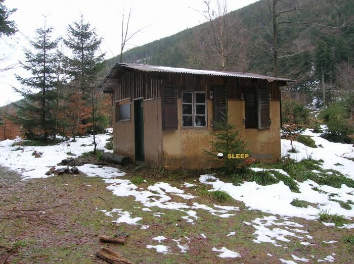
Mountain refuge Chalet St-Hubert
We have it listed in the app!
We have it listed in the app!


Discover the vastness of chalet st-hubert, chemin des hautschires, ribeaugoutte, lapoutroie, colmar-ribeauvillé, alto rin, gran este, francia metropolitana, 68650, francia by spending the night at the Chalet St-Hubert refuge. It sits at 1060 meters, offering a unique balcony over the natural landscape. Find it on the map at latitude 48.18 and longitude 7.148.
11.8°C
Feels like: 6.8°C31.7 km/h
Gusts: 87.1 km/h3140 m
Snow lineUV 0.55
Clouds: 100% 5.5 mm
 31.6 km/h
 UV máx: 4.05
 05:33
05:33
 21:26
2.5 mm
22.3 km/h
UV máx: 5.95
05:33
21:26
0.6 mm
14.9 km/h
UV máx: 7
05:32
21:27
0 mm
15.9 km/h
UV máx: 5.6
05:32
21:28
1.2 mm
11.8 km/h
UV máx: 6.55
05:31
21:29
2.1 mm
16.2 km/h
UV máx: 4.75
05:31
21:30
0 mm
10 km/h
UV máx: 6.6
05:31
21:30
21:26
2.5 mm
22.3 km/h
UV máx: 5.95
05:33
21:26
0.6 mm
14.9 km/h
UV máx: 7
05:32
21:27
0 mm
15.9 km/h
UV máx: 5.6
05:32
21:28
1.2 mm
11.8 km/h
UV máx: 6.55
05:31
21:29
2.1 mm
16.2 km/h
UV máx: 4.75
05:31
21:30
0 mm
10 km/h
UV máx: 6.6
05:31
21:30
It is necessary to plan the water before leaving: the nearest source is just over 1.5 km, so it is not wise to have immediate supply next to the shelter. Villa St-Hubert , in the term of Lapoutroie, it is located in the Alsatian High Rhine at about 1,060 meters, at a level where the forest and the rounded lomas of the Vosgos can quickly change the sense of orientation according to the direction on which it is advanced.
Its position fits better as a support shelter within road planning than as an isolated destination. In this part of the massif they connect itineraries of different range, from the GR 5 and GR 532 even around Lac Blanc and Lac Noir. This gives you an interest both in dividing a journey and in having a point of withdrawal if the weather is complicated or if a long day forces you to cut a journey. In wooded and half-mountain terrain, the changes in orientation between umbria, soft crests and valley links have a significant impact on the progression and reading of the itinerary.
It can also make sense to support moving to nearby cities such as Grand Brézouard, very close, or to Tête des Faux and Tête des Immerlins. It is not a pirenees or a high technical mountain, but it is an area where fog, moisture and continuity of tracks and trails can require attention in navigation, especially when several signposted routes are linked.
Because of this combination of nearby routes, moderate relief and exposure to time changes, the most logical use often depends on the day: short base to explore the sector or point of passage to not extend a stage in excess. If it is proposed as a mountain shelter within a wider route, it is appropriate to leave with basic autonomy and with the itinerary well closed in advance.


📏 1.6 Km
⛰️ 1200 m
📏 1.9 Km
⛰️ 940 m

📏 2.6 Km
⛰️ 950 m

📏 2.9 Km
⛰️ 926 m

📏 3.1 Km
⛰️ 740 m

📏 3.5 Km
⛰️ 1110 m

📏 3.6 Km
⛰️ 846 m

📏 4.5 Km
⛰️ 1100 m
Download the app and start looking for the shelter of your next adventure


Find a place to sleep before night falls.


