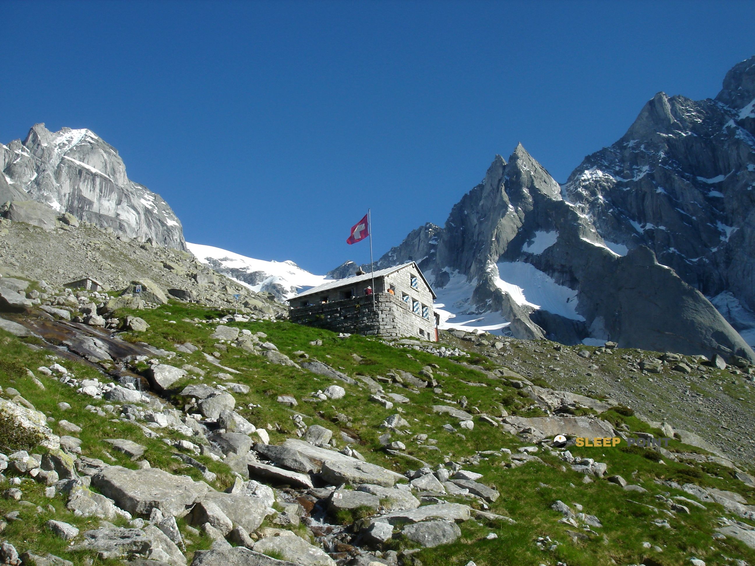
Mountain refuge Capanna del Forno CAS
We have it listed in the app!
We have it listed in the app!


The Capanna del Forno CAS refuge acts as a base camp for the summits and routes of fornohütte - capanna del forno cas, 3, val forno, bregaglia, maloja, grisones, 7516, suiza. At 2574 meters of elevation, its coordinates (46.332, 9.709) represent safety after a long day of effort.
6.8°C
Feels like: 3.2°C11.3 km/h
Gusts: 44.6 km/h3440 m
Snow lineUV 4.85
Clouds: 90% 17.8 mm
 16.6 km/h
 UV máx: 4.8
 05:31
05:31
 21:08
37.9 mm
14.4 km/h
UV máx: 7.05
05:30
21:08
2.8 mm
11.6 km/h
UV máx: 5.5
05:30
21:09
0.6 mm
9.3 km/h
UV máx: 5.2
05:29
21:10
0 mm
12.5 km/h
UV máx: 7.7
05:29
21:11
1.8 mm
12.2 km/h
UV máx: 5.75
05:29
21:11
0 mm
11.4 km/h
UV máx: 3.35
05:28
21:12
21:08
37.9 mm
14.4 km/h
UV máx: 7.05
05:30
21:08
2.8 mm
11.6 km/h
UV máx: 5.5
05:30
21:09
0.6 mm
9.3 km/h
UV máx: 5.2
05:29
21:10
0 mm
12.5 km/h
UV máx: 7.7
05:29
21:11
1.8 mm
12.2 km/h
UV máx: 5.75
05:29
21:11
0 mm
11.4 km/h
UV máx: 3.35
05:28
21:12
Here the mountain feels exposed and quite apart. At 2,574 metres, Capanna del Forno CAS is located in Val Forno, within the Swiss Bregaglia, in a sector where the altitude and continuity of the land force to measure well the effort from the approach. More than a shelter associated with a single immediate goal, it works as a support in an alpine transit environment, useful to order long days in the Sierra de Bregaglia.
Its position fits well in itineraries that link slopes and mountain steps. In the environment there are tours such as the Senda Segantini, the link to Albigniahütte , the journey between Capanna Sciora and the area of the Albagna, in addition to connections to Casaccia or to the Passo Tremigge . This network suggests a practical use: to divide stages, chain traverses or resolve steps between valleys without concentrating the entire gap on a single day.
To plan the rise it is necessary to think less about the linear distance and more about the sum of the gap, altitude and meteorology. At this point, a change of time can greatly harden the march, and the overall orientation of the high mountain terrain requires time limits. It is also a place where autonomy weighs: the registered sources are far from the shelter, with the closest to about 3.6 km, so it is not appropriate to have immediate water in the vicinity.
The lack of clear references to nearby summits reinforces this idea of a safe passage or logistical support rather than an obvious basis for a concrete ascension. In a border area between alpine basins and long-breath routes, your interest is above all in how you can share the effort and maintain a prudent planning within the massif.


📏 4.2 Km
⛰️ 2336 m
📏 7.9 Km
⛰️ 2118 m

📏 9.9 Km
⛰️ 1904 m

📏 11.3 Km
⛰️ 2610 m

📏 15.3 Km
⛰️ 2583 m

📏 16.1 Km
⛰️ 3597 m

📏 19 Km
⛰️ 2495 m

📏 21.5 Km
⛰️ 2978 m
Download the app and start looking for the shelter of your next adventure


Find a place to sleep before night falls.


