Mountain refuge Cabane du Menhir
We have it listed in the app!
We have it listed in the app!
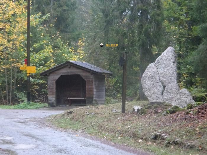

At 1160 meters above sea level, nestled in menhir du combasson, vy-perroud, les verrières, neuchâtel, 2126, suiza, stands the Cabane du Menhir refuge. It is the perfect stop to spend the night or catch your breath. GPS coordinates: 46.922, 6.472.
9.2°C
Feels like: 6.7°C10.2 km/h
Gusts: 29.9 km/h3750 m
Snow lineUV 0
Clouds: 100% 16.2 mm
 23.1 km/h
 UV máx: 6.2
 05:41
05:41
 21:23
11 mm
15.1 km/h
UV máx: 6.7
05:41
21:24
0 mm
20.4 km/h
UV máx: 7.25
05:40
21:24
0 mm
13.7 km/h
UV máx: 6.45
05:40
21:25
7.2 mm
11.2 km/h
UV máx: 6.95
05:39
21:26
14.4 mm
20.6 km/h
UV máx: 3.2
05:39
21:27
0 mm
14.1 km/h
UV máx: 7.15
05:39
21:27
21:23
11 mm
15.1 km/h
UV máx: 6.7
05:41
21:24
0 mm
20.4 km/h
UV máx: 7.25
05:40
21:24
0 mm
13.7 km/h
UV máx: 6.45
05:40
21:25
7.2 mm
11.2 km/h
UV máx: 6.95
05:39
21:26
14.4 mm
20.6 km/h
UV máx: 3.2
05:39
21:27
0 mm
14.1 km/h
UV máx: 7.15
05:39
21:27
In the field of Les Verrières , very close to the border between Switzerland and France, Cabane du Menhir appears in a passing area more linked to half-mountain hiking than to the severe alpine environment. Its position, in the environment of Combasson and within the canton of Neuchâtel, places it in a relief of lomas and changes of orientation where the progression can vary quite according to the chosen itinerary, the state of the land and the visibility.
At 1160 meters, this shelter fits mainly as a timely support for days in which it is appropriate to divide the route, to guard from time or to avoid lengthening the march when the schedule is complicated. It can also be useful for those who travel signposted traces of the area and need an intermediate point without going back down to the valley. In such a terrain, with crosses and senderist variants, it does not so much command the altitude as the ability to read the map well and adjust the route to the weather.
Your practical interest is better understood by looking at nearby itineraries. The route Le sentier montagnard du Grand Taureau connects with a known cordal of this sector, while the axis Combason-Petit Cernets It strengthens its role as a transit shelter rather than an isolated destination. The proximity of Le Grand Taureau at about 3.3 km, it adds an orographic reference, although it does not necessarily turn the cabin into a direct ascension base: here the continuity of the journey weighs more than the attack on a particular summit.
In the logistics part it is appropriate to be prudent. The nearest registered source is just over 2 km away, so it is not sensible to have immediate water next to the shelter. For long exits or hot days, it is reasonable to have sufficient autonomy and to review the actual availability on the ground. This same prudence is especially useful when fog, rain or accumulated tiredness enter, because in this type of itineraries the deviations, although modest in altitude, can extend the day a lot.


📏 1.3 Km
⛰️ 1020 m

📏 3.6 Km
⛰️ 1290 m

📏 5.7 Km
⛰️ 1190 m

📏 6.1 Km
⛰️ 1087 m

📏 6.2 Km
⛰️ 1180 m

📏 7.5 Km
⛰️ 958 m

📏 7.8 Km
⛰️ 963 m

📏 7.8 Km
⛰️ 1056 m
Download the app and start looking for the shelter of your next adventure


Find a place to sleep before night falls.


