Mountain refuge Cabane du château d'Oliferne

We have it listed in the app!


            Mountain refuge Cabane du château d'Oliferne in château d’oliferne, d 60, coisia, condes, lons-le-saunier, jura, borgoña-franco condado, francia metropolitana, 39240, francia
Five orange stars in a horizontal row representing a five-star rating.

Cabane du château d'Oliferne

Lat: 46.32xxx – Lon: 5.589xxx
📍 château d’oliferne, d 60, coisia, condes, lons-le-saunier, jura, borgoña-franco condado, francia metropolitana, 39240, francia
Cabane du château d'Oliferne

Protected by the wild surroundings of château d’oliferne, d 60, coisia, condes, lons-le-saunier, jura, borgoña-franco condado, francia metropolitana, 39240, francia, the Cabane du château d'Oliferne refuge is your best ally at 790 meters of elevation. Once you reach its coordinates (46.32, 5.589), you can enjoy a well-deserved mountain rest.

See more
See more
Usuario

Lucas Martinez

Premium user

Live weather: Cabane du château d'Oliferne

Live weather report for Cabane du château d'Oliferne: current 12.5°C at 790 meters (feels like 11.6°C). Wind at 3.9 km/h with gusts that may reach 28.8 km/h. The freezing level is at 3550 m and the maximum temperature will be 16.3°C.
Temperature

12.5°C

Feels like: 11.6°C
Wind

3.9 km/h

Gusts: 28.8 km/h
Freezing level 0°

3550 m

Snow line
Sky & UV

UV 0.3

Clouds: 100%

Next 48 hours evolution

7-day forecast

04/06
16.3° 10.6°
28 mm 10.5 km/h UV máx: 4.9
05:47 21:24
05/06
15.3°
0 mm 8.6 km/h UV máx: 6.5
05:47 21:25
06/06
19° 7.1°
0 mm 15 km/h UV máx: 7.25
05:46 21:26
07/06
19.2° 10.5°
0 mm 7.4 km/h UV máx: 5.9
05:46 21:26
08/06
24.8° 8.6°
0.3 mm 17.4 km/h UV máx: 6.1
05:46 21:27
09/06
16.7° 12.4°
6.45 mm 12.2 km/h UV máx: 6.8
05:45 21:28
10/06
17.1° 7.1°
0 mm 9.1 km/h UV máx: 7.05
05:45 21:28

In the heart of the Jura massif, within the region of Burgundy - Franco Condado , Cabane du château d'Ofuerne it is a reference point linked to the historical ruins that crown the relief. At an altitude of 790 meters, the environment is marked by a landscape of half mountain where the dense forests and the limestone outflows characteristic of the department of Jura, near the town of Condes .

Access and forthcoming summits

The approach to the shelter requires a constant physical effort through trails that gain height from the valley, being the Pic d'Ofuerne its most immediate summit just a few meters away. This rise of 807 meters allows to visually dominate the sector, while other reliefs such as the Molard of Netru complete the accessible mountain horizon for those who travel these crest. It is a useful enclave for mountaineers who seek to explore the cords without getting too far away from the cores of Coisia or Thoirette .

Connections and logistics

The shelter is integrated into long-distance itineraries such as Le Tour de l'Oignin or the route of Les 2 Vallées facilitating the connection between different aspects of the massif. Its strategic location makes it possible to fragment long days or to support adverse weather conditions in the area. The progression along these paths requires careful reading of the land, especially in the wooded sections that connect with the ancient communes of the region.

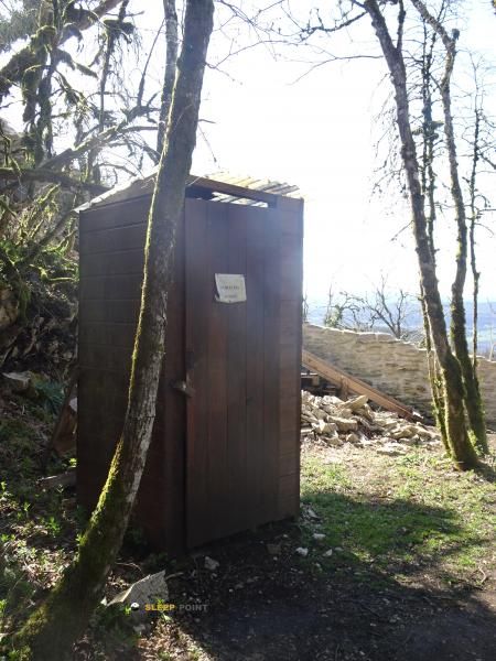
Logistics planning must be rigorous because of the need for total autonomy. The nearest source is at a distance of 1.7 km, which forces water management in advance before reaching the Cabane du château d'Ofuerne . In the absence of permanent services, the mountain must carry all the necessary equipment for the night or rest, understanding this space as a basic mountain resource in an environment of great historical and natural value.

Hiking routes from the refuge

Local

Les 2 Vallées

↔ Variable distance
Local

Le Tour de l'Oignin

↔ Variable distance

Nearby peaks

Molard de Netru

496 m
Lat: 46.3464 Lon: 5.6378

Pic d'Oliferne

807 m
Lat: 46.3192 Lon: 5.5885

Planet

Altitude not available
Lat: 46.3103 Lon: 5.6545

Nearby water fountains

Fuente

1.73 Km
Lat: 46.3103 Lon: 5.6545

Fuente

5.35 Km
Lat: 46.3103 Lon: 5.6545

Fuente

5.39 Km
Lat: 46.3103 Lon: 5.6545

Fuente

5.42 Km
Lat: 46.3103 Lon: 5.6545

Fuente

5.78 Km
Lat: 46.3103 Lon: 5.6545

Fuente

6.54 Km
Lat: 46.3103 Lon: 5.6545

Fuente

6.94 Km
Lat: 46.3103 Lon: 5.6545

Fuente

6.96 Km
Lat: 46.3103 Lon: 5.6545
FAQ

Frequently asked questions

Pregunta frecuente
Is it necessary to carry a GPS to reach the Cabane du château d'Oliferne refuge?
It is always highly recommended to carry a GPS device, a route track, or a topographic map in the mountains. You can use the coordinates 46.32, 5.589 to locate this refuge precisely.
Pregunta frecuente
In which municipality or region is the Cabane du château d'Oliferne refuge located?
This refuge is located within the municipality of Condes, belonging to the community or region of Borgoña-Franco Condado.
Pregunta frecuente
Are there other mountain refuges near Cabane du château d'Oliferne?
Yes, nearby you can find other options to spend the night or take shelter. El refugio más próximo es el Abri du Molard de la Justice, que se encuentra a aproximadamente 0.9 km de distancia.
More areas

Other areas

Collaborative

Together we improve

image

Send your photos

You can upload photos of shelters and update their status so other users know if they can go there.

Get started
Get started
image

Rate the shelter

Leave your comments to rate the shelter’s condition. In the mountains, we look after each other.

Get started
Get started
image

Add new ones

Did we miss any? Publish the shelters you know so everyone can use them.

Get started
Get started
Download for free from the Apple App Store and Play Store.

Download the app and start looking for the shelter of your next adventure

Aplicación móvil para encontrar refugios de montaña donde dormir
Aplicación móvil para encontrar refugios de montaña donde dormir.
Mapa interactivo de refugios de montaña en los Pirineos dentro de la app
Mapa de refugios de montaña para senderismo y trekking en la app.
Pantalla con información de refugio de montaña con altitud capacidad y servicios
Pantalla con información de refugio de montaña con altitud capacidad y servicios.
Detalles de refugio de montaña con servicios y meteorología en aplicación móvil
Detalles de refugio de montaña con servicios y meteorología en aplicación móvil.
Aplicación para explorar refugios de montaña mediante mapa interactivo
Aplicación para explorar refugios de montaña mediante mapa interactivo.
Ficha completa de refugio de montaña con opiniones y servicios
Ficha completa de refugio de montaña con opiniones y servicios.
Información detallada de refugio en app para montañeros
Información detallada de refugio en app para montañeros.
Listado de refugios de montaña para senderismo y trekking
Listado de refugios de montaña para senderismo y trekking.
Explorar refugios de montaña desde una aplicación móvil
Explorar refugios de montaña desde una aplicación móvil.