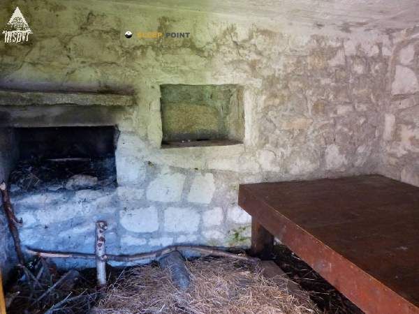
Mountain refuge Cabane de Litouese
We have it listed in the app!
We have it listed in the app!


Discover the vastness of luz-saint-sauveur, argelès-gazost, altos pirineos, occitania, francia metropolitana, 65120, francia by spending the night at the Cabane de Litouese refuge. It sits at 2086 meters, offering a unique balcony over the natural landscape. Find it on the map at latitude 42.818 and longitude -0.023.
8.8°C
Feels like: 5.9°C8.7 km/h
Gusts: 28.1 km/h3600 m
Snow lineUV 0
Clouds: 21% 13.7 mm
 17.3 km/h
 UV máx: 6
 06:22
06:22
 21:33
0.8 mm
11.9 km/h
UV máx: 8.1
06:22
21:34
0 mm
15.2 km/h
UV máx: 7.8
06:22
21:35
0 mm
11 km/h
UV máx: 8.05
06:22
21:35
1.2 mm
9.4 km/h
UV máx: 8.25
06:21
21:36
0.6 mm
6.3 km/h
UV máx: 7.95
06:21
21:37
0.6 mm
7.7 km/h
UV máx: 7.85
06:21
21:37
21:33
0.8 mm
11.9 km/h
UV máx: 8.1
06:22
21:34
0 mm
15.2 km/h
UV máx: 7.8
06:22
21:35
0 mm
11 km/h
UV máx: 8.05
06:22
21:35
1.2 mm
9.4 km/h
UV máx: 8.25
06:21
21:36
0.6 mm
6.3 km/h
UV máx: 7.95
06:21
21:37
0.6 mm
7.7 km/h
UV máx: 7.85
06:21
21:37
It can fit well as an intermediate stop on high ground. At 2086 meters, in the environment of Luz- Saint- Sauveur , this free cabin is located in a strip where the landscape is already clearly pyrenees: open slopes, marked relief and a meteorology that can change quickly even out of winter season.
The Cabane de Litouese is especially interested in its position in a network of mountain itineraries rather than in its proximity to a single objective. From their sector are linked to the Col le Pourteillou , Refuge et Lac d'Estom , the Plateau de Saugué or the area of the lakes of Cestrède and Antarrouyes. That makes it a logical support to divide days, raise short journeys or move between valleys and glacier cubes without having to return on the same day.
The surrounding area also approaches a summit environment. The Soum de Lianne de Castillon appears very close, while towards the horizon there are more alpine references such as the Pic d'Ardiden . It is not so much a question of using it as a basis for direct ascension to large three thousand and understanding it as a point of support in a mountain of steps, loins and links between itineraries.
The exit should be considered with autonomy. Although there are several sources in the wide area, the nearest ones are more than 2.5 km away, so it is not wise to have immediate water next to the shelter. At this altitude, wind, fog or a sudden drop in temperature can complicate orientation and lengthen times, especially if collates, lakes and irregular terrain are combined.
By location and context, it is a useful reference for well-known mountain trails that seek a point of passage on the Occitania side, within a sector with natural continuity towards high valleys, circuses and routes that require a good reading of the map.


📏 2 Km
⛰️ 1660 m

📏 2.5 Km
⛰️ 1883 m

📏 3.6 Km
⛰️ 1980 m

📏 4.3 Km
⛰️ 1988 m

📏 4.3 Km
⛰️ 1964 m

📏 4.5 Km
⛰️ 1988 m

📏 5.2 Km
⛰️ 1980 m

📏 5.5 Km
⛰️ 2035 m
Download the app and start looking for the shelter of your next adventure


Find a place to sleep before night falls.


