Mountain refuge Cabane de Courtalis
We have it listed in the app!
We have it listed in the app!


The mountains of cabane de courtalis - ustou, route du cirque d'anglade, couflens, saint-girons, ariège, occitania, francia metropolitana, 09140, francia hide essential places like the Cabane de Courtalis refuge. Situated at an elevation of 1950 meters, it offers protection and rest. Its exact coordinates are 42.748, 1.233.
7.7°C
Feels like: 4.2°C13.4 km/h
Gusts: 31.7 km/h4270 m
Snow lineUV 0
Clouds: 100% 16.7 mm
 15.1 km/h
 UV máx: 5.8
 06:18
06:18
 21:28
0.2 mm
14.5 km/h
UV máx: 8
06:17
21:29
0 mm
15.2 km/h
UV máx: 7.45
06:17
21:30
0 mm
12 km/h
UV máx: 6.95
06:17
21:30
1.5 mm
10.4 km/h
UV máx: 8.05
06:16
21:31
6.6 mm
6.8 km/h
UV máx: 7
06:16
21:31
1.2 mm
9.3 km/h
UV máx: 7.85
06:16
21:32
21:28
0.2 mm
14.5 km/h
UV máx: 8
06:17
21:29
0 mm
15.2 km/h
UV máx: 7.45
06:17
21:30
0 mm
12 km/h
UV máx: 6.95
06:17
21:30
1.5 mm
10.4 km/h
UV máx: 8.05
06:16
21:31
6.6 mm
6.8 km/h
UV máx: 7
06:16
21:31
1.2 mm
9.3 km/h
UV máx: 7.85
06:16
21:32
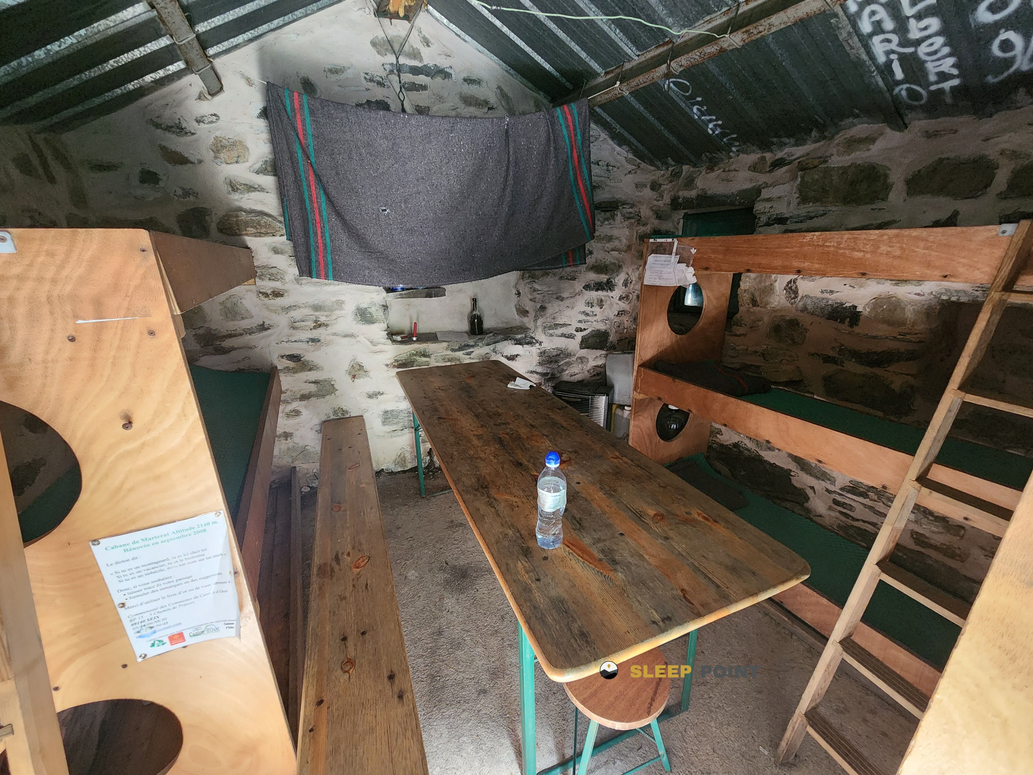
Basic support in pyrenees. The Cabane de Courtalis At 1,950 meters, it fits into a mountain strip where the relief gains alpine character and the shelter serves above all to leave the day or to guard itself in a transit area between the high Ariège and the steps towards the certascan environment. From Couflens in Occitania, it is linked to a sector frequented by routes of journey such as HRP , Porta del Cel and access to cirque de Cagateille , which gives him more interest as a point of support than as an isolated destination.
The nearby ground is a mix of the upper valley with slopes and summits that clearly exceed 2,600 and 2,800 metres. Names like the Pic de Montarenyo , the Tuc de Montabòna or the surroundings of Certascan help to place it in a context of border mountain, with days that can be extended according to the chosen itinerary. This combination makes it especially useful for mountaineers with a certain autonomy, used to moving along high mountain trails, long links and rapid time changes.
In planning, simple logistics is needed. There is a registered source about 1.8 km, reasonable but not immediate distance, so it is not appropriate to take the water for granted by the shelter and it is better to leave with sufficient margin. As is the case in many free shelters at this level, weather, visibility and the state of the ground can make the day much more conditioned than the distance on the map. If it is used within a long journey or as a support for linking hills and valleys in the Salau sector, the most sensible thing is to put it forward with autonomy and with a prior check of the intended route.


📏 1.2 Km
⛰️ 1777 m

📏 1.2 Km
⛰️ 1923 m

📏 1.6 Km
⛰️ 1886 m

📏 1.8 Km
⛰️ 1400 m

📏 2 Km
⛰️ 1627 m
📏 2.8 Km
⛰️ 2139 m

📏 2.8 Km
⛰️ 2004 m

📏 3.3 Km
⛰️ 2003 m
Download the app and start looking for the shelter of your next adventure


Find a place to sleep before night falls.


