Mountain refuge Cabana d'Estanho

We have it listed in the app!


            Mountain refuge Cabana d'Estanho in gr 11, alto arán, valle de arán, lérida, cataluña, 25539, españa
Five orange stars in a horizontal row representing a five-star rating.

Cabana d'Estanho

Lat: 42.658xxx – Lon: 0.828xxx
📍 gr 11, alto arán, valle de arán, lérida, cataluña, 25539, españa
Cabana d'Estanho

If you are looking for total disconnection, venture into gr 11, alto arán, valle de arán, lérida, cataluña, 25539, españa until you reach the Cabana d'Estanho refuge, positioned at 1980 meters. Use your device to navigate to the exact point (42.658, 0.828) to find this alpine shelter.

See more
See more
Usuario

Lucas Martinez

Premium user

Live weather: Cabana d'Estanho

At 1980 meters, the area around Cabana d'Estanho records 10.6°C with 50% cloud cover and a UV index of 1.5. The temperature will peak at 12.7°C today, with winds of 5.6 km/h and a freezing level of 3940 m.
Temperature

10.6°C

Feels like: 7.3°C
Wind

5.6 km/h

Gusts: 46.4 km/h
Freezing level 0°

3940 m

Snow line
Sky & UV

UV 1.5

Clouds: 50%

Next 48 hours evolution

7-day forecast

04/06
12.7° 3.8°
13.75 mm 15 km/h UV máx: 5.25
06:20 21:29
05/06
10.9° 0.8°
0.2 mm 14.7 km/h UV máx: 8.05
06:19 21:30
06/06
15.2° 5.2°
0 mm 13.9 km/h UV máx: 7.7
06:19 21:31
07/06
16.9° 6.9°
0 mm 9 km/h UV máx: 7.75
06:19 21:32
08/06
20° 8.7°
0.9 mm 11.4 km/h UV máx: 8.25
06:18 21:32
09/06
11.6° 4.1°
6 mm 6.7 km/h UV máx: 7.1
06:18 21:33
10/06
18° 4.1°
0.6 mm 7.5 km/h UV máx: 7.8
06:18 21:33

Between lakes, crest and cross

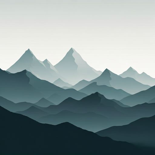
At almost 2,000 meters, in the Upper Aran and within the scope of the Aran Valley , the terrain around Cabana d'Estanho already has clear features of high mountain pirenaica: lacustrous cubes, stony slopes and a network of hills and crests that links with very visible summits of the sector. In its surroundings, mountain references such as the Montardo , Tumeneia or the cord that leads to Beiberri Nord , which helps to understand the nature of the shelter: not so much a valley bottom, but an open ground support, exposed to time changes and with a fully alpine environment. The mention near the Labada de Sarrahèra and the Tuc de Sarrahèra reinforces this reading of the landscape, specific to a zone of chained reliefs and important orientation.

Useful step on long routes

Its position fits well in several-day tours. The proximity of the GR 11 and the crossing of traces of the HRP that this cabin can serve as a reference of passage in long journeys through the central Pyrenees, while the general framework of Foc Carros and the Val d'Aran Circular place the shelter within a very connected area to link valleys, hills and shelters. This utility does not eliminate the demand: access and travel through the area require mountain habit, especially if it is proposed as a link between stages or as a basis for moving towards summits and high steps. In planning, it is necessary to have autonomy and not to rely the water on the immediate environment, as the registered sources are several kilometres away. It is also reasonable to anticipate changing meteorology and attentive navigation, especially when visibility gets worse on high ground.

Hiking routes from the refuge

CF

Carros de Foc

↔ 55 km
GR 211

Circular Val d'Aran

↔ 153.4 km
HRP

Étape 22

↔ Variable distance
HRP

HRP Étape 23

↔ Variable distance
HRP

HRP Étape 24

↔ Variable distance
HRP 21.2

Variante 21.2

↔ Variable distance
Local

HRP Variante 23.1

↔ Variable distance
Local

HRP Variante 24.1

↔ Variable distance

Nearby peaks

Montardo

2833.2 m
Lat: 42.6333 Lon: 0.8753

Besiberri Nord

3008.3 m
Lat: 42.6053 Lon: 0.8263

Punta d'Harlé

2885.0 m
Lat: 42.6104 Lon: 0.8426

Mussol de Tumeneia

2832.3 m
Lat: 42.6131 Lon: 0.845

el Pa de Sucre

2862.6 m
Lat: 42.6136 Lon: 0.8464

Tumeneia

2783.1 m
Lat: 42.618 Lon: 0.8518

Tuc des Monges

2698.6 m
Lat: 42.6224 Lon: 0.866

Tuc des Estanhets

2886.9 m
Lat: 42.6193 Lon: 0.807

Nearby water fountains

Fuente

3.36 Km
Lat: 42.6193 Lon: 0.807

Fuente

4.62 Km
Lat: 42.6193 Lon: 0.807

Hont de Cal

4.7 Km
Lat: 42.6193 Lon: 0.807

Fuente

4.77 Km
Lat: 42.6193 Lon: 0.807

Fuente

4.77 Km
Lat: 42.6193 Lon: 0.807

Fuente

4.92 Km
Lat: 42.6193 Lon: 0.807

Fuente

4.96 Km
Lat: 42.6193 Lon: 0.807

Fuente

5.02 Km
Lat: 42.6193 Lon: 0.807
FAQ

Frequently asked questions

Pregunta frecuente
What are the GPS coordinates of the Cabana d'Estanho refuge?
To locate the Cabana d'Estanho refuge on your GPS or map, use the following coordinates: Latitude 42.658 and Longitude 0.828.
Pregunta frecuente
Is it necessary to carry a GPS to reach the Cabana d'Estanho refuge?
It is always highly recommended to carry a GPS device, a route track, or a topographic map in the mountains. You can use the coordinates 42.658, 0.828 to locate this refuge precisely.
Pregunta frecuente
Are there other mountain refuges near Cabana d'Estanho?
Yes, nearby you can find other options to spend the night or take shelter. El refugio más próximo es el Refugi de Escunhau, que se encuentra a aproximadamente 1.5 km de distancia.
More areas

Other areas

Collaborative

Together we improve

image

Send your photos

You can upload photos of shelters and update their status so other users know if they can go there.

Get started
Get started
image

Rate the shelter

Leave your comments to rate the shelter’s condition. In the mountains, we look after each other.

Get started
Get started
image

Add new ones

Did we miss any? Publish the shelters you know so everyone can use them.

Get started
Get started
Download for free from the Apple App Store and Play Store.

Download the app and start looking for the shelter of your next adventure

Aplicación móvil para encontrar refugios de montaña donde dormir
Aplicación móvil para encontrar refugios de montaña donde dormir.
Mapa interactivo de refugios de montaña en los Pirineos dentro de la app
Mapa de refugios de montaña para senderismo y trekking en la app.
Pantalla con información de refugio de montaña con altitud capacidad y servicios
Pantalla con información de refugio de montaña con altitud capacidad y servicios.
Detalles de refugio de montaña con servicios y meteorología en aplicación móvil
Detalles de refugio de montaña con servicios y meteorología en aplicación móvil.
Aplicación para explorar refugios de montaña mediante mapa interactivo
Aplicación para explorar refugios de montaña mediante mapa interactivo.
Ficha completa de refugio de montaña con opiniones y servicios
Ficha completa de refugio de montaña con opiniones y servicios.
Información detallada de refugio en app para montañeros
Información detallada de refugio en app para montañeros.
Listado de refugios de montaña para senderismo y trekking
Listado de refugios de montaña para senderismo y trekking.
Explorar refugios de montaña desde una aplicación móvil
Explorar refugios de montaña desde una aplicación móvil.