Mountain refuge Buron des Chichourles
We have it listed in the app!
We have it listed in the app!


The Buron des Chichourles refuge (grange de graule, saint-saturnin, saint-flour, cantal, auvergne-rhône-alpes, francia metropolitana, 15190, francia) is a classic meeting point for mountaineers and hikers. At 1285 meters, its coordinates 45.195, 2.759 mark the end of a stage or the beginning of a new adventure.
10.1°C
Feels like: 8.2°C12.1 km/h
Gusts: 23.8 km/h3230 m
Snow lineUV 0.2
Clouds: 100% 17.5 mm
 31.6 km/h
 UV máx: 1.4
 06:03
06:03
 21:31
0 mm
23.3 km/h
UV máx: 7.55
06:02
21:32
0.1 mm
32.6 km/h
UV máx: 7.8
06:02
21:32
0 mm
6.8 km/h
UV máx: 7.8
06:02
21:33
4.5 mm
24.6 km/h
UV máx: 7.75
06:01
21:34
0 mm
24.1 km/h
UV máx: 7.25
06:01
21:34
0 mm
12 km/h
UV máx: 7.6
06:01
21:35
21:31
0 mm
23.3 km/h
UV máx: 7.55
06:02
21:32
0.1 mm
32.6 km/h
UV máx: 7.8
06:02
21:32
0 mm
6.8 km/h
UV máx: 7.8
06:02
21:33
4.5 mm
24.6 km/h
UV máx: 7.75
06:01
21:34
0 mm
24.1 km/h
UV máx: 7.25
06:01
21:34
0 mm
12 km/h
UV máx: 7.6
06:01
21:35
The approach to Buron des Chichourles It fits better into a half-mountain hiking day where the orientation and reading of the terrain weigh more than the search for services. It is located in the environment of Saint-Saturnin, in the department of Cantal, within Auvernia-Ródano-Alpes, in an open relief strip where changes of lome, vaguada and lute can change the progression and visual reference quite easily. At 1,285 metres, it is not a high-mountain pyrenian shelter, but it is a basic support in an area where it is necessary to plan with autonomy.
In this sector of Auvergne, close to communes like Cheylade or Dienne, the land often functions as a link between small basins and large dorsal areas. This provision allows the shelter to serve more as a point of protection or passage than as a destination in itself. The hiking route Les Ombrages appears in the vicinity, although without a closed layout here, so it is more prudent to understand the broon as a useful reference within variable routes than as the end of a defined stage.
It also helps to position itself with regard to nearby elevations such as Signal du Limon or Puy de Niermont , modest but sufficient summits to explain the wavy and exposed character of the area. In days of fog, wind or changing visibility, these changes in orientation between sides can complicate an apparently simple journey. So, more than absolute altitude, here matters the ability to maintain course and time margin.
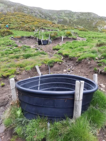
In logistical terms, there are no immediate sources next to the shelter: the nearest ones are several kilometres, from about 4.6 km. This data clearly conditions the day. If you plan to use Buron des Chichourles In support, it is necessary to get out with sufficient water and not to have close supply without first checking on the ground. In a relatively isolated area with limited practical information, this autonomy makes a difference.


📏 6.1 Km
⛰️ 1099 m

📏 7.2 Km
⛰️ 1175 m

📏 7.8 Km
⛰️ 1100 m

📏 8.1 Km
⛰️ 1440 m

📏 9.1 Km
⛰️ 1250 m

📏 10.4 Km
⛰️ 1040 m

📏 10.8 Km
⛰️ 1420 m
📏 11.2 Km
⛰️ 1450 m
Download the app and start looking for the shelter of your next adventure


Find a place to sleep before night falls.


