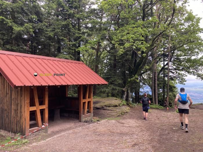
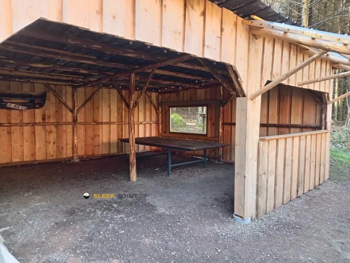
Mountain refuge Abri du Waldbruder
We have it listed in the app!
We have it listed in the app!


Prepare your backpack and head to abri du waldbruder, route de la forêt, klingenthal, bœrsch, molsheim, bajo-rin, gran este, francia metropolitana, 67530, francia. There you will find the Abri du Waldbruder refuge at 410 meters of elevation. An essential stop along the way (Lat: 48.47, Lon: 7.402) for any mountain enthusiast.
16.4°C
Feels like: 13.9°C14.3 km/h
Gusts: 36 km/h3200 m
Snow lineUV 0
Clouds: 100% 5.9 mm
 15.4 km/h
 UV máx: 3.4
 05:31
05:31
 21:26
0.3 mm
15.2 km/h
UV máx: 6.45
05:30
21:27
0.7 mm
10.6 km/h
UV máx: 6.55
05:30
21:28
0 mm
13.4 km/h
UV máx: 6.55
05:29
21:28
0.6 mm
12.9 km/h
UV máx: 6.4
05:29
21:29
7.2 mm
18.8 km/h
UV máx: 5.95
05:29
21:30
0 mm
9.9 km/h
UV máx: 6.75
05:28
21:30
21:26
0.3 mm
15.2 km/h
UV máx: 6.45
05:30
21:27
0.7 mm
10.6 km/h
UV máx: 6.55
05:30
21:28
0 mm
13.4 km/h
UV máx: 6.55
05:29
21:28
0.6 mm
12.9 km/h
UV máx: 6.4
05:29
21:29
7.2 mm
18.8 km/h
UV máx: 5.95
05:29
21:30
0 mm
9.9 km/h
UV máx: 6.75
05:28
21:30
Abri du Waldbruder remains in the Klingenthal forest environment, within the term Bœrsch, in the French Lower Rhine. At only 410 meters of altitude it does not respond to the profile of alpine shelter, but it does fit as a half mountain coat in an area where the relief gains entity towards the slopes and peaks that surround the sector of the Mont Sainte- Odile . This position places it on a transitional ground: accessible from low levels, although already linked to long routes and a network of trails with quite continuity.
The clearest reference to understanding its usefulness is the close step of the GR 5 to which the GR 531 , GR 532 and local tours such as the Sentier du Mur Païen or the Circuit du Bischenberg. More than an isolated destination, this coat fits into days that combine forest, moderate levels and links between signposted roads. In a stage planning it can serve as a point of protection or intermediate pause, especially on routes that climb from the valley to the forest heights of the area.
The next highlight helps to put it better: towards the south and south-west, summits such as Treisskopf, Schwarzkopf, Kienberg or Mont Sainte- Odile, which mark a horizon of half the Alsatian mountain more broken than their initial altitude might make you think. This is why it is necessary to measure the effort not only for the shelter's height, but for the type of itinerary chosen, the actual length of the link and the slope changes in the massif.
It is also important to plan with autonomy. The nearest invented sources are more than 2 km away, so it is not appropriate to have immediate water next to the coat. In days with changing weather, this detail weighs as much as the direction of the route: the place can be useful as a safe in transit, but it does not replace a complete preparation of the route or a prior verification of the state of the land and the supply.


Download the app and start looking for the shelter of your next adventure


Find a place to sleep before night falls.